Browsed by
Category: Llwybr Arfordir Ynys Môn – Isle of Anglesey Coastal Path

64. Brynsiencyn – Bangor

64. Brynsiencyn – Bangor

Distance: 13.6 miles

Max Altitude: 58 m

Min Altitude: 2 m

Height Gain: 310 m

Height Loss: 286 m

A refreshing night’s sleep coupled with a hearty breakfast at The Outbuildings set me up for the day ahead. 

It was a nice way to do breakfast too. Instead of the usual business of everyone being on separate tables, all the guests sat together around a large kitchen table instead. So over food we all chatted. 

The lady next to me recognised me. “Were you going up Holyhead Mountain the other day?” 

Indeed it was me. I had encountered Jacqueline, from Ayrshire, half way up. I was on the ascent, huffing and puffing while she was descending to Ynys Arw (North Stack). What an incredible coincidence that we’d be eating breakfast together just a few days later. 

I got dropped off back at Foel Farm Park and started walking. It was mid-morning and I needed to upload the blog, so in I went to the Sea Zoo cafe to do so. I may have had a scone too. 

And then I was properly on my way. The name of this boat greeted me. An omen? Or a fact? Something to accept and overcome, probably. 

And from then on, for a few hours anyway, it was a relatively quiet walk with few distractions. The only thing that wasn’t quiet was the wind, which was beyond blustery and was buffeting me off balance. 

It was like Ynys Môn was winding down and preparing to deliver me back to the mainland, but not wanting to let me go, at the same time.

The Wales Coast Path took me across field and through farmland. At one point, I wished I had that trusty flamethrower/ machete combo that I’d invented back on the Offa’s Dyke Path. I didn’t though and got stung by nettles instead.

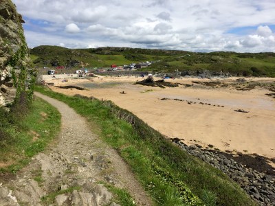
Soon I ended up back on the shores of the Menai since high tide had passed. I walked for what felt like ages with this underfoot.

There were very few things of interest. I could barely keep my phone still to take photos because of the winds. 

https://instagram.com/p/BIpiVuNh5dg/

Finally, the Britannia Bridge came into sight. 

Walking on further I came to the bizarre Nelson monument on the shore. I didn’t stop to examine further and soon it was behind me. 

Once again, I was led inland and through the grounds of a church. The high winds made the graveyard resemble something out of The Omen. I didn’t hang about.

And then, I passed under the Britannia Bridge. The space beneath bridges is always creepy and this one was no exception. 

I could have stayed for hours photographing the structure and capturing all the little details but the winds on the Menai were still giving me trouble. 

Still a bit creeped out from the graveyard and the bridge, I practically flew through a dark forest that followed. Relief when I saw the Menai Bridge through a gap in the hedge. The end was nearing.

The events that followed were an extraordinary coincidence. And I’d love to know the odds. Long story short, In Menai Bridge, I bumped into the woman who is responsible for the Wales Coast Path’s social media accounts. Eve and I have been communicating digitally on Twitter/Facebook/Instagram for weeks, but of course, under the guise of the WCP. Suddenly, she was in front of me completely by accident. A human face! And a lovely one at that too. What were the chances of that happening???

We talked for ages. She even got me a cup of tea and then offered me a lift to Bangor. How kind. 

And then a further coincidence. As Eve and I were getting into her car, another pulled up beside us. It was Jacqueline from breakfast (and Holyhead Mountain).  Again, the chances of that?

With my mind boggling I was dropped off in Bangor by Eve. We said our goodbyes and I was so happy to have met her.

I had a BnB at The Garden booked. I didn’t think the local council would take kindly to me camping in the middle of a traffic island. That’s where I ate that evening too. It was a healthy meal which I badly needed after weeks of sugar and junk. The waitresses there were incredibly kind and quizzed me on my journey. They even hugged and high fives me as I departed to bed. 

I was sorry to say goodbye to dear Ynys Môn. I had grown to love the island. Already, I cannot wait to return. But first I have the small matter of another 500 miles to travel. 
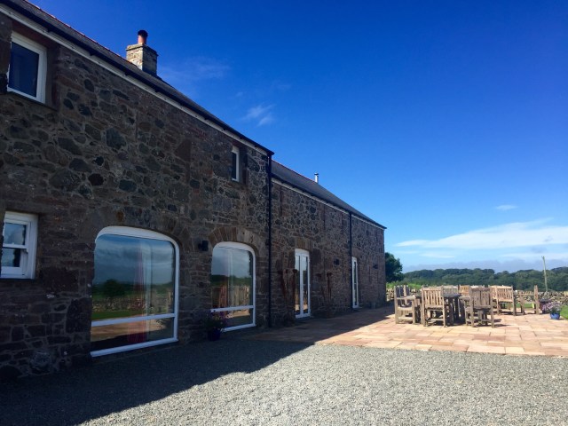
63. Pen-lôn – Brynsiencyn

63. Pen-lôn – Brynsiencyn

Distance: 4.21 miles

Max Altitude: 29 m

Min Altitude: 6 m

Height Gain: 77 m

Height Loss: 85 m


There had been rain overnight so my first task was to dry to dry Clark Tent off as best I could. It hadn’t been a particularly great night’s sleep. Ok, it had been awful, truth be told. I had a quick coffee before packing up. Rain had turned into a muggy day, and I was clammy already.

Fortunately, the White Lodge, where I was camping, was right on the side of the Wales Coast Path. Thanks to them for my discounted pitch and thank you to the tireless Terry for arranging it.

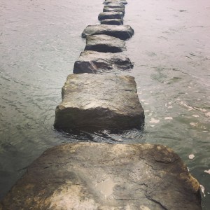
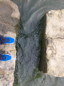
The path directed me through farmland and tracks, away from the coast. Then it hit the side of the Afon Braint, where the only means of crossing were these stepping stones.

A bit nerve-racking at high tide!

But I made it to the other side without plunging in!

After the previous night’s rain, the boggy marshland was even more sodden underfoot.

It occurred to me that I must be close to my 500th mile of walking. I checked and I had indeed just gone past that milestone, probably when I was crossing the stepping stones. So I stopped at the edge of a field to contemplate my journey. 500 miles on foot….when you say it like that…(!) I felt chuffed at that moment, and a tad overwhelmed.

I continued. And that, reader, is when I learnt that on a journey like this, you have to take the rough with the smooth. What I hadn’t realised in my moment of self-congratulation was that I was in a boggy field saturated with silage. As soon as I put my right foot down it got stuck in the grot and I was up to my legs in the foul gloop. I pulled my foot out only for my shoe to be left behind.

Meanwhile, there was my sock, dripping in cow effluent. Lovely.

I pulled my shoe out of the muck with a loud “schlock!” and hopped back to the kissing gate on the edge of the field, where I attempted to do a clean up job. But really, without hot water and soap, there’s only so much you can do. All I can say is that my travel towel took a hammering (and turned a deep brown colour), while I thanked science for the invention of hand sanitiser.

I won’t tell you how I got to the other side of the field eventually. All I will say is that the US Navy SEALS would be impressed.

Still inland, I walked through more farmland and even through people’s front yards before being led through country lanes. And very nice lanes they were too.


I was also impressed with the closing mechanism on this gate. I don’t want to sound dull but when you have to open numerous gates every day, you really do notice a bit of innovation.

And then the view of the day as I rounded back towards the coastline. The Menai Straits with Caernarfon directly opposite.


The WCP then hugged the shoreline and I crunched across it.

With my feet still wet and my socks still saturated in cow diarrhoea I decided to call it a day when I got to Foel Farm Park. I had promised myself a half day after all.

It turned out that the tireless Terry had organised a room for the night for me at the wonderful Outbuildings in Gaerwen.

And so that is how I ended my evening. I was able to bathe and rid myself of dung, as well as relax and have a decent meal.

It had truly been a day of ups and downs.

62. Malltraeth – Pen-lôn

62. Malltraeth – Pen-lôn

Distance: 8.71 miles

Max Altitude: 51 m

Min Altitude: 7 m

Height Gain: 148 m

Height Loss: 109 m

I woke up at the crack of dawn, literally. It had just turned 5am. I tried to get back to sleep but couldn’t do I decided to do something practical instead – I re-waterproofed my kit. It was long overdue too. 

I wandered back and forth to my tent, feeling smug at how efficient I was being with my time (a rare thing in my life). Pitched next to Clark Tent was another tiny tent. I had mistakenly made assumptions about who was inside when I saw a bike next to it. So when Pam (who I’m sure won’t mind me saying that she’s a little bit older than I am) came over to say hi, I was full of admiration because I learnt that she was cycling from Cardiff to Holyhead solo. We spoke for ages about all outdoor matters – kit, load carrying, feet, distance, water purification, maps; geeky stuff, you know. 

Pam also had a close relative die from pancreatic cancer so understood the severity of the disease. I was touched and energised when she praised my efforts. Being admired by someone who has travelled the world, biked across America and climbed mountains far and wide was high praise indeed. I watched her pack her bike and waved her on her way.

Hopefully Pam will have reached Holyhead safely and will by now, be back at home on the Isle of Wight. I hope we keep in touch.

It was time for me to get packing. As I was filling my dry bags, I heard an “Excuse me”. The lady from the large tent on the other side was calling to me. “Would you like a hot drink?”, she asked. Well, I didn’t need asking twice. What a kind gesture.

I joined Katherine, Kol and their two children – from the Wirral – for a coffee outside their tent. We talked for long time while we sipped our drinks. When you travel alone, and suddenly get the chance to talk to another person or people, the effect is overwhelming. We exchanged details and I went on my way. 

But it wasn’t long before they had donated to my page and left the nicest message for me too. As with Pam, I hope we stay in touch.

Thank you to Pen-y-Bont Camping for giving me a complimentary pitch for the night. Highly recommended, not least because they have laundry facilities, which is fairly thrilling when you are stinking like a dog. I am, as ever, grateful for the generous gesture.

When I left camp, I had about a 1.5 kilometre hike back into Malltraeth, where I intended to grab breakfast. Disappointment greeted me –

So I went into the village to the shop, where I had a rather depressing egg bap. Food was food though. 

I needed to cross the Malltraeth marsh on the cob to get to the forest on the other side. Tidal doors first designed by Thomas Telford about 200 years ago were replaced a few years ago. But the originals can still be seen in a display.

Hitting Niwbwrch Forest meant the start of a very long walk through the forest. The weather was looking iffy and rain was forecast.

A few kilometres later I rejoined the coast again as the Wales Coast Path touched the beach. It was wide and there was barely a soul around. 

Despite not being on the WCP, I had already decided to visit Ynys Llanddwyn. It would have been criminal not to. Llanddwyn means ‘the church of St. Dwynwen’. She is the Welsh patron saint of love, and generations of people have made a pilgrimage to this island. My turn was long overdue.

Up ahead was the Tŵr Mawr Lighthouse. And you know how I enjoy a good lighthouse by now. 

On a fine day, Eryri (Snowdonia) and Llŷn would be clearly visible across the water but today were shrouded in cloud.

I found this cannon a bit odd. Why was it pointing inland? Any ideas?

I vowed to return to Ynys Llanddwyn on a fine day with blue skies. But then it was time to rejoin the Wales Coast Path, and re-enter the Niwbwrch Forest. It felt endless.

Eventually, after several kilometres, I left the bizarrely sand-ridden forest. Fine rain had been coming down for a while and yes, I was walking in wet and sandy shoes yet again. I was overjoyed to walk on grass again after trudging through the sand; honestly, it really is the small things in life.

My feet were paining me though. Probably the result of yesterday’s over-zealous 18.5 miles. But I had no choice but to wince onwards. I would take it easy over the next couple of days to make up for it.

Grass turned to country roads and I ended up at a historical place of interest that I’d never heard of, and I felt a bit ashamed. Llys Rhosyr was a court belonging to the native royal family before they were killed and Wales conquered by Edward I in 1282. The site was explored and excavated in 1992. I had no idea it even existed; so much for my A Level in history eh, (though I never did see the point of studying Protestantism in England in the 16th century, but there we go).

With the rain coming down harder, I had to rush to get to camp in Pen-lôn. When I got there I put Clark Tent up in lightning fast time in order to avoid getting soaked. I jumped inside as soon as he was pitched and slid into my sleeping bag. I felt pretty glum. 

Eventually I got to sleep despite the best efforts of the Olympic snorer in the tent next door, who managed to produce a noise of Harley Davidson proportions.

———–

Today was the fourth anniversary of my dad’s death and it had been on my mind for the entire day. I wondered what he’d make of my walk. 

Cwsg mewn hedd, Dad. 

61. Pontrhydybont (Four Mile Bridge) – Malltraeth

61. Pontrhydybont (Four Mile Bridge) – Malltraeth

Distance: 18.5 miles

Max Altitude: 57 m

Min Altitude: 1 m

Height Gain: 302 m

Height Loss: 308 m

That was the best night’s sleep I’ve had in ages. I awoke in Gary’s house refreshed. And I was able to have a proper wash too. Heaven. Diolch o galon i ti a’r teulu oll, Gary!

It was a pretty decent day for walking. Not too hot or cold, but sunny and with a fresh breeze. The optimum day to get some miles underfoot.

I left Pontrhydybont and was soon back on Ynys Môn, where I was taken through farmland, marsh and foreshore, first off.

The terrain began to change and it became very sandy underfoot. Something told me that I was getting closer to RAF Valley. The signs were very subtle…

Ignoring the welcoming notices beside me I strode onto a wide beach which would take me around the coast to Rhosneigr. It stretched right out in front of me.


The going was pretty difficult because every step I took sank my feet into the soft sand. It was energy sapping but the wind was behind me, and I wasn’t the only one taking advantage of it.


I noticed lots of jellyfish that had been washed up.

https://instagram.com/p/BIiTV25hN1R/

That’s when my feet got soaked as I tried, unsuccessfully, to navigate a river. I wanted to stop when I got to Rhosneigr itself (to dry my trainers amongst other things) but the cafes and restaurants were fully booked. So I ate a snack instead and ploughed on.

Up ahead was a mound and inside it a Neolithic burial chamber, dating from 2500BC. Most of the features at Barclodiad-y-Gawres are behind bars in order to protect it.

As afternoon became evening, I surveyed where I had come from. There was Mynydd Tŵr (Holyhead Mountain) all the way in the distance.


The tide was in, which was a shame, and bad timing on my part. Had it been low, I could have visited St Cwyfan.


This church is perched on a miniature island called Cribinau and encircled by a sea wall. It dates back to the 12th century. Another place to return to.

I went inland to Aberffraw in search of some grub but my plans were thwarted once more. The pub stopped serving at 6pm and the shop was shut. Gah!

So I had no choice but to walk on to Malltraeth since that’s where camp was. 

I was shattered when I got there but also quietly pleased. I had gone my longest distance in weeks despite my feet. 

60. Penrhosfeilw – Pontrhydybont (Four Mile Bridge)

60. Penrhosfeilw – Pontrhydybont (Four Mile Bridge)

Distance: 11.6 miles

Max Altitude: 56 m

Min Altitude: 1 m

Height Gain: 216 m

Height Loss: 262 m

Another night of rain on Ynys Môn. The current pattern seems to be bad weather at night and fine weather during the day. As long as it’s not rain when I’m walking, I don’t care!

I had a cooked breakfast at Blackthorn Farm, and an enormous amount of coffee. I then spent a good ninety minutes trying to get the blog online. The signal ever a problem.

When it had uploaded I got back on the Wales Coast Path. I must say a big thank you to everyone at Blackthorn Farm for making me so welcome and giving me a free pitch for the night. The facilities are fabulous, especially the shower block!

I found my way back to the trail and this was the sight that greeted me –

Based on that alone, it was going to be an excellent day.

As I walked, I noticed lots of activity in the water below me. This was to continue. There were people in yachts, people in speed boats, coasteers, divers, kayakers…


One day during this walk, and soon, I’ll have to have a dip in the sea at the very least.

Next stop was Porth Dafarch, a sweet and not-too-busy cove, with toilets, and more importantly a food van.

I had a bag of cheesy chips and a can of Vimto (top notch!) with this as my view –

Energised, I walked on across fields and past a few houses. From afar, this house reminded me of Norman Bates’ house in Psycho for some reason.

Outside were a number of maritime relics, beautifully rusted.

The next location was tourist hotspot Bae Trearddur. I could have stopped but as soon as I saw the throngs of holidaymakers, I hotfooted it onwards. The crowds made me feel claustrophobic. Another place I’ll have to return to;the list becomes longer.

A tatty kissing gate signalled that I was back in the wild.

And then, a wonderful surprise as Bwa Du (black arch) appeared before me. The photo in no way does it justice.

And shortly after Bwa Du, an even greater surprise – Bwa Gwyn. Incredible.

I didn’t want to leave and reluctantly dragged myself away in order to continue on the path.

Way ahead in the distance, I could see the outline of Eryri (Snowdonia) and Llŷn in the distance. This is where I was headed.

I could see a small Coastguard’s lookout in front of me. As I got nearer, I waved at the man inside and he waved back.

I could see why he did his job.

I rounded the Rhoscolyn headland and headed inland up the beach.

I walked up the road and nipped in to the White Eagle pub for a drink and snack. It was evening, so I decided to head towards my base for the night in Pontrhydybont (Four Mile Bridge).

My friend Gary had kindly offered me the use of his house. I virtually collapsed into it, shattered. There are no words for the joy I felt at the sight of a proper bed and a set of towels. Diolch o galon, Gary a’r teulu! I was set for a fantastic night’s sleep.

59. Morglawdd Caergybi (Holyhead Breakwater) – Penrhosfeilw

59. Morglawdd Caergybi (Holyhead Breakwater) – Penrhosfeilw

Distance: 5.2 miles

Max Altitude: 176 m

Min Altitude: 32 m

Height Gain: 273 m

Height Loss: 259 m

It was another rough night on Ynys Môn. Persistent rain drummed down on Clark Tent and I barely slept. I awoke bleary eyed which turned into a state of crankiness a few minutes later.

The saving grace was the wonderful Caffi’r Parc, where I had breakfast and plenty of coffee. 

As ever I was having signal issues and was unable to upload the blog from yesterday, so I decided to look around.

I was in a country park that at one point was an old quarry which supplied stone for the 1.5 mile long Holyhead Breakwater, the longest in Europe. 

https://instagram.com/p/BIdl4_7hS2I/

There’s a memorial in the park to the crew of the ‘Jigs Up’, a US Eighth Airforce B-24 Bomber, who died when their aircraft crashed near Ynys Arw (North Stack) after running out of fuel in December 1944


If you’re at the country park, do pop in to the visitors’ centre and ask for Will Stewart, the warden. I spent ages chatting with him and he has a wealth of knowledge about the local area. 

When I eventually left for my walk it was early afternoon and I decided to make it a short day. It had been a late night the day before so I thought what the heck. 

What lay ahead was Mynydd Tŵr (Holyhead Mountain). But with blue skies above me I couldn’t wait to get started. There couldn’t possibly be a better day than this to tackle this stretch of the Wales Coast Path. 


I was stunned by the beauty surrounding me. I felt alive.


It was raw and rugged. Everywhere I looked there was something of interest, something to contemplate.


Up ahead was Ynys Arw (North Stack). This is the site of a redundant fog warning station, including the Trinity House Magazine, where shells for the warning cannon were stored. 

What a location! And what magnificent views of Ynys Lawd (South Stack), where I was headed next.

It was time to ascend. 


I climbed up rocks and crag. It wasn’t too dissimilar to the Inca Trail underfoot in places, with huge bits of rock carved into chunky steps.

It was pretty tough going, but I was constantly rewarded with the most awesome views so felt great despite my aching calves. 


I didn’t make for the summit of Mynydd Tŵr (Holyhead Mountain). It is a reason for me to return to this incredible spot another time. 


I spotted a group of climbers ascending a face near me. What an exhilarating location to climb.


And then the best view of all, Ynys Lawd (South Stack).


I sat and took it all in for a while. I decided against actually visiting the lighthouse. All the more reason to return.


After that it was a simple walk to camp for the night. Blackthorn Farm had generously offered me a free pitch for the evening, thanks to Terry who had rung ahead for me. 

I set Clark Tent up happily. It had been one of the best days so far.

58. Llanfachraeth- Morglawdd Caergybi (Holyhead Breakwater)

58. Llanfachraeth- Morglawdd Caergybi (Holyhead Breakwater)

Distance: 10.8 miles

Max Altitude: 30 m

Min Altitude: 1 m

Height Gain: 140 m

Height Loss: 121 m


What a difference a decent night’s sleep can make. A stark contrast to the previous night, I slept like a log.

As soon as I went downstairs at the Holland Hotel, I was greeted by owner Liz, who made me a huge portion of scrambled eggs on toast and two massive mugs of coffee. With my belly full, I said goodbye to her and husband Steve before I set off. Thank you so much to the two for giving me a place to stay for the night.

First job was to cross the Afon Alaw on this green footbridge.

https://instagram.com/p/BIaQ4gyBCm7/

The sky was murky and threatened rain. It had rained during the night but when I began walking, it was dry, just. It wasn’t to last though and two kilometres in, it started pouring. My new trainers gave way almost immediately and I was soon squelching along on the Wales Coast  Path.

When it started to rain harder I donned my waterproofs and covered my pack. By now, a very familiar drill. And then, it was a case of head down and just go.

I reached the housing estate of Newlands Park, drenched. I needed to dry off in order to continue. My feet were in a state inside my trainers, I could feel. So instead of continuing on the WCP, I made my way towards Valley where I took respite inside  the pub, The Valley. I’ve never been so happy to see electric hand (trainers) driers in my life. Oh, and their coffee wasn’t half bad either.

I stayed for a couple of hours drying out and becoming human again. The weather cleared and I decided to make a break for it, walking towards Ynys Gybi (Holy Island) by the side of the A5. I walked along a structure built by Thomas Telford between 1823 and 1824.

Before entering Penrhos Nature Reserve I spotted the Coffee Cups tearoom on the side of the road so went in to see what was on offer. When I saw the words ‘cream’ and ‘tea’, I didn’t need much convincing. I wasn’t about to ignore the chance to eat scones and jam like I had a couple of days ago.

Satisfied, I rejoined the path and followed a route through the forest.


The trail left the forest and came out where there were views of the port ahead.

I looked across the bay to where I had walked from during the previous few days. In the distance, Porth Swtan and Porth Penrhyn.

On arrival in Holyhead I made a beeline for the port, as I knew it would be open. I had a coffee and a snack with my feet elevated, while watching people coming and going.

I got on my way and crossed the Celtic Gateway Bridge.

New contrasted with old as the WCP went past the historic heart of the town – a 1700 year old Roman fort. The fortress of Cybi is named after St Cybi, hence ‘Caergybi’, the Welsh name for Holyhead.


I had already decided at that point that my stopping point would be just short of Holyhead Mountain. I enjoyed strolling along Traeth Newry and nosing at all the random bits of maritime history.

https://instagram.com/p/BIceUHqB9ij/
I finished walking finally when I got to the Holyhead Breakwater Country Park.


It had been a wonderful day, and I had managed my painful feet successfully. Tomorrow it would be onwards and upwards on the craggy Holyhead Mountain.

57. Porth Swtan – Llanfachraeth

57. Porth Swtan – Llanfachraeth


Distance: 8.08 miles

Max Altitude: 29 m

Min Altitude: 1 m

Height Gain: 147 m

Height Loss: 160 m

What a night of sleep that wasn’t! I had expected storms, and boy, they didn’t disappoint. I spent the night in some sort of half consciousness wondering whether the wind would be so strong as to lift Clark Tent up into the air and off out to sea… That didn’t happen, but nor did any sleep either. 

So I woke up bleary and irritated. I cooked porridge and ate it half heartedly. After washing, I was on my way once more, heading south. 

Thank you to Karen from the Gadlys campsite in Porth Swtan for generously donating a pitch. It’s a stunning spot with a warm welcome. 

The sun was out and the sky a cheery blue. What a difference a few hours can make on the Wales Coast Path.

I arrived at Porth Tyddyn-Ucha and decided that this would be a good spot to elevate my feet. Plus I hadn’t had coffee yet. A cardinal sin surely!

Across the bay, I could see Holyhead in the distance. A huge ferry from Ireland was coming into dock. I watched with fascination. 

After a strong coffee and several biscuits I continued. Before I knew it I had reached Porth Penrhyn. 

The path took me through a park with dozens and dozens of static caravans. Usually, I would curse such ugliness but not today. Why? Well, they had a shop on site (yes, I am that fickle these days). I bought myself an ice cream and stocked up on a few supplies before rejoining the trail. 

I trekked across farmers’ fields and on roads, through reeds and marshland. The Wales Coast Path arrived at a broad beach which seemed to go on for miles. I was the only person there. Had it not been for my painful feet, I would have donned my bathing costume and gone for a dip. 

The sun on my face was heavenly but the grit in my shoes wasn’t. I stopped to brush them off and just laid there for a while with my eyes closed. Bliss.

I could have stayed there forever but I had a room to get to, once again organised by the wonderful Terry!

Thank you to Liz and Steve at the Holland Hotel Llanfachraeth for giving me such a friendly welcome. It meant the world to this weary traveller. The delight of a bed and shower was beyond compare!

My evening was spent catching up with old friend, Gary, whom I used to work with at the BBC. 

I passed out, probably with a smile on my face, as soon as my head hit the pillow.

56. Wylfa – Porth Swtan

56. Wylfa – Porth Swtan

Distance: 7.75 miles

Max Altitude: 59 m

Min Altitude: 4 m

Height Gain: 246 m

Height Loss: 236 m

Today began with an inevitable and sad goodbye. I said farewell to my beloved Ann and Noel. They have been thoroughly wonderful these past two weeks, none more so than last week when I was injured. I will be forever grateful for all the help they gave me.

There were smiles all round when they dropped me off at Wylfa Nuclear Power Station.

But as soon as their car pulled away, I had tears in my eyes.

Confusion as to the route of the path kept me somewhat focused on the task ahead. It wasn’t clear and there were a multitude of different maps on signposts, all showing a variety of diversions due to the works taking place on the site. So I went for broke and walked in through the front gate. Lo and behold I saw a waymark! And I was on track. I never would have thought the trail would have gone through a nuclear power station.


I had a light lunch and continued walking across fields. I stopped to consider my route when I came to this sign. Flashbacks of my close scrapes with cattle across Wales suddenly. 

Fortunately, my concerns were unfounded and the giant, snorting beast I was expecting wasn’t there. Phew.

I then bade farewell to Wylfa, as it disappeared out of my sight. 

In front on me appeared Cemlyn Nature Reserve.

This is when things started to go a bit wrong as waymarks got confusing following a choice of inland or shore coastal path. I decided to go inland since I didn’t know the tide times and has no signal on my phone in order to be able to check. 

I got excited when I saw a sign for cream teas. I decided against it when I realised it would take me at least a mile off route. Looking back I regret that. What’s a mile when there’s a scone on the horizon eh??

After that I completely missed my markers and ended up on a walk across farmland for a few kilometres, having to go in certain directions due to being faced with electric fences at every turn. 

There were cattle everywhere. I looked at them. They looked at me.


Cattle = water. And since I was running low on bottled water, I decided to drink from this receptacle. 


But don’t worry if you’re currently reading this while gagging! I used my Water-to-Go bottle. 

Finally, I found the coast again, to my relief. 


I walked to the next cove and decided to have a cup of coffee and a biscuit.

Energised, I strode on to my stopping point for the night, Porth Swtan. It stretch 

It stretched out in front of me and I stopped for a while to take it all in. The weather wasn’t the best but that didn’t matter.

Ever the great friend, Terry from Terry’s Trek had organised a free pitch for me at the Gadlys campsite. What a star. So off I went to set Clark Tent up. I was given a warm welcome at the site, and took the opportunity to have a hot shower. 

All was well.

—–

Ann,

Fe fydda i’n gweld eisiau eistedd o flaen yr adolygiad bapurau newydd gyda’n gilydd yn bwyta orennau bach! Diolch o galon am bopeth dros yr wythnosau ddiwethaf. X

55. Torllwyn – Wylfa

55. Torllwyn – Wylfa

Distance: 7.33 miles

Max Altitude: 78 m

Min Altitude: 12 m

Height Gain: 274 m

Height Loss: 293 m

I’m back! 

Words cannot express how good it feels to be not only back on the trail but also back on this blog. I have spent the time since I limped off the Wales Coast Path last Monday with my feet up and on ice being looked after like a queen by Ann and Noel. I have had a professional opinion on the state of my feet, new footwear and orthotics. I am also held together almost entirely by K tape by now. 

So earlier today, I hit the path where I left off…the side of the road. But I was back on the real Wales Coast Path in no time. 

The path stretched out in front of me in a series of ups and downs.

My lunch stop was at the most northern point of my journey, overlooking Ynys Badrig (aka the ridiculously named Middle Mouse in English). 

Not a bad view eh? Apparently St Patrick found himself shipwrecked on the little island before he swam ashore to found a nearby church. He must have been one heck of a swimmer, that’s all I can say. 

After lunch I faced the steepest and most treacherous descent so far on my journey (or maybe I’ve just blocked out that switchback section of the Offa’s Dyke Path). It zig-zagged all the way down to Porth Llanlleiana, and its derelict porcelain works.

Just as I was walking across the front of the beach, I spotted a group of kayakers paddling towards the shore. I resolved that I would return to this perfect little beach in the same fashion in the future.

And of course, with every sharp descent comes the inevitable ascent. Oh dear. Better on the knees but brutal on the lungs.

Then the sight of Llanbadrig came into view, which is the church that Olympic swimmer St Patrick founded in 440AD. It’s not a particularly inspiring structure. However, what I did notice as I walked past was that passers by had stuffed flowers into the exterior wall alongside the cemetery.

I saw a bench and took that as my cue to have a sit down and elevate my feet. This is something I do every hour or so of walking. 

An older woman walked past me with a Welsh border collie on a lead. I said hello and asked if she wanted to sit down. She thanked me and declined, adding that she’d been inside the church sitting down for ages and had just managed to escape. She had been there for a thirty minute talk on the history of the church with her husband which had turned into a two hour agonising lecture. When the dog got restless she’d taken that as her chance to leave, abandoning her husband inside for the sake of politeness. 

My fifteen minutes were up so on I went, rounding Porth Padrig, with Llanbadrig behind me across the bay. 

In no time I was in Cemaes Bay. I had an ice cream (vanilla and rum & raisin) while overlooking the harbour. It would have been rude not to.

Everywhere there were relics from Cemaes’ maritime past.

https://instagram.com/p/BISi1j7B0ca/
I headed out of the town and towards the imposing figure of Wylfa Nuclear Power Station. It has now been shut down but will be forever a blot on the landscape since it will not only take decades to decommission but also because another plant is going to be built practically next door. 

The Wales Coast Path is currently being diverted from its usual route due to archaeological works being undertaken as part of the new nuclear development. I walked across fields and through a mini forest to try to find the alternative route but went a tad wrong. So I decided to call it a day and headed for the road, past the entrance to Wylfa. 


A few months ago I would have been able to pop in and try one of their wonderful luminous green coffees at the visitors’ centre. Alas, the cafe has also been decommissioned. 

I am happy with my day’s progress. More than seven miles and barely a sign of tendon trouble. I hope it stays that way.

error: This content is under copyright.