Browsed by
Category: Llwybr Arfordir Sir Benfro – Pembrokeshire Coast Path

137. Dinbych-y-Pysgod (Tenby) – Pentywyn (Pendine)

137. Dinbych-y-Pysgod (Tenby) – Pentywyn (Pendine)

Distance: 11.74 miles

Max Altitude: 103 m

Min Altitude: 5 m

Height Gain: 323 m

Height Loss: 343 m


I was back on the trail today after a day off yesterday. I had to go on the hunt for a new phone after the demise of the old one. Thrilled with my new addition, I was looking forward to a day of walking and phone photography.

It’s fair to say that over these past few weeks I’ve been spoilt with regards to the weather. Somehow the sun has shone on me almost every day whilst I’ve been in Pembrokeshire. Yes I’ve had a few light showers here and there but I can’t remember the last time I had torrential rain (that’s why I’m writing these blogs…so I don’t have to remember).

That all changed today and not by half either. Torrential would be an understatement. Biblical, more like. Had I not had yesterday off I would probably have retreated indoors when I saw the rain. However, I didn’t want to miss out on yet another day’s walking. So I donned my waterproofs and headed out of Tenby.

I’d love to tell you that it was fresh and bracing and that I loved every second. That would be a massive lie though. I’m not a rain person, never have been, never will be. The truth is that I trudged in misery for miles on end, my new phone firmly in my waterproof pocket. I got to Saundersfoot, somewhere that I’d been looking forward to. The rain poured harder. I continued without a single photo of the village or of anything else for that matter.

On and on I slogged, finally arriving in Amroth. I had reached the end of the Pembrokeshire Coast Path.

It felt bittersweet.

There was hope of a blue sky in the distance but it felt like Pembrokeshire was spitting me out into Carmarthenshire. I knew that I would miss this section. Despite the struggles and difficulties it had become a part of me. I could foresee spending a lot more time here in the future.

I carried on walking, with the blue sky taunting me in the distance.

By the time I got to Pentywyn (Pendine), the showers were only light but the sea was full of chop. High spring tides were imminent, and coupled with the rain, local residents were out and about preparing for flooding.

There was only one thing for it. I headed into the Springwell Inn pub to dry out. It wasn’t just me who’d had that idea. When I walked through the door there was a topless man at the bar. “Sorry”, he said to me when he caught my eye, “I got stuck in the rain and I’m trying to dry my clothes off”. His coat and sweater were hanging up above the stove.

I sat in the window looking at the dirty storm outside. Another chapter of my journey was over. Pembrokeshire was done and I was feeling nostalgic already.

135. Maenorbŷr (Manorbier) – Dinbych-y-Pysgod (Tenby)

135. Maenorbŷr (Manorbier) – Dinbych-y-Pysgod (Tenby)

Distance: 9.07 miles

Max Altitude: 75 m

Min Altitude: 9 m

Height Gain: 163 m

Height Loss: 158 m


After passing out last night from exhaustion, I’d had solid night’s sleep. Boy had I needed it. Truthfully, by now, I feel like I need days worth of sleep in order to recover properly. It won’t be long before that’s possible though.

I was lucky to have yet another day of sunshine and a blue sky. Just what I needed to accompany me on my walk. I started underneath Manorbier Castle once more.


I headed towards the beach on the Wales Coast Path. It was so peaceful. Once again, I almost had the entire place to myself.


I took a final look back at the village before rounding the headland.

I really should have taken more notice of this sign. At this point in my hike, I wasn’t to know how useful this information would be.


The Wales Coast Path took me past Carreg Coitan (King’s Quoit) burial chamber. This is a neolithic tomb which is literally perched on the path overlooking the bay.

Surely this must be one of the most spectacular locations in Britain for such a burial chamber?


I headed onwards. The path on this section is precarious. There are steep and severe drops every few metres. Certainly not for the faint hearted!


However, it was yet another perfect day for walking.


Ah the Wales Coast Path….(!)

I could see Air Defence Range Manorbier in the distance but thought nothing of it. Suddenly though, I heard a buzzing. There was nothing in the sea or in the air…. or was there? I shielded my eyes and looked up at the sky, scanning for aircraft. Nothing. Then it twigged. I was hearing a drone. I couldn’t see it but I could certainly hear it buzzing over the water. After about five minutes, the buzzing stopped. Daydreaming, I continued walking. Then…..BOOM! A huge explosion rattled me out of my musings and took my breath away. See, I really should have paid attention to that earlier sign.


I carried on, still fairly alarmed. The footing was loose and I lost my balance falling into a gorse bush. Gah!

I continued hiking, while trying to pick dozens of tiny needles from my hand, arm, leg and backside. What a sight I would have looked if anybody had seen me.

The path cut inland to avoid the range. My book promised a cafe up ahead at the Youth Hostel Association so I made a beeline for that. I was gasping for a nice cup of tea. Just my luck though, it was closed.


I doubled back on myself in order to get a good look at the bits I’d missed whilst on my quest for tea. I knew that there were some amazing sights on this stretch and it would have been a crime to miss them.


Sure enough, near Skrinkle Haven, was the phenomenon known as the Church Doors, named because because two high arched caves in the cliffs resemble the doorways of a church. I had to descend a set of very steep steps in order to get down to this bit. But this sight was worth every single one. I sat a while and just stared. How magnificent.

I sighed as I left this magical spot, and kept looking back until the doors were out of sight. Back at the youth hostel again further down the path, I heard the familiar buzzing sound again. Another drone. In no time, there was another explosion (which I was ready for this time). And then the most extraordinary sight. Flying right across my line of vision was the Banshee drone (yes, I’ve looked it up). It travelled a couple of hundred metres maybe before a large red parachute popped out of it and down it floated to earth. It’s not every day you see that sort of thing.

Honestly, between one thing and another, the Wales Coast Path has more variety that most other trails on earth. I’d be keen to see one with more, frankly.

Lydstep was my next port of call. And a wonderful view of Ynys Bŷr (Caldey Island). A small group of Cistercian monks inhabit the island, and to my shame, I have never visited despite the hundreds of times I’ve been to Pembrokeshire. I must remedy that before long.


It was getting cold and my phone was playing up. I had dropped it on the floor last night and it wasn’t right. I kept rebooting all day long but to little effect.

I got to Dinbych-y-Pysgod (Tenby) early evening. South Beach was looking as stunning as ever.

To my horror I saw my first Christmas tree of the season in the window of the Belgrave Hotel. Come on guys, it’s not even Halloween yet!


However, there were much more pleasant sights on the Esplanade.


Most notably, Ynys Catrin (St Catherine’s Island) came into view. At low tide you can walk over to it from Castle Beach, not that I ever have. It’s always fascinated me though. There’s a little cafe on Castle Beach that overlooks it and I’ve sat there countless times with a cup of tea staring at it. I had been intending to visit the island and the fort that’s built on it on this walk. It’s another Palmerston fort, and I’ve now walked past several since Milford Haven and Pembroke Dock.

The fort on the island was open to the public. However, I learnt a few weeks ago that it was shutting due to ongoing planning problems with the Tenby Town Council, Pembrokeshire County Council and the National Park. For shame, is all I can say. Icons like this should be protected and encouraged not left to go to rack and ruin. I feel very bad for the people who tried to get this project off the ground in the face of such myopic opposition. I hope for a positive outcome for St Catherine’s Fort but I’m not holding my breath. Rant over.


Anyway, I should tell you that Tenby really is one of my favourite places. There are gems around every corner.


And the devil is always in the detail in Tenby.


Here’s the oldest building in the town, the Tudor Merchant’s House. The house was built in the late 15th century. It’s owned and run by the National Trust.

I wonder how many hundreds of thousands of people have taken this exact photograph…. It’s practically mandatory when you’re in Tenby.


I’d say that this is a one of a kind though.

After a plate of chips (it had to be done) I re-examined my poorly phone. I’d have to do something about it if it wasn’t sorted by the morning.


134. Broadhaven – Maenorbŷr (Manorbier)

134. Broadhaven – Maenorbŷr (Manorbier)

Distance: 9.19 miles

Max Altitude: 85 m

Min Altitude: 8 m

Height Gain: 408 m

Height Loss: 425 m

Two days ago I attempted to do today’s walk but ended up giving in after a few metres due to my enormous and painful ankle. I was disappointed in myself. There was to be consolation, however.

Terry and his friend John had driven down to see me and to have a walk. Terry had forgotten that Castlemartin would be closed for firing though, meaning no walking on that section. So instead, we shot the breeze and just enjoyed the downtime in Tenby. What a tonic to talk to someone who has undertaken a similar  challenge and experienced the same things.

The next day was another day off. I considered going to A&E for my ankle but instead spent the day with my foot elevated and on ice. I also had the pleasure of meeting Frans (my host at St Ann’s Head) for a cup of tea. The most wonderful things about this challenge has been the people that I have been fortunate enough to meet along the way. So many still keep in touch with me via text and social media. And meeting up is a extra treat. I feel very lucky.

Back to the trail then…

I started from Broadhaven on the National Trust’s Stockpole Estate. There were barely any people about and I had the entire beach to myself.

Even the rock pools looked perfect.


It was a wonderful October’s day, which felt more like summer than summer. The only clue that it wasn’t was the nip in the air.

I soon reached Barafundle, one of Pembrokeshire’s best kept non-secrets. There’s no parking for at least half a mile meaning that people who come here have made the special effort to arrive on foot. It’s often completely deserted and consistently gets voted one of the world’s best beaches. You can see why.


I sat on the beach and ate a snack. There were a few people milling about but not too many. I made the climb up the beach stairs.


Barafundle = incredible.


Walking around the headland I got to Stackpole, where I had a cup of tea in the cafe and charged my phone. This is the tiny harbour there. It seemed that there was a slice of perfection around every turn.


After tea I continued. The layers in the cliffs were unbelievable.

I spotted this red tractor.


My next port of call was Freshwater East.

I had to negotiate my way through dunes so I was very grateful for the Wales Coast Path waymarks.


I think I should probably have stopped for some proper food at Freshwater East but I decided to push on in order to get to Manorbier faster.

It wasn’t long before I started to flag. Fatigue started setting in. There seemed to be re-entrant after re-entrant, each one sapping my energy more than the last.

By the time I rounded the headland to get to Manorbier, I had started laughing like a hyena, but not from amusement. The stunning vistas were scant consolation.

Relieved, I finished my walk underneath Manorbier Castle. It was built in the 12th century by a Norman knight. This is also where Gerallt Gymro, or Geraldus Cambrensis, or Gerald of Wales was born. He declared it the most pleasant place in Wales. This is firmly on my return list.

I was relieved to have gotten through the day. It had been hard and I was shattered. I would sleep well if nothing else.

131. Castlemartin Range – Broadhaven

131. Castlemartin Range – Broadhaven

Distance: 5.8 miles

Max Altitude: 58 m

Min Altitude: 31 m

Height Gain: 84 m

Height Loss: 93 m

Today’s walk started once again from the Castlemartin Firing Ranges. The Wales Coast Path was open for business and possible to be walked. I was glad because I had heard that this particular stretch is beautiful and not to be missed. I was also happy to avoid a lengthy detour inland.

My first stop was the Elegug Stacks (or Stack Rocks), which are two pillars of rock rising from the water. Yet another stunning feature on the Pembrokeshire coast. The two stacks are important nesting sites for guillemots and kittiwakes, in fact ‘elegug’ is the Welsh word for ‘guillemot’.

The path lay incredibly close to the edge of the cliff, hence many signs like this –

I keep using the word breathtaking, but for good reason, I think.

There were several seals on the beach below, including a pup. I hadn’t seen seals for quite some time so I was delighted to be reacquainted.

Sometimes it’s easy, on this stretch, to forget that you’re actually walking across a firing range.

I spotted a band of climbers making good use of the cliffs at Huntsman’s Leap. The name comes from local legend in which a hunter on horseback is said to have jumped from one side of the gap to the other whilst being chased. When he looked back and saw the gap that he had jumped, he died of shock.

Arriving at St Govan’s Head I made my way down the steps to St Govan’s Chapel. Apparently, the number of steps differs on the way down to the number on the way up. Hmm (no I didn’t count).

This tiny chapel is built into the side of the limestone cliff.

The story goes that Sant Gofan or St Govan as an Irish monk who travelled to Wales, but was chased by pirates. He hid in the cliffs here.

This building dates from the 13th century but it’s possible that some bits go back to the sixth century.

After the climb back up the stairs (again, I didn’t count the number of steps, sorry!), I continued past various structures on the range.

The scenery continued to be incredible.

I was very much enjoying the walk. It was easy underfoot and the surroundings were inspiring.

I honestly could have stayed all day long. It’s such a shame that this stretch of coastline isn’t open all the time.

I wasn’t the only one appreciating the scenery.

I was arriving into Broadhaven on the National Trust’s Stockpile estate. My day was almost at an end.

I had enjoyed the walk immensely. However, my feet had different ideas, in particular my right one. When I removed my socks I discovered that my ankle had grown a small pillow. Oh dear.

Will I be able to walk tomorrow?

130. West Angle Bay – Castlemartin Range

130. West Angle Bay – Castlemartin Range

Distance: 12 miles

Max Altitude: 66 m

Min Altitude: 7 m

Height Gain: 294 m

Height Loss: 254 m

I started from the beach at west Angle. I had to retrace the two miles back to my stopping point from yesterday evening. I bought an ice cream at the Wavecrest Cafe to keep me company.

I arrived back at where I’d stopped, just short of Sheep Island (yes, this its name and I did see a solitary sheep on the rock). A wild pony with a mane of dreadlocks followed me across the field to the gate. I fed him some grass and petted his nose. I felt bad leaving him behind.

It was overcast with traces of blue sky poking out from beneath the greyness.

Here was more evidence of a fort, originally from the Iron Age which was turned into a lookout around the time of Word War One.

The terrain got more challenging – loose earth, mud, and even worse – big climbs. I had to tackle this one on all fours for balance! Suddenly I was pretty happy with my decision to turn back yesterday.

After much moaning and complaining to myself, I finally arrived at the edge of Freshwater West, one of Wales’ finest surfing beaches, and also the scene of a couple of blockbuster movies. In 2009 ‘Harry Potter and the Deadly Hallows’. Later that year another film was shot here when the beach was transformed into the scene of a battle for the Scott Ridley film ‘Robin Hood’ starring Kate Blanchette and Russell Crowe.

I looked at the line of the Wales Coast Path. It continued above the beach. All I could see were ascents and descents. Keen to avoid any more unnecessary abuse on my feet with more ups and downs, I decided to climb down to the beach across the rocks.

All of a sudden I appeared to be on Mars.

I left the red planet and continued across the beach and up towards the road. From here the Wales Coast Path is diverted away from the coast inland in order to avoid the Ministry of Defence’s Castlemartin Training Area.

The waymarks changed too.

I don’t remember seeing these road signs in the Highway Code…

The ranges are usually closed to the general public for obvious reasons and you have to ring a special phone line to check which bits are accessible on the day. Fortunately for me, this section was open.

Flimston Chapel is situated right in the middle of the range. You can get a key for it if you want. But I kept walking.

I made it to Flimston Bay, which was looking stunning as the evening came to a close.

The most incredible sight lay ahead, that of the Green Bridge of Wales, an 80-feet high natural arch jutting out from the cliffs. It was breathtaking.

I had the privilege of witnessing yet another of the most stunning of Pembrokeshire sunsets again. I was being spoilt.

I watched the sun go down on the tanks. You can find beauty in the most unlikely places.

129. Rhoscrowdder – West Angle Bay

129. Rhoscrowdder – West Angle Bay

Distance: 9.6 miles

Max Altitude: 57 m

Min Altitude: 5 m

Height Gain: 178 m

Height Loss: 169 m

I won’t lie to you, it wasn’t exactly the best start to the day. Due to my trainer-saving detour around the Valero refinery yesterday, I had finished my day on the wrong side of the plant. So I needed to find my way back to the Wales Coast Path in order to get on my way again. Easier said than done though.

I could see it across a couple of fields so off I strode, making a beeline for the path. There was just one problem, well two actually – a huge bramble hedge and a double barbed wire fence. I took my pack off and chucked it over the barbed wire and then climbed over. My jacket got caught and a hole was ripped. Curses! I landed on the other side and prodded the ground with my foot. It was spongy. I was actually in a bramble-covered bog. Great! Three days ago I would have just waded through the ditch, but with my new trainers on that wasn’t even an option. I exhaled, stared at the sky and wondered what to do. There was no choice but to take the long way around. So back over the barbed wire I went, this time snagging my trousers. And back I trudged across the field towards the road again. A whole 3.5km wasted!

Still, I was back on the Wales Coast Path, and leaving the heavy industry behind me.

It was a fairly straightforward path towards Angle, nice and flat and took me through this field of cabbages.

I arrived in Angle to sounds from the Castlemartin firing range booming in the distance. The tide was out, so I began so walk around the headland.

The joy I felt when I got to The Old Point House pub! The even greater joy of seeing the words ‘walker’s lunch’! At spring tides this pub gets cut off from the mainland. I’m sure the people inside really hate it when that happens….(!)

Although I had walked past this pub on a previously, I’d never been inside before. It didn’t disappoint.

As well as the fire, various nick nacks had been encased in the walls.

There were interesting things everywhere, not least this bottle of booze, which had pride of place on the wall. I learnt why.

In 1878, the schooner, Loch Shiel, bound for Adelaide with a cargo of 100% proof whisky and gunpowder, was wrecked just off Thorn Island (which I would arrive at later in the day), near Angle. The Angle lifeboat was launched and the passengers and crew were all rescued. As the ship broke up, her cargo began to float ashore. The locals arrived at the beach to see what they could find and quickly realised what was contained in the wooden cases! In order to avoid Customs officials, many of the bottles were stashed in nearby caves, into alcoves in cottage walls, in attics or boarded up completely. Some lay hidden for decades. There were some fatalities though – three men died, two of them drowned while trying to recover whisky from the sea, the other from alcohol poisoning after drinking the 100% proof booze. Divers are still pulling up bottles to this day and it’s still drinkable. The bottle on the wall is an original recovered from the Loch Shiel.

After deciding that this is one of the finest pubs on the Wales Coast Path so far, I got on my way reluctantly. I will be back to The Old Point House though.

I was pleased to see Stack Rock Fort in its full glory from the other side of the Haven. I continued walking, daydreaming about what it would be like to live there.

Moving through a gate I encountered this little fellow. I’ve never seen a sheep that resembles a teddy bear quite so much.

I heard a loud rumbling in the distance. On my right shoulder was the ferry on its way out of Pembroke Dock towards Ireland.

Another place I’ve previously walked past but never visited is Chapel Bay Fort. This was previously a military fort and is now a museum and cafe.

Built in 1891, it’s part of a series of defences along the Haven, some of which I’ve walked past and blogged about (included Stack Rock Fort!). Last year it was re-opened as a museum and cafe after having been restored.

There were interesting artefacts everywhere. Yet another place to return to.

As I proceeded around the headland I saw my ultimate home, even more so than Stack Rock Fort – Thorn Island, site of the Lock Shiel shipwreck.

This is also one of the former military defences of the area. The fort was built in 1854 with a casemated battery of nine guns. When it was decommissioned after World War Two, it became a hotel, accessible only by boat. It went on sale in 2011 and was snapped up quickly by the current owners. Who could blame them?

With my head filled with daydreams, I proceeded towards the western side of Angle.

I continued around West Angle Bay. My progress was hindered at one point by this friendly wild horse. After some nose petting, he let me pass.

Within a couple of miles, my phone conked out. I think it was the cold. I debated whether to carry on or turn back. I decided to walk the two miles back to Angle rather than proceed. The next stretch was tough and remote and I didn’t want to be caught out without communications so I did the sensible thing (I’m sure my mother reading this will be delighted).

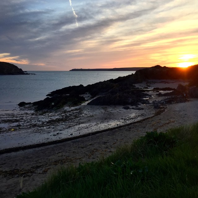
A little disheartened at my retreat, I sat on the shore eating a Welsh cake. My spirits soon lifted as I watched the sun disappear over Pembrokeshire.

128. Penfro (Pembroke) – Rhoscrowdder

128. Penfro (Pembroke) – Rhoscrowdder

Distance: 11.1 miles

Max Altitude: 80 m

Min Altitude: 10 m

Height Gain: 305 m

Height Loss: 306 m

After a day off for medical purposes, I arrived back on the trail.

I had found myself a new pair of trainers on my day off. The treads on the others had worn down so much that it was like wearing slippers.

My walk started beside Pembroke Castle. The Wales Coast Path runs alongside it, almost right the way around.

This bench was placed here to commemorate the birth of Henry Tudor, who would become Henry VII of England. It was good of them to put a bin there too. Handy.

I left Pembroke and followed the road out of the town for ages, walking on the pavement. I’d had a good look around the town before I got going.

It wasn’t the most inspiring of paths. I walked urban areas and a housing estate until the path led me to a small country road. I could see the power station and traces of heavy industry around me.

Some scenes were more familiar than others. What would the Wales Coast Path be without cows?

I was being careful of my new trainers. Is it just me who doesn’t like getting new shoes dirty? I avoided mud as best I could and walked on tarmac and concrete if possible. I was determined to keep my new footwear clean for as long as possible.

I followed a road next to the power station which led me onto a forest trail, a muddy forest trail. No way! I turned back and walked on the side of the road, which led me on a path right next to the Valero oil refinery.

By the time I reached Rhoscrowdder, my feet were aching badly. However comfortable my new trainers were, they were not yet worn in and were starting to pinch my feet.

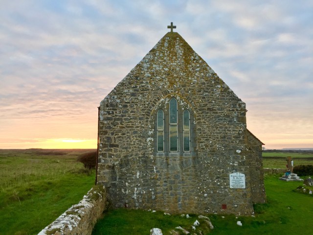
I stopped next to the church. For you Welsh poetry aficionados out there, this is where Waldo Williams composed the poem ‘Cofio’ in 1931. He was harvesting turnips at the time. There’s a remembrance plaque there to commemorate it.

I peeled my socks off to reveal some fresh blisters. I had managed to keep my trainers in pristine condition, but not so my feet, alas.

126. Aberdaugleddau (Milford Haven) – Penfro (Pembroke)

126. Aberdaugleddau (Milford Haven) – Penfro (Pembroke)

Distance: 13.7 miles

Max Altitude: 63 m

Min Altitude: 3 m

Height Gain: 354 m

Height Loss: 364 m

It was a windy day on the Wales Coast Path. My walk began in front of the memorial to a plane crash which happened during the Second World War. The memorial overlooks the site where Wellington IC, N2749, of 27 OTU, RAF Lichfield, crashed in the early hours of the 19th July 1942. There were no survivors.

I continued down Hamilton Terrace.

And I arrived at another memorial. This time a sculpture dedicated to the four workers who died in an explosion at the former Chevron oil refinery in 2001. 

The sculpture is made from bronze and stainless steel, with fossils embedded around the base.

A few metres further along the Wales Coast Path was a third memorial. This was a tribute to the fishermen of the area. The inscription read ‘thanks to them Milford Haven flourished’, which I thought was lovely.

I’ve heard many people complain about this stretch of the Pembrokeshire Coast Path, saying that it’s ugly and too industrial and so forth. And yes, maybe that’s true in many ways. However, today, to me, it looked glorious.

In another few metres I came to my fourth memorial of the day so far, and I had barely walked a couple of kilometres. This was dedicated to wartime mine laying operations and the port of Milford Haven.

I took a wrong turn and thought I’d found a fifth memorial. I hadn’t. It was a Celtic cross.

After rediscovering the correct route, I ended up at Black Bridge, crossing the tidal estuary.

From then it was a pretty dull trudge around the Dragon LNG terminal, which used to be an oil refinery. When I got to Llanstadwell I sat down and ate.

I found this sorry looking pair of discarded shoes. Would they ever be reunited with their owner?

I walked past houses along the side of the estuary until I got to the outskirts of Neyland at Brunel Quay.

in 1856 this place became the site for the western terminus of Isambard Kingdom Brunel’s Great Western Railway, hence the name. This whole area is dotted with information about the man himself and his most famous engineering projects.

Who knew that Brunel modelled himself on Willy Wonka though? Uncanny.

On the waterfront was this helpful plaque with all the various surrounding locations.

And I got my first glimpse of Pont Cleddau.

Prior to building of the bridge, the river Cleddau divided the area. The towns of Pembroke Dock on the south side and Neyland on the north side were less than 1 mile apart across the water but a 28 mile journey apart via road. Incidentally, the people of Aberdyfi and Borth still feel this pain (as do certain walkers who recently had to travel up and down the Dyfi estuary for two days!). The Pont Cleddau was opened in 1975 and these days costs a princely 75p to cross in a car. However, people on foot like me get to go over for free, which is marvellous.

First up though I had to walk across the smaller Westfield Pill bridge.

I arrived at the Pont Cleddau but started to wonder if someone was trying to tell me something with this omen hanging from a lamppost. I mean, it was a gusty day….

Across I went.

I got to the other side and carried on along the side of the water.

I was rather thrilled not only to reach this gun tower but also this multicoloured bench.

This is known as a Cambridge Gun Tower and was built in 1851 to protect the Royal Dockyard. It’s one of a chain of forts known as ‘Palmerston’s Follies’ built to encircle the Milford Haven waterway during the Napoleonic Wars. It’s now a museum, but it was shut when I walked past.

Passing through the town I spotted this rather timely piece of street art.

My stopping point for the evening was Penfro (Pembroke). In 1093 Roger of Montgomery built the first castle at the site when he fortified the promontory during the Norman invasion of Wales. I considered going in but it was too late in the day. Another for the return list.

Henry Tudor (the future Henry VII of England) was born here in Pembroke Castle in 1457.

I’ve seen many many memorials on my travels (not least today), and I’ve walked past hundreds of memorial benches in particular. However, I hadn’t seen a memorial bench dedicated to an English monarch until today.

My day was at an end. It wouldn’t be long until I was leaving the industrial parts of the Pembrokeshire coast. Barafundle, Manorbier, Tenby and Saundersfoot beckon….

125. St Ishmaels – Aberdaugleddau (Milford Haven)

125. St Ishmaels – Aberdaugleddau (Milford Haven)

Distance: 8.9 miles

Max Altitude: 56 m

Min Altitude: 1 m

Height Gain: 289 m

Height Loss: 271 m

->

My day started in St Ishmael’s. It was a short walk to find the Wales Coast Path at Monk Haven.

Monk Haven was a landing place centuries ago for traders and pilgrims on their way to St David’s.

Yet again, I was fortunate enough to be experiencing one of those perfect Pembrokeshire days.

Up and down the coast, everything looked so idyllic. The going underfoot was pretty easy too. Not too many ups and downs.

On the way, there were further signs of Pembrokeshire’s military past.

In the distance were the industrial areas of Aberdaugleddau (Milford Haven) and Doc Penfro (Pembroke Dock).

Arriving at Lindsway Bay, the Wales Coast Path was at its best. Quiet, sunny, remote.

There were just three people and a dog on the beach. Nobody else was to be seen for miles.

One of the best things about walking the trail at this time of year is the abundance of blackberries. The Wales Coast Path seems to be flanked by burgeoning brambles. My pace slows down as I pick off the fattest berries to gorge on.

I was certainly nearing the industrial and shipping zones, as I arrived at this radar station.

There were two men renovating a house right on the tip of the headland. This must be one of the remotest and weather-beaten dwellings in Britain. 

I had timed my walk so that I would arrive at Sandy Haven at low tide. It was very important else I’d have to take a detour of several miles away from the tidal estuary.

There used to be a set of stepping stones here to enable people to cross the river without getting their feet wet. It’s now been replaced by this new level crossing point.

And then it was onwards towards Milford. At South Hook Point I was level with Stack Rock Fort, a structure that has fascinated me ever since I saw it. A fort was built on these rocks between 1850 and 1852. Disarmed in 1929, it was first placed on the market in 1932 and sold for £160. In 2005 it was sold for £150,000. And I have to say, that I would love to own it!

Pondering a potential life on Stack Rock Fort, I arrived at the South Hook LNG terminal.

It may not have puffins or seals or golden sands, but sometimes simple industrial symmetry has its own sort of beauty.

The locals certainly have some quirks.

My finishing point was in the town itself, just above the marina. I was just in time for a beautiful Pembrokeshire sunset too.

124. St Ann’s Head – St Ishmaels

124. St Ann’s Head – St Ishmaels

Distance: 7.2 miles

Max Altitude: 58 m

Min Altitude: 1 m

Height Gain: 210 m

Height Loss: 225 m


It had been almost a fortnight since I had last walked.

To cut a very long story short, I had been fortunate enough to meet a retired consultant on St Ann’s Head, who was on holiday from London; this was all courtesy of my kind (and worried) host, Frans. When I told the consultant my symptoms (which I shan’t go into here for fear of boring you to death) he was very concerned and told me to see a doctor pronto. So off I toddled to my GP, who then dispatched me to the hospital for tests. They found my brain, my heart and a few other defects, but fortunately, nothing that can’t be helped with a series of injections and tablets. I will need some further investigations when I finish my hike, but all in good time…

Whilst all this was happening, I also caught some kind of fever, had a birthday and slept an awful lot.

Still shattered (and on my much-lamented rubbish feet) I decided to return to the trail in order to finish what I had started, and to hell with any medical conditions. Hurrah!

And so I found myself back on St. Ann’s Head on a beautiful Pembrokeshire day complete with blue skies and crisp sunshine. My welcome was complete when this fellow came to say hello. The Wales Coast Path just wouldn’t be the same without a bovine or two.

I fed the cow some grass and got on my way, past the lighthouses on St Ann’s Head.

It’s hard to believe that this is where the Sea Empress disaster happened in 1996. This entire coastline was awash with black oil for a long time afterwards, but twenty years on there’s no trace that it ever happened to the naked eye. Nature is amazing.

A short walk and I arrived at Mill Bay. In 1485, Henry Tudor arrived in this very location, with his 55 ships and 4000 soldiers landing at nearby Dale. Just two weeks later he defeated Richard III in the Battle of Bosworth Field to become Henry VII.

I struggled to imagine the scene here and wondered whether Henry got his feet wet coming ashore. He must have, I concluded.

My next destination felt very personal to me. I knew that my grandfather was stationed at St Ann’s Head with the Royal Artillery at the beginning of the Second World War. But I didn’t know much more than that, other than the fact that he operated the search light.

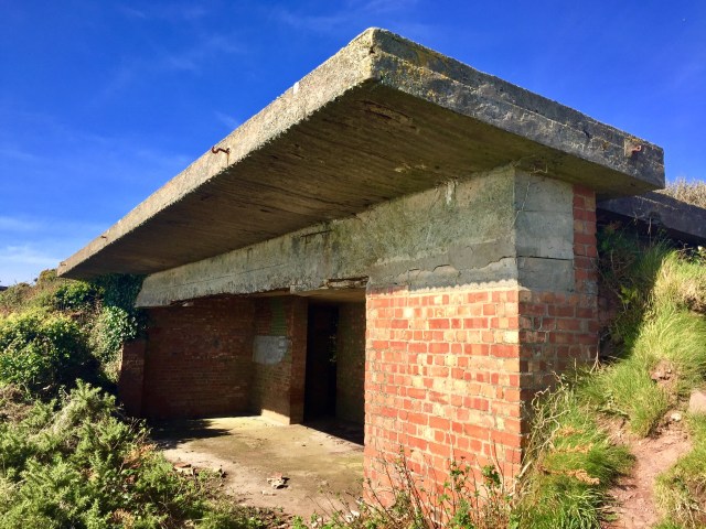
This bit is known as West Blockhouse Fort. The site is now derelict but there’s plenty of evidence of the buildings that would once have stood here, including concrete gun emplacements, bunkers and so forth. I imagined my grandfather here as a young man. I felt sad.


I continued on towards Dale. On the way in to the village, I walked past a series of driftwood sculptures by local artist, Sean Kehoe. I was impressed.

I couldn’t have asked for a better afternoon to be walking. The sea was calm at Dale and the tide was low.

It was a short walk across the Gann from Dale, which saved me a lengthy detour inland fortunately. I arrived at St Ishmael’s, my stopping point for the evening. I had managed more than seven miles under foot despite not feeling the best. All in all I was pleased and ended the evening with a smile on my face.

error: This content is under copyright.