Browsed by
Category: Llwybr Arfordir Llyn – Llyn Coastal Path

78. Porthmadog – Porthmadog

78. Porthmadog – Porthmadog

Distance: 1.49 miles

Max Altitude: 40 m

Min Altitude: 1 m

Height Gain: 30 m

Height Loss: 43 m

Look at my ridiculously short journey today! My shortest day yet on the Wales Coast Path has a story behind it though.

I left Tyddyn Llwyn just outside Porthmadog and walked into town. Thank you once again for my pitch for the night and also the very kind donation.

I was meeting ITV Wales News reporter, Rob Shelley in order to film a short item about my journey and why I’m doing it. We spent a couple of hours shooting around Porthmadog marina and on the cob.

It was the perfect day to be filming and the resulting item appeared on the evening news later on.

Screen Shot 2016-08-20 at 00.56.26

Hopefully this along with the feature on S4C’s Heno will lead to a little bit of awareness raised.

77. Llanystumdwy – Porthmadog

77. Llanystumdwy – Porthmadog

Distance: 10.12 miles

Max Altitude: 43 m

Min Altitude: 1 m

Height Gain: 171 m

Height Loss: 183 m

I woke up when the morning sun heated up my tent and created a sort of sauna effect inside. A quick porridge, coffee and wash, and I was on my way.

Thank you to everyone at Llanystumdwy Camping and Caravanning Club for my pitch and the warm welcome. And thank you for sending me on my way with an ice cream….I needed that!

I re-joined the Wales Coast Path and walked alongside an A road for a while. It was then routed through farmland towards the coast across a railway line and over marshland.


Once again I could see the vista of Eryri and the northernmost parts of Ceredigion. 

In a good while, I turned a corner and right ahead of me in the distance was Criccieth Castle. 


It wasn’t even 11am and it was sweltering. So I did the only human thing that I could when I arrived into the town. I went and got an ice cream at Cadwalader’s. Yes, another ice cream.  And what an ice cream it was!


I ambled through the town slowly. It was a busy day on the beach at Criccieth. I’ll never tire of people watching tourists and holidaymakers. 
The castle was imposing, as all castles should be. Who would have believed amongst all the sweaty tourists that this was once the scene of battle and bloodshed?

I decided to save an actual visit inside for another day. 

I carried on past the beach and out of town. 

The trail led me on a path next to the railway line for quite some time. And in no time I was ascending Garreg Ddu to overlook the Anglicised-named version, Black Rock Sands. 

Acres of golden sands spread out in front of my eyeline. There were dozens and dozens and dozens of vehicles parked on the beach though. I imagined this place to look perfect while deserted in the midst of winter.

The day had become even hotter so I made the sensible decision to walk via Morfa Bychan to camp, just in case I needed more water or whatever. 

When I arrived at Tyddyn Llwyn, just outside Porthmadog, I had the most kind welcome. The owners, Catherine and Peter, have had personal experience of pancreatic cancer and were incredibly supportive of my challenge. 

After I pitched up, I discovered that the item I’d filmed last week for Heno would be aired that very evening. I didn’t have a TV to watch it on, so here’s the temporary link to the piece in all its glory. Scroll to 18 minutes 30 seconds to see me! If the link doesn’t work, let me know but I don’t think it’s going to be available for more than a month.

76. Mynytho – Llanystumdwy

76. Mynytho – Llanystumdwy

Distance: 17.08miles

Max Altitude: 98 m

Min Altitude: 1 m

Height Gain: 220 m

Height Loss: 216 m

A parky night turned into the most glorious morning on Llŷn. The sun was out and the sky was blue; my favourite kind of walking day. 

I left Gwel y Môr campsite (thank you again so much for my pitch) and headed back towards the Wales Coast Path. The first task of the day was to follow the trail around Mynydd Tir-y-Cwmwd. The view wasn’t half bad.


Rounding the headland gave the most incredible view of Eryri and the northern part of Ceredigion.

I would have walked past this iron man had I not have spotted him out of the corner of my eye and turned around to inspect further. This is the third statue to be placed at this spot. The first was a ship’s figurehead that had been placed here by the family who owned the nearby mansion, Plas Glyn y Weddw. It was burnt down by vandals in the late 1970s. It was replaced by another tin man in the early 1980s but that one rusted. So then this one was commissioned and placed on the spot in 2002. 

I like him

What a view the tin man has eh?

Following waymarks took me down to Plas Glyn y Weddw, which is now an art gallery, theatre, shop and cafe. 

And yes I did stop for food at the cafe. It would have been rude not to. Also, this place is yet another addition to my ‘must return’ list.

Fuelled, I made my way down on to the beach and began walking along the kilometres of stony sand.


After rounding the point at Carreg y Defaid, I was practically alone on the beach. The water looked so inviting and being a hot day, I couldn’t resist it any longer. So in I went. But I almost changed my mind when I saw this jellyfish.

It wasn’t enough to deter me though and the sea was tremendous. 

Walking on to Pwllheli, I felt happy and refreshed. For most of the walk I was alone. The beaches were mostly deserted in spite of the weather.

When I got to Pwllheli, I went wrong a couple of times but I didn’t mind. I didn’t even mind when I got lost in the marina and ended up next to a yacht for sale for a mere £300,000. Next year maybe…

When I finally found the path again, I was back on the beach, walking on sand. I couldn’t have been happier. 

A little after Abererch, the WCP was routed inland and I walked the rest of the way to Llanymstudwy next to a busy road.

I pitched up at the Llanystumdwy Camping and Caravanning Club site, and couldn’t have had a warmer welcome. Thank you to Martin and the rest of the staff for being so kind. 

Another perfect trail day over. 

75. Llanengan – Mynytho

75. Llanengan – Mynytho

Distance: 11 miles

Max Altitude: 118 m

Min Altitude: 1 m

Height Gain: 444 m

Height Loss: 433 m

It wasn’t a long way to rejoin the Wales Coast Path from camp. Soon I was walking on the sandy beach of Porth Neigwl. Despite its fearsome reputation (in olden days, sailors would refer to it as ‘hell’s mouth’) the sea was calm.

It was then a steady climb up to Mynydd Cilan. From up high, the water looked like a freshly ironed sheet. 

I was making good progress and rounded Trwyn Cilan in no time. Suddenly I had the most wonderful view of Ceredigion in the distance, and where I was headed.

Hundreds of thousands of pounds worth of yachts, speedboats and jet skis were below me. I was getting closer to Abersoch. 

By this time, the sun had started to come out and Porth Ceiriad was shining. How I wanted to ditch walking and spend some time on that beach.

And then a sign that made me stop in my tracks, considering what had happened the previous day and numerous other occasions. But then I looked again…(!)

A wannabe graphic designer with a sense of humour maybe? Anyway, there were no breeding bulls or anything else. Relief.

Rounding Trwyn yr Wylfa, I got my first glimpse of Ynysoedd Tudwal. 

The nearest one in the photo belongs to Bear Grylls, who uses it as a holiday home. He paid £95,000 for it in 2001. The island behind it was owned by Carla Lane until she died earlier this year. 

Machroes was the next stop where I could see Traeth Abersoch stretching out ahead. 

A short walk along the beach took me past dozens of pretty beach huts. One of them was recently sold for £153,000. A metaphor for all that’s wrong with the world maybe.

I have happy memories of Abersoch (including the time when I threw sand at people on the beach as a toddler…my family enjoy reminding me of this), but it has changed so much. Some of it looks the same.

https://instagram.com/p/BJGZzVYhaW_/

But the vibe was different. It was like Primrose Hill had descended upon the town and dragged the cast of ‘Howard’s Way’ along with them. 

I didn’t stay but pushed on to camp instead. Thank you to Gwel y Môr for my pitch for the evening and to the ever wonderful Terry for organising. 

The end of Llŷn was in sight.

74. Aberdaron – Llanengan

74. Aberdaron – Llanengan

Distance: 13.6 miles

Max Altitude: 184 m

Min Altitude: 3 m

Height Gain: 318 m

Height Loss: 311 m

Today was one of those days where it depends entirely on your point of view as to how it went. I could declare that the entire day went wrong. On the other hand, I could choose to believe that I made good progress in spite of the conditions. It’s just a case of perspective.

The confusion happened as soon as I left Aberdaron. I walked out of the village via the road. My map was telling me one thing. The waymarks were telling me something different. I decided to continue via road. 

I then saw one waymark telling me to go one way and another telling me to turn right so I remained going straight ahead. At least this way I knew where I was headed on the map. 

The only problem was that I seemed to be getting too far away from the coast. So I hung a right just before I got to Rhiw. There were farms and cottages dotted about but also the most wonderful view. Getting ‘lost’ isn’t half bad at times.

I found a waymark and got on my way. It took me through a farmers field and out onto a road again. I walked ahead and saw another waymark across a farm yard on top of a kissing gate. Great! The only problem was the snarling and barking dog guarding the kissing gate. Not so great. There didn’t seem to be anyone around so I wasn’t about to risk it. Dismayed, I decided to turn back up towards the road.

Upwards I slogged. They don’t call it Rhiw for nothing (Welsh for ‘hill’). It felt never ending. But I finally got to the brow and started my descent. Once again, I found myself glad to be on a slightly different route because the view was incredible. The panorama ahead was of Eryri (Snowdonia) and it was stretching right across my horizon.

The waymarks reappeared and all was well. I had only made a slight deviation and was now back on course. I could see Porth Neigwl ahead. On the map the Wales Coast Path made a huge detour to avoid it, which was unfortunate. 

The track left the road and started across farmers’ fields. It was quiet. Not a soul about. 

More farmers’ fields. I spotted cows. I looked again….bullocks. Oh no. I walked onwards with my head held high and they more or less ignored me. I got to a small brow and realised that I wasn’t just walking across one field of bullocks but about seven or eight fields full of them, and none of the gates between them were shut. 

Out of my peripheral vision, I saw two start to follow and close in on me. Within seconds, more had joined them. Suddenly I was almost surrounded, with bullocks to the front, back, left and right of me. I went horizontally towards a fence. In the next field were sheep. Safety. I had to climb over the barbed wire, getting stabbed in the process. Safety though. 

I walked parallel to the cattle. But what I didn’t realise was that the gate at the bottom of the field adjoining mine and the cattle’s field was open. In they streamed at speed towards me and horizontally I went again, into yet another field, over barbed wire. 

And for a while, this was the situation. By now I was way off course and had no chance to get back to the Wales Coast Path unless I wanted to come face to face with more menacing bovine. 

So I waited about 30 minutes, eating some snack, until they got bored of me and went horizontal again until I did manage to find a field without any open gates.

I continued until I found a road and just kept walking. Eventually I saw a Wales Coast Path waymark and felt relief. 

I finished my day in Llanengan in camp. Not exactly the most pleasant day’s walking but I had achieved more than 13 miles and 1000 feet of height in spite of it all. 

Not bad. 

73. Anelog – Aberdaron

73. Anelog – Aberdaron

Distance: 7.4 miles

Max Altitude: 160 m

Min Altitude: 2 m

Height Gain: 446 m

Height Loss: 491 m

I woke up to high winds in camp. Packing Clark away was a challenge and at one point the tent looked more like a kite as I struggled to hold on to it.
Thank you again to Gillian and Geraint at Aberdaron Farm Holidays for giving me the pitch. Another gem of a campsite on Llŷn.
I had partly climbed Mynydd Anelog the previous day, so up I went again to rejoin the trail. The winds were getting even stronger, so much so that someone had taken pity on this Wales Coast Path marker post.

Ahead of me was Braich y Pwll and Mynydd Mawr, the next big hill to tackle.


The trail descended to just above Llanllawen and then arose sharply. Suddenly I was struggling up a steep bank of gorse and heather.


Behind me was Mynydd Anelog, which gave me some comfort at least.


Even the sheep were shattered!

After much huffing and puffing and with my calves burning, I reached the top. There were two tiny brick huts. This location was a lookout point for the Coastguard’s until 1990. It was also part of a chain of signalling stations guarding against invasion during the Second World War. During the 1940s more than 70 RAF personnel would have been stationed here.

But up ahead was the real prize – the view over to Ynys Enlli (Bardsey). Even under grey skies it looked majestic.

I pushed on despite the high winds. The seas beside me were rough. There were no boats or ships out there.

I passed the headland of Pen-y-Cil but went wrong. One way marker pointed in one direction while the next one pointed back in exactly the same direction. Eventually after traversing a couple of fields I rejoined the Wales Coast Path, much to my relief. I could see Aberdaron poking out from behind the headland in the distance.

I descended on steps into Porth Meydwy, which is where the boat to Yns Enlli is launched from. All boats were in port. I was happy to see this jolly green tractor though. An addition to my seaside tractor photo collection.

Another steep climb on steps again and my feet were screaming at me. Not long until Aberdaron though. When I saw yet another set of steps however, it was game over. No way.


I decided to walk along the beach to get to Aberdaron instead. The tide was coming  in so I had to traverse these boulders instead of walking on the sand.

And then I reached my destination. Relief! I had my dinner in Y Gegin Fawr, which had its own history too. It was built in 1300AD and pilgrims would gather at this communal kitchen before they made the crossing to Ynys Enlli. It felt fitting. After all, I am on my own sort of pilgrimage.

It had been a hard day of climbs and descents but I was happy with my progress.

72. Porth Colmon – Anelog

72. Porth Colmon – Anelog

Distance: 8.1 miles

Max Altitude: 107 m

Min Altitude: 2 m

Height Gain: 277 m

Height Loss: 227 m

Refreshed from my day’s rest yesterday, I found myself raring to go when I woke up. And I needed to be because I was filming an item for the S4C programme, Heno. I met the crew, Gerallt, Dyfan and Dafydd and we got underway at Porth Colmon, where I had finished a couple of days ago. Following a quick interview, I started walking and Gerallt came with me. How fantastic to have company and someone to talk to for a change.

The kilometres fell away, and we were soon at Porth Iago, where Dyfan and Dafydd had gone to meet us. Another quick interview and it was time to say goodbye. Again, I was sad to see the three walk away. It had been a lovely few hours and it was good to be back with a film crew, albeit for a short time.

I ate my lunch overlooking the beach at Port Iago. What a gem this location is.


And then with my rucksack back on my back, I was off once more. The terrain was rugged and wild. Waves smashed into the rocks below me. I’d stop to watch every few minutes, mesmerised.

The next beach was Porthor. I saw it from afar, long and yellow on my horizon. It looked idyllic and I deviated from the Wales Coast Path in order to walk along the beach.

Everything about it was perfect, the sand, the waves, the sky. I took my time walking right at the edge of the water and let the waves roll towards my shoes.

There was a cafe on the other side of the beach so in I went and had a cup of tea and an ice cream. Not long after I got there, a group of woman arrived, all talking in Welsh. Naturally we got chatting and we sat together for ages. From the Corwen and Bala areas, they were also tackling the perimeter of Wales, like me, but were doing it in stages. So it was great to compare notes on the Offa’s Dyke Path and bits of the Wales Coast Path.

Inevitably, it came time to say goodbye (doesn’t it always unfortunately?). Before we parted company though, they stuffed a variety of food into my rucksack – an apple, Jelly Babies, a hunk of cheese, several tiny packets of salt/pepper and a packet of oat biscuits. After cwtches, we went our different ways and I was alone on the trail once more. I hope to see them all again and with a bit of luck, maybe we can all walk together on a few stretches.
I headed away from Porthor, having added it to my ‘must return’ list (which is getting increasingly massive day by day).

The terrain continued to be wild and rugged but looked majestic in the evening sun. The miserable start to the day had been transformed and here was Llŷn around me in all her glory.


With no signal, I had to guess the way to camp, pretty much, in spite of directions. But I guessed well and ended up at Aberdaron Farm Holidays in good time. A tremendous welcome was given by Geraint and Gillian and in no time, Clark Tent was up for the night.

It had been one of those perfect trail days.

70. Rhôs-y-Llan – Porth Colmon

70. Rhôs-y-Llan – Porth Colmon

Distance: 7.25 miles

Max Altitude: 58 m

Min Altitude: 3 m

Height Gain: 166 m

Height Loss: 180 m

The first mission of the day was to find food. My supplies bag was almost empty due to not finding any shops or cafes open. So I walked to Tudweiliog as I had been told that there was a shop and Post Office there. 

The ladies in the Post Office had read about my challenge in the Daily Post when the fabulous Bethan Gwanas wrote her column about me. I restocked on (mainly junk, sadly) food and enquired about WIFI. They pointed me in the direction of The Lion just down the road. So that’s where I headed and spent two hours struggling to get yesterday’s blog online.

Only then could I get back on the trail. I rejoined the Wales Coast Path at Porth Towyn.

Shortly after that last photo was taken, I wandered into a field, off the path, mistakenly. A couple who’d been in the hotel eating pointed me back to the WCP from over a fence and after that, we got talking. Gwilym and Enid are walkers from Bangor who love Llŷn, and really, who can blame them. 

Gwilym told me a few things about the local area. These decaying huts were once owned by fishermen. In the background you can see Yr Eifl, which I passed over a couple of days ago.

The ruined building on the horizon was once the harbourmaster’s house and not a church as I had thought.

Before we said our goodbyes, we spotted something bobbing in the waters below. A seal with a beautiful grey nose had popped its head up for a look around. Feeling happy at seeing yet another seal, I continued alone. 

Reaching Penllech, I had a cheeky tea cake which I’d bought in Tudweiliog. I hadn’t eaten one of these in years. So so good!

It was a windy day, and despite wearing my layers, I was still feeling the chill. As you can see.

One of the things I’ve noticed most in this neck of the woods is landslides. I walk past them almost every day. Some more frightening than others. None more so than this one, on the southern end of Penllech. Clambering down with care, I got past this bit with my heart beating in my throat. 

I walked into Porth Colmon with my feet raging at me so I decided to quit while I was ahead. This bright red tractor signified the end of my journey today.

69. Pistyll – Rhôs-y-Llan

69. Pistyll – Rhôs-y-Llan

Distance: 10.77 miles

Max Altitude: 88 m

Min Altitude: 1 m

Height Gain: 243 m

Height Loss: 278 m

Greeting me at the breakfast table was a hearty meal, two friendly smiles and plenty of hot coffee. Once again, I had a great conversation with Jane and Brian before saying my goodbyes.

Thank you from the bottom of my heart to the two for looking after me and providing such fantastic accomodation for the night. It meant the world.

And with that, I was back on the trail in Pistyll, heading towards Nefyn first off. I was happy to be walking under a blue sky again.

The Wales Coast Path was diverted down a country road, probably to avoid some farmers’ fields. I spotted a campsite with a cafe that said non-campers were welcome, and more crucially they had wifi. So I went in for a cup of tea and the intent to update the blog with my number 67 and 68 entries between Pontllyfni and Pistyll. No such luck. It wasn’t open on Mondays. Ah well. Onwards to Nefyn.

I walked along the beach for a couple of kilometres. I was the only person around. The sand was dotted with pretty rocks and I wanted to pick each one up and put them all in my pocket.

When I reached Nefyn, I made a beeline for the cafe. Again, not open. And so, for the people who ask me why I carry food with me, this is why! It’s also why my blogs are so late in being published.

I ploughed on towards Porth Dinllaen. I was high above the beach by now.

During this time, I bumped into a backpacker from the Netherlands named Ralph. He’s a journalist on holiday and walking the Llŷn section of the Wales Coast Path. I overtook him and he overtook me a few times. We chatted for a bit. It was good to see a tourist from farther afield than usual. The reason he’s here is even better. He chose Wales because of Euro 2016, proving that a little football success stretches far beyond just sport.

I had to stop in wonderment when I reached Port Dinllaen. So perfect.

My intent was to get to the famous Tŷ Coch Inn in order to stop for food and sort the blog out. It seemed though, that everyone else had had the same idea as me; well, the food bit anyway. It was jam packed with tourists, and the queue stretched way out of the door. I couldn’t stand the thought of battling the throngs with my rucksack on in order to get food so I ended up just having a quick drink and getting on my way. What a shame. Well, I guess it gets added to my ever-growing list of places to return to.

I felt low having to walk away from Tŷ Coch. It really is a stunning spot for a pub.


After navigating a craggy section of the WCP, I ended up on a golf course. The contrast between the rugged coastline and the coiffured green was bizarre.

I was gawped at and admonished by portly men sitting in golf buggies, festooned with designer brands. Imagine somebody walking the coastline! Walking! With a rucksack! The humanity…

The Nefyn and District Golf Club was once an Iron Age promontory fort. How times change. Sometimes not for the better.

On I treaded. From nowhere, the weather changed and I was quickly donning my waterproofs. After it passed, I sat down above a quiet cove and listened to the sounds around me. I saw something bobbing in the sea. Could it be…? Yes, it was a seal! I hadn’t seen one since Llandudno. One of his friends popped his head up above the water next to him and before I knew it I was watching two seal pals frolicking in the waves. It made my day.

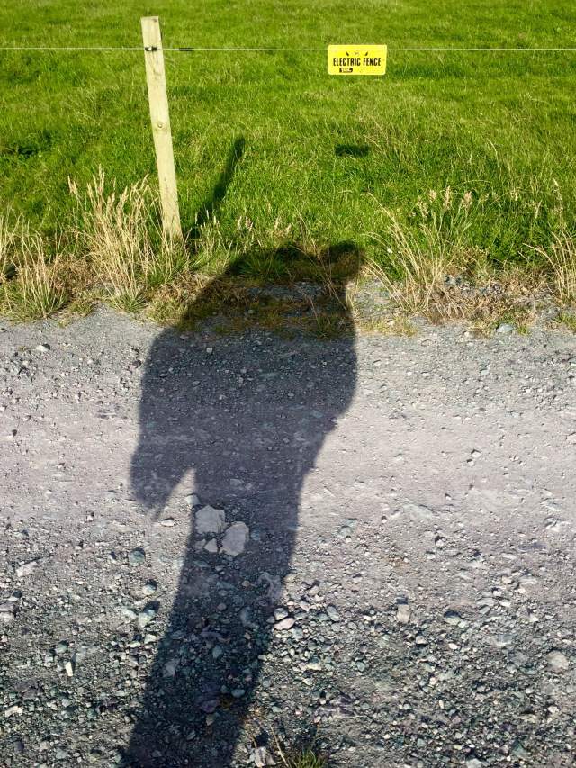
It was time to get to camp for the night. My instructions were to find an electric fence and head inland, which is what I did.

IMG_3303


A huge thanks to Hirdre Fawr Farm for giving me a pitch for the night! And thank you to the tireless Terry for arranging once more.

———–

I’m currently sitting in The Lion Hotel in Tudweiliog trying in vain to upload this blog. The internet is painfully slow. It’s taken me 90 minutes to get this far. Something tells me that this is how it will be for the next couple of days at least. It may be a few days until the next instalment so apologies in advance if that is the case.

68. Trefor – Pistyll

68. Trefor – Pistyll

Distance: 6.1 miles

Max Altitude: 349 m

Min Altitude: 15 m

Height Gain: 478 m

Height Loss: 469 m

Like yesterday, I decided before the get go that this would be a half day, of sorts. Better than having a full day off kicking my heels, I thought that getting even a few miles under my belt would be better than none at all.

So off I went from Trefor. Almost immediately the Wales Coast Path started going up. And up. And up. In no time, Trefor and the surrounding coast was distinctly small.


But it didn’t stop there. The ascent continued up and through Yr Eifl, the three-peaked mountain range. The views got better and better.


Meanwhile, my calves were staging a coup against me. I struggled on upwards, my pack seemingly getting heavier with every single step. Eventually with much huffing and puffing and geeing myself on, I got to Bwlch Yr Eifl, standing at 1150ft. It’s not a great height to climb by any stretch of the imagination, but it is when it’s tagged onto more than 500 miles of walking.

From there it was a nice easy descent down into Nant Gwrtheyrn.

https://instagram.com/p/BIz0upIBczJ/

This tiny quarry village was abandoned in the 1940s, the buildings becoming derelict. But the land was purchased in the 1970s and a restoration project got underway. It is now a vital heritage and learning centre for the Welsh language. I have happy memories of staying here in primary school. I couldn’t wait to see how it had changed.


It still had the warm and homely village feel that I remember.


Cafe Meinir (named after the tragic heroine of the Rhys and Meinir Welsh love legend) was open and it would’ve been rude to go past without ordering something.

With my belly full, I rejoined the Wales Coast Path, which helpfully goes right through Nant Gwrtheyrn and across to Porth y Nant.

Strewn along the beach were heavy duty quarrying artefacts from the bygone industrial era; a gold mine for someone like me who loves such things!


Once again, the WCP started to ascend. “Please, no!” I thought to myself. One mountain range is quite enough for one day.


Yes the views were spectacular as you can see but my oh my, my calves, feet, legs…soul (!) hated my guts.


My day was almost over however, and the pain in my feet would shortly be gone.

A few weeks ago, if you remember, I was interviewed on the Shan Cothi programme on BBC Radio Cymru. Brian Thomas who runs Penllŷn Accomodation was listening and got in touch with me offering a place to stay when I got to Pen Llŷn. And there he was in Pistyll waiting for me!

I was whisked away to his BnB, where I met his wife Jane and was shown to the most wonderful room, fit for a queen. I felt very lucky and very spoilt. I shall add some photos of this fabulous place tomorrow, as soon as my signal allows it. In the meantime, here was the sunset from my window.


That reminds me, apologies in advance for late blog posts. My signal is mostly non-existent at the moment but I shall be uploading updates as an when it’s possible.

error: This content is under copyright.