Browsed by
Month: September 2016

111. Hafan San Ffraid (St. Bride’s Haven) – St Anne’s Head

111. Hafan San Ffraid (St. Bride’s Haven) – St Anne’s Head

Distance: 12.24 miles

Max Altitude: 80 m

Min Altitude: 9 m

Height Gain: 302 m

Height Loss: 273 m

It was mid morning when I set off from St Bride’s. Next to the beach here is a church and also a non-obvious building. I stepped inside to discover that it’s a pump house.

I discovered that it had been built in 1904 to provide fresh water to St Bride’s Castle. This is an imposing building and had been visible to me most of yesterday (though I have failed to get a decent photo of it with my phone). The water comes from a nearby spring and amazingly the engine and pump are still in working order.

Satisfied that I had learnt something, I started walking.

As ever, there were wild ponies grazing. This beauty kept me company and accompanied me across a field.

One thing I’ve noticed over the last couple of weeks on the Wales Coast Path is an upsurge in fungi. This one had grown to the size of a palm tree (no, really).

I began seeing oil tankers out at sea, an indication that I was nearing Aberdaugleddau (Milford Haven) and Doc Penfro (Pembroke Dock).

As ever, it was pretty idyllic on the trail. I couldn’t believe the colour of the sea, a purest turquoise.

I looked back at my day’s progress so far. Not bad. Incidentally, that black dot below is not a bit of grit on the lens but a divebombing bird. The birds in these parts don’t muck about, I tell you.

I was flagging. Luckily though, the hedges were brimming with blackberries. My progress slowed as I gorged myself on fat, tangy berries every few metres. A much needed sugar boost.

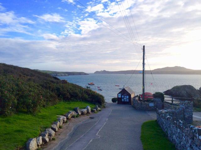
I got to Martin’s Haven around lunchtime. Boats to nearby Skomer Island all depart from the small jetty in the photo. There were none leaving today due to rough seas. I had visited Skomer in my teens whilst on a biology field trip. I saw puffins, seals and all manner of wildlife. I suddenly wished that I could visit again. I felt that it would happen soon, somehow.

As I walked up the road, I noticed this strange-shaped stone jammed into the wall. A nearby inscription said that it was discovered in 1984 in the foundation course of the Victorian wall. The ring-cross stems from the 7th to the 9th centuries and more than 30 have been found in Pembrokeshire. The speculation is that it marks a prayer station or burial location.

My guidebook had alerted me to the presence of Lockley Lodge, a small visitors’ centre also selling refreshments and the like. I was hungry and looking forward to eating. But as I strode up to the building, I saw that it was shut. When was it open again? April 2017. Oh.

With my belly complaining, I decided to walk into Marloes in search of grub.

Here I am.

After walking some two miles down the road I got to Marloes.

I made a beeline for the Lobster Pot pub and practically inhaled a cheese and onion baguette. I was the only person in the pub. I also had my shoes and socks off in order to try to get some life back into my trotters. Sometimes, needs must.

I picked up some supplies at the shop on the way out of Marloes and got on my way.

Just as I was leaving I got a message from Terry to tell me that accommodation was all sorted for the evening. A very kind man was welcoming me into his home on St Ann’s Head. Excellent, I thought.

I found a bridleway and eventually got back on to the Wales Coast Path. The route took me across the disused Dale airfield. This was one of eight airfields that were built in Pembrokeshire during the Second World War. It opened in June 1942 and for a year operated Wellington bombers of No. 304 (Polish) squadron. They flew on convoy protection missions as well as bombing raids on ports in occupied France. Back in Marloes in the church, there is a roll of honour to the Polish aircrew who served here.

Looking at the satellite image, Dale has a pattern of three intersecting runways in a triangle. This is impossible to discern from the ground, of course. I found myself walking down one of the runways, and ended up on the cliff edge looking out towards Skokholm island. I was the only person around for miles.

The views were, as always, spectacular.

As well as the runways, there was evidence of other buildings too. A quick look on Google showed me that buildings such as accommodation blocks were sited on farms and other areas well away from the airfield as this offered better protection from enemy action.

I wanted to stay and explore further. But I had to push on. Needless to say, it has been added to my return list and I also have a lot of historical reading up to do on it too.

When I got to west Dale beach I was amazed at the scale of the landslides that have occurred there.

I possibly should have taken advantage of the fact that I was the only person in the vicinity. But I needed to get to St Ann’s Head.

How perfect is it here though?

For quite some time, these wild ponies followed me as I made my way along the trail.

At one point they began galloping together. I could have filmed them doing so but I just absorbed the scene with my eyes instead. Soon they were silhouettes on the horizon behind me.

St Ann’s Head was looking stunning in the late afternoon sunlight.

I was so happy to see the lighthouse in the distance. I had almost reached my destination for the evening.

I was given the warmest welcome imaginable at The Officer’s House by Frans. Over dinner that evening we discussed the local history, politics and architecture amongst other things. I can’t thank him enough for opening his fascinating house to me and being so hospitable.

110. Niwgwl (Newgale) – Hafan San Ffraid (St. Bride’s Haven)

110. Niwgwl (Newgale) – Hafan San Ffraid (St. Bride’s Haven)

Distance: 12.67

Max Altitude: 81 m

Min Altitude: 3 m

Height Gain: 475 m

Height Loss: 475 m

My flip flops finally gave way after months of trusty service. Despite my best efforts with gaffa tape, they could not be saved. So I decided to get another pair in a surf shop before I left Newgale. I found some I liked, bought them, had a cup of tea and started walking.

It was overcast and washed out, weather-wise. But the geology was astounding.

It didn’t take me long to reach Nolton Haven.

I got down to the beach and decided that it would be the perfect time to try my  flip flops on. I walked about the sand exploring and taking photos in my brand new footwear.

What I hadn’t realised was that I had trodden in dog muck, considerately left behind on the beach by some ******* (insert applicable term) dog and its owner.

Disgusted and traumatised I began to scrape the foul-smelling material from the sole, gagging every couple of seconds.  I cleaned until every trace was gone. Then I doused them in anti-bacterial hand sanitiser for good measure.

On the up side though, I found a stone on the beach that looks like a sombrero.

I continued.

Not long out of Nolton Haven, I ambled past the so-called ‘Teletubby’ house, named Malator. I had no firm opinions on it whatsoever except it looks like a huge eye.

I was more excited about this washed-up buoy to be honest.

This is a memorial to Olympic swimmer, Glyn Charles, who died at sea. He wasn’t from Pembrokeshire but he loved it, according to the inscription.


And then I encountered this huge beast. How grateful I was that there was a fence separating me from him. Look at the size of the horns!

Broad Haven was empty but for a few people wandering about. Imagine the same spot just three weeks ago…. throngs of tourists everywhere no doubt. I was glad to be passing through on a quiet day.

I had a quick coffee and a bit before continuing to Little Haven.

It was also very quiet. It suited me.

How chuffed I was to encounter seals yet again on my walk. I heard them calling before I got to the cliff edge and sure as anything, there they were on the shore. Joy!

Nearby was another family member bobbing about in the sea. Granted these are not the most detailed photographs!

Did you know that in Pembrokeshire they have cows which faithfully point you in the right direction?


I didn’t have long to go. Dusk was on its way. Meanwhile, I thought this bit of the cliff looked like a steak (rare).

Around the headland was my stopping place for the evening, San Ffraid (St. Bride’s Haven). Relief.

My feet were swollen and painful. But I had a treat awaiting me so I almost didn’t care. Tireless Terry had organised a bed at a nearby B&B for me. I arrived at Pendyffryn in Little Haven before it got dark and was shown to my wonderful room by Rosemary. What a welcome and a surprise!

I had a shower and watched the news (which I goggled at in bemusement; I am a little out of touch with current affairs by now). I fell asleep exhausted but glad to have a roof over my head.

109. Porthstinian – Niwgwl (Newgale)

109. Porthstinian – Niwgwl (Newgale)

Distance: 16.3 miles

Max Altitude: 108 m

Min Altitude: 2 m

Height Gain: 535 m

Height Loss: 548 m

It was another fine day on the Wales Coast Path and I started walking from the Tyddewi (St Davids) Lifeboat Station. The forecast was favourable and I planned to make a proper assault on the trail.

Ynys Dewi (Ramsey Island) opposite was bathed in sunlight.

I was curious about this line of buoys in the photo, and wondered whether they were there to denote a wreck of some sort. Anyone reading who has an idea, please tell me.

I had miles of rugged coastline ahead of me. The terrain underfoot was pretty tough going, I must say. I was careful about where I trod and watched every step carefully. I didn’t want to give my feet any further reason to hate me.

I came around the headland into the narrow Porth Clais.

There was plenty of evidence of its industrial past.


I continued onwards after a break to elevate my feet. I came past Bae Santes Non (for those of you who don’t know, Non was St David’s mum), and noticed a group of coasteers having a whale of a time. Like lemmings they leapt from the rocks into the sea below.

Bae Caerfai was my next port of call.

I could scarcely believe the variety of colours in the rocks.

There were signs warning that there were wild ponies grazing about the place but I hadn’t seen any. Just as I started to wonder where they all were, I saw this pair happily munching away next to the path.

The wild coastline continued. Each cove took my breath away.

One thing that struck me in particular was the nature of the grassy terrain. It was wavy and looked like someone had laid carpet over a set of office cables.

Late afternoon was starting to produce that distinctive Pembrokeshire sunset.

I was delighted to see yet another natural arch at Porth y Rhaw. I started to wonder how many there were around Wales’ coastline. And then I started to wonder whether it was possible to kayak through all of them. Was this another hair-brained adventure scheme I was dreaming up?

Finally I had reached Solfach (Solva), one of my favourite harbour-side villages.

Even better was the fact that I had a yarnbombed waymark to guide me in.

It was promising to be a beautiful dusk.

Here’s a pointless local fact for you. The musician David Gray moved to Solfach when he was eight years old. His parents ran this craft shop in the village.

A quick drink and snack at The Harbour pub and I was back on my way again.


It wasn’t far out of Solva when I encountered this beautiful wild pony right on the track.


I kept having to stop to look at the sunset.

By the time I arrived into Newgale, the sunset was a true work of art.


The sea was calm with no surf whatsoever. I sat on the beach and watched the sun disappear.

103. Porthgain – Porthstinian

103. Porthgain – Porthstinian

Distance: 12.36 miles

Max Altitude: 103 m

Min Altitude: 1 m

Height Gain: 484 m

Height Loss: 471 m

My day began at The Sloop Inn at Porthgain. A mighty breakfast to start the day.

It’s hard not to like this place or not be fascinated by its contents. Everywhere you look there are bits and bobs, various sorts of memorabilia, trinkets, maritime odds and ends, photographs and ephemera. And the food is great too!

Before I re-joined the Wales Coast Path I decided to look around the village and harbour.

These white beacons were placed here as markers to guide boats into the harbour.

On the green in the middle of the village was this washed up float from a catamaran. I was about to do the research on where it had come from when I saw  The Sloop’s Facebook page contained all the information already, thus saving me the trouble! This float washed up at Abereiddy and was moved here by staff from The Sloop. It was competing in the Transit Jacques Vabre race when it struck a shipping container. The two crew members made their way safely back to France, while this bit of their vessel made it all the way here to Pembrokeshire.

It was time to move on. I was sorry to say goodbye to Porthgain. It continues to be one of my favourite places.

I walked past these dilapidated buildings and wondered what they looked like when they were in use, who worked here, what happened to them…

25photo_2016-09-16_12-57-51

23photo_2016-09-16_12-57-39

22photo_2016-09-16_12-57-35

It was a wonderful day outdoors. It was all I could do to carry on walking instead of stopping to gawp at every sight I encountered.

21photo_2016-09-16_12-57-29

I arrived in Abereiddy in the aftermath of the Red Bull Cliff Diving. I had tried to get tickets for the event but they had long since sold out. Apparently thousands of people had crammed into the environs around the so-called Blue Lagoon to witness the spectacle. But by the time I came through it was empty, with just a couple of security guards hanging about.

20photo_2016-09-16_12-57-24

My breath disappeared from my lungs when I saw the diving boards. Look how high up they are!

19photo_2016-09-16_12-57-19

And the Visit Wales ‘EPIC’ slogan was also still there. But so was the miserable security guard sitting in the car behind, ruining my shot!
17photo_2016-09-16_12-57-03

By the time I made my way around the path to the bottom of the cliff, Miserable Security Guard was sitting on the actual sign. I was destined to not get an epic shot by the looks of it.

16photo_2016-09-16_12-56-56
15photo_2016-09-16_12-56-53

My next encounter was with a group of hay bales. Or at least, it could have been. They appeared to have rolled down the hill and onto the Wales Coast Path. I began imagining scenes from Indiana Jones, only with me in the title role instead of Harrison Ford.

13photo_2016-09-16_12-56-22

The last time I had seen the sea this blue was on Ynys Môn weeks and weeks ago.

12photo_2016-09-16_12-55-50

10photo_2016-09-16_12-55-42

Just as I was comparing the Pembrokeshire Coast with the Greek Islands, something burst my bubble and reminded me that I was, indeed, still in Wales…. yes, cattle. My nemeses.

They were scattered across the path, blocking my way. ‘Oh no’, I thought to myself, ‘not again’.

9photo_2016-09-16_12-55-37

As I got closer I saw that they were trying to have a drink in a stream. It was a hot day, so who could blame them. I tried to moo and chat to them (three months alone on the trail will do this to a person), but it was no good. So I had to raise my voice, and shoo and clap them out of my way. For some reason I felt bad for doing so.

8photo_2016-09-16_12-55-34

And I was walking again. Unscathed.

7photo_2016-09-16_12-55-30

Porth Mawr (Whitesands Bay) was strangely quiet when I got there. Just a few surfers dotted about in the waves. I continued.


Yet more delight was about to greet me as I heard the now familiar sounds of seals. I peered over the edge of the cliff and there they were, lying down having a chat.

6photo_2016-09-16_12-55-24

Ynys Dewi (Ramsay Island) was up ahead. What a relief. My feet were barking at me to stop walking.

3photo_2016-09-16_12-55-13

And here was my stopping point in Porthstinian (St Justinian’s), at the Tyddewi (St David’s) Lifeboat Station. A new station is under construction. The old RNLI station below on the left was being sold as a holiday home (ah, Wales, country of holiday homes….).

2photo_2016-09-16_12-55-04

I sat and looked out on Ynys Dewi opposite me and contemplated my walk. I concluded that it had been yet another perfect day on the Wales Coast Path.

1photo_2016-09-16_12-54-44

102. Pen Caer (Strumble Head) – Porthgain

102. Pen Caer (Strumble Head) – Porthgain

Distance: 14.3 miles

Max Altitude: 136 m

Min Altitude: 3 m

Height Gain: 590 m

Height Loss: 624 m

Bless me, bloggers, for I have sinned. It’s been….er, quite a few days since my last post. My last walk, although only 10km in distance had left me banjaxed in mind and body (or feet more specifically). So I decided to rest. That coupled with never ending technical troubles have led to a shabby upkeep of this blog.

My feet have never warranted this much attention in my entire life. But each night I peel my socks off and stare at them wondering exactly what is going on beneath the surface. I don’t think I want to know. All I do know is that they hurt, badly, constantly.

As for what’s going on in my mind, well, that’s also a blank. I am feeling a little more refreshed than I had been. But in truth, I am shattered. I’ve been walking since June and yes, it has taken its toll. However, I shall plough on to the finish line even if I have to do it on all fours at 1 centimetre increments!

Back to the trail then….

The starting point for today was, as ever, where I left the Wales Coast Path a few days ago on my rubbish feet – Pen Caer or Strumble Head.

What a location eh? Yet another lighthouse to add to my burgeoning collection too. And you know how I love a lighthouse, reader.

I wasn’t the only one to appreciate the area either. Dozens of people had come for a visit, armed with cameras, tripods and binoculars. With the sun shining and the skies a happy blue, who could blame them?

I couldn’t hang about though and got on my way. Every few steps I kept looking back to see what I’d left behind.


It wasn’t hard to be in a good mood today in spite of my feet. I mean, just look at the surroundings.

A few days ago I was lucky enough to have a seal-filled walk. I encountered them around every cove and corner. And although they weren’t quite as prevalent today, I did spot them once again sunning themselves on the secret beaches below me. Delight!

16photo_2016-09-16_12-59-39

It was a truly glorious day, rugged and wild. How lucky we are in Wales.

15photo_2016-09-16_12-59-44

How about this for a view to eat your sandwiches to. Better than a computer screen eh?

14photo_2016-09-16_12-59-33

13photo_2016-09-16_12-58-32

I didn’t see many people, just one or two. It felt as though I had the entire path to myself.

12photo_2016-09-16_12-59-28

I was approaching the twin little and large beaches of Aberbach and Abermawr.

11photo_2016-09-16_12-57-58

I had another sit down here.

10photo_2016-09-16_12-58-11

Now, although I was surrounded by glorious scenes of nature throughout the day, the going was tough underfoot. And that’s no exaggeration. It was up and down constantly. And boy did my feet know about it.

9photo_2016-09-16_12-58-05

And as well as the ascents and descents, the nature of the terrain was at times tricky. It alternated between rock and stone, and muddy sog due to rain.

8photo_2016-09-16_12-58-20

It was evening by the time I made my way into Abercastell. The terrain and the state of my feet had slowed me to a snail’s pace. But hey, I was still going!

7photo_2016-09-16_12-58-37

One thing I love to see on my travels are the various types of houses on the Wales Coast Path. So many and so varied. I adore to see gardens decorated with the various maritime gubbins of buoys and ropes like this one on the way in to Abercastell.

6photo_2016-09-16_12-58-53

I could have stopped in Abercastell, and in many ways I probably should have. But I decided to continue. Don’t ask me why. Maybe it was the sunset beckoning me onwards. Maybe I just wanted to go ‘a proper distance’.
5photo_2016-09-16_12-58-45

As I rounded past Trefin the sun sank deeper into the sea in a deep honey and russet. I decided to walk the extra mile or so to Porthgain. After all, it would be foolish to waste such a sky. I definitely made the right decision.
2photo_2016-09-16_12-59-15

And so it was that I arrived into Porthgain as the last beams of orange sunlight spread out across the water. I stopped and just took in the scene before me.

Only now did I decide to stop. I watched the sun disappear completely and hobbled towards The Sloop for a drink. In spite of the pain, I felt content. Yes, I had managed to walk more than 14 miles and climbed almost 2000 feet. But really, that was beside the point almost. I had seen some of Wales’ finest coastline in its best light, witnessed seals in their natural habitat and experienced an epic sunset too.

Pretty much a perfect day’s walk.

98. Wdig (Goodwick) – Pen Caer (Strumble Head)

98. Wdig (Goodwick) – Pen Caer (Strumble Head)

Distance: 6.58 miles

Max Altitude: 98 m

Min Altitude: 4 m

Height Gain: 288 m

Height Loss: 255 m

Today’s theme is most definitely seals. Seals swimming, bobbing, sleeping, resting, flumping and frolicking.

But I’m getting ahead of myself. Let’s go back to the beginning.

I awoke to chunky sea fog which had descended upon Goodwick and made the visibility near zero. What a sight. I looked at the forecast and it promised that the fog would lift so I waited a couple of hours before leaving. No sense setting off when you can barely see your own hand.

Today was the day that I’d have to leave behind Chris and Richard’s wonderful hospitality. I had had a great time in their company, with many hours spent putting the world to rights too. It was a sorry goodbye and I felt sad as soon as I started walking. Thank you both so much!

So, a simple 5.5 miles on the Wales Coast Path to Pen Caer (Strumble Head) eh? Sounds like nothing, right? Wrong! It should have been entitled Struggle to Strumble. And yet it started out so positively overlooking the port.

Again, as with yesterday, the colours surrounding me seemed so vivid, almost hyper real. Should the water in a ferry port be this shade of luxurious turquoise at all? I marvelled at it.

Of course, I had the obligatory cannon to signal my farewell.

And with that I was off towards Pen Caer. It was difficult from the start. My feet pained me, it was muddy underfoot and the ups and downs were relentless. The whole time I was having to overcome the little voice in my head telling me to stop. It never seems far away these days.

I rounded a headland a couple of kilometres into the walk and spotted something moving in the water below. To my delight, it was a seal. It lifted my spirits and simultaneously had me cursing the fact that I didn’t have a better camera than my phone.

That black dot in the middle of the next photo is a seal. Honest.

And that’s how it went, pretty much until I stopped walking. Each cove I passed by had seal occupants enjoying various activities.

There were adults and babies, some more vocal than other side.

Some were swimming about, others were sleeping, while a large amount appeared to be just sunning themselves on rocks. A community of seals going about their business, whilst I had the privilege of looking on. These are sights I never thought I would witness.

I was so preoccupied with seal thoughts that I forgot to take a photo  at Carregwastad of a stone marking where French soldiers had landed during the last invasion of Britain. When I realised my mistake, I couldn’t face walking back so here it is from afar.

Once again I was checking my GPS every few metres. The sign back at the start of my walk had said 5.5 miles but I was already on 6 miles, and every step agony. How much more?

I can’t tell you the relief I felt when I saw the lighthouse flashing in the distance. I had made it. It was 6.5 miles (yes, the sign was a liar!) and a comparatively shorter distance than usual but because of my mindset it had felt like 26.5 miles.

I resolved to regroup and refocus over the coming days.

Luckily I had an offer of accomodation nearby from my friend Laura at her parents’ house. And so that’s where I ended up being treated like a queen thanks to Elspeth and Len. I had a bath, food, drink and rest. Diolch i chi’ch dau!

I felt very fortunate indeed.

97. Trefdraeth (Newport) – Wdig (Goodwick)

97. Trefdraeth (Newport) – Wdig (Goodwick)

Distance: 0.0 km

Max Altitude: 0 m

Min Altitude: 0 m

Height Gain: 0 m

Height Loss: 0 m

If I hadn’t slept well the night before last then last night certainly made up for it. I had virtually passed out at Chris and Richard’s house – I will never underestimate shelter, warmth and comfort ever again.

After breakfast I rejoined the Wales Coast Path at Trefdraeth. My intention was to have a quick bite at the Morawelon pub before setting off but it was shut, so on I walked. The tide was in so had a few sections which had to go inland.

It was one of those strange weather days on the coast. A light mist danced in the air making visibility poor, yet it was warm and muggy at the same time. Like walking into a bathroom after someone has had a shower.

Ynys Dinas (it’s not really an island though, but a peninsula) up ahead was shrouded in cloud. I made the decision not to circumnavigate it in such poor visibility.

Behind me though, the mist had risen to reveal the stunning colours of the surroundings.

I was making pretty good progress and was soon at the tiny beach of Aber Rhigian. I debated whether to stop but after a few moments elected to push ahead.


The sea glistened. The colour looked almost fake, like someone had coloured it in with a chunky crayon.

Aber Fforest was the next beach where I did stop to have a drink from the little stream. There were two older couples there with their dogs, Helga the German Shepherd and Lily a non-descript woolly one. If I had closed my eyes and just listened to the conversation, I could have sworn they were human children being spoken about, not dogs.

Cwm-yr-Eglwys was my next port of call. I had been looking forward to arriving here because my guide book promised a snack van. Indeed, there it was so I got my money ready and strode up to it. When I got to the window I saw that it was closed. Monday really isn’t the best day to be walking on any of the Wales Coast Path when it comes to food places. So many seem to be shut.

Well, there was consolation to be found in the St Brynach church. Not for religious reasons, mind you, but for historical ones. Only the belfry and west wall remain of this building. The rest was destroyed in the Royal Charter storm of 1859, the effects of which I learnt about on Ynys Môn in Moelfre.

I had a lie down on a bench so that I could raise my feet above my heart for a while. My view was eerie.

It was in Cwm-yr-Eglwys that the Wales Coast Path split into two. One way sends you around Ynys Dinas, the other is a wheelchair accessible route that takes you to Pwllgwaelod. So I chose the latter, having made the decision earlier on in the day. On the flat, smooth path I got to Pwllgwaelod in no time, and just ready for lunch.

The cheapest thing on the menu at the Old Sailors pub was a £5 cheese sandwich, so that’s what I had, reluctantly. To rub salt in the wound, my phone did something to delete the entire morning’s GPS mapping, meaning my journey from Trefdraeth had been wiped out and created a dreaded gap in my cherished stats. Ah well….

It was good to rest my feet though. Plus you can never underestimate the glory of a simple loo while you’re walking a trail all day along.

On I continued. The ups and downs seemed to get much worse after Pwllgwaelod and I was suddenly glad of my sandwich.

A thin mist still hung in the air. Up ahead, I could just about make out the port of Abergwaun (Fishguard) in the distance. There was a ferry in port.

Flagging already despite my nourishment I had a quick sit down at Aber Bach. Somebody had left this stone sculpture there.

The trail suddenly became very muddy and challenging underfoot.

The ups and downs also continued. My knees were not happy with this situation.

Everywhere I looked there were interesting rock formations to spot.

Finally, I arrived at the edge of Abergwaun, at the old fort.

I descended into Cwm Abergwaun (Lower Town).

I stumbled about on my painful feet looking at the community art.

And the cannons. They do love a cannon here.

What is interesting about Abergwaun is the fact that it was the setting for the last invasion of Britain. I’m sure that most people would think it was Pevensey or Hastings or whatnot. But no, the last one occurred in 1797 and right here to boot. Yes it was a failed invasion but an invasion it was nonetheless. The very cannons I encountered at the old fort had been used to fire blanks at the French ships.

I don’t think any of this is terribly well known or publicised beyond the local area. I only know about it because my mother used to tell me the story. I particularly loved the part about a heroine called Jemima Niclas rounding up a group of French soldiers with a pitch fork and holding them captive until a surrender was given at the Royal Oak pub (which is still open for business in the town).

Another thing which isn’t terribly well publicised is the fact that the longest tapestry in Europe, which tells this epic tale, is housed in the town hall. Yes, it’s longer than the Bayeux Tapestry!

Even if you’re not into your needlework you can’t help but be blown away by the amount of planning, creativity and hard graft that went into making this tapestry. I just wish more people knew about it.

My journey through Abergwaun continued. Goodwick is a very short distance away. On the surface of the Marine Walk path, I spotted this plea for forgiveness. I’d love to know the story behind it!

And with that, I arrived in Goodwick which is where the Stena Line ferry port is located. Sorry, Fishguard, but you know it and I know it…the port is quite clearly in Goodwick!

It was to be my stopping point for the day. That evening, Richard, Chris and I had a farewell meal at the Royal Oak. It was the perfect setting. Tomorrow I would have to bid them both a sorry farewell.

96. Pen Cemaes – Trefdraeth (Newport)

96. Pen Cemaes – Trefdraeth (Newport)

Distance: 13.85 miles

Max Altitude: 178 m

Min Altitude: 1 m

Height Gain: 595 m

Height Loss: 697 m

It had been a difficult night’s sleep in the blustery weather. Bleary eyed, I started rounding Pen Cemaes.

What struck me straight away were the rock formations in the cliff, the layers, folds, colours.

IMG_8887

Looking across, I was keen to get a decent photo of Ynys Aberteifi but in glum weather it was hard.

In a similar situation to Ynys Seiriol in the north, Ynys Aberteifi was once the home of puffins and Manx shearwater. But when a ship ran aground there in 1934, rats made it ashore and subsequently wiped out the island’s population of puffin and Manx shearwater. They’ve never returned. At least on Ynys Seiriol an effort was made to eradicate the island of rats, meaning that the puffins have returned.

I made my way past an abandoned Coastguard’s lookout and suddenly felt a ‘whoosh’ overhead. I looked up but saw nothing but then from the corner of my eye spotted two peregrine falcons jousting in sky. I had almost been collateral damage. Plus I wasn’t quick enough with the camera.

As I came to the crest of yet another cliff top I noticed a mass of rocks perched on a ledge. How vulnerable the coastline is, no matter how rugged the cliffs look.

IMG_8886

The route certainly wasn’t forgiving. Lots of steep climbs, flat sections, steady downhills and then back up again. I didn’t enjoy it.

On one of my descents I saw yet another rock formation. It was at times like these that I wish that I had paid more attention in geography.

IMG_8885

This section of the Wales Coast Path is notoriously remote, with very few facilities. However, due to it being the famous Pembrokeshire Coast Path, there were walkers everywhere. In fact it was busier than most other places I’d walked through.

I caught up with a group of ‘proper ramblers’, as I call them.  I come across them most days. They are identifiable because they’re always in big groups, wearing the same kit, usually have maps inside plastic pockets worn around their necks, and generally give me looks of disdain or ignore me completely. I think I could write a sociology book about the various types of walkers in existence when this challenge is done.

IMG_8882

I was finally homing in close to Trewyddel (Moylgrove). As I approached I could hear the waves crashing in the cove. Around the last corner was a bench, with a memorial plaque on it advising me to sit and observe the view.  So I did as instructed, took a seat, listened to the waves and watched them smash against the rocks.  I then followed the path down to the beach at Ceibwr.

IMG_8883

It was a melancholy little beach, compared to others. It made me a little sad so I didn’t stop for long.

I stopped for a bite to eat and got mesmerised by the rhythm of the crashing waves once more. I find it so hypnotic. The sea looked almost like ice.

IMG_8880

I had read about Pwll y Wrach (which mean’s ‘witches pool’) but it wasn’t what I was expecting. It’s certainly one of those natural phenomena best seen rather than explained. IMG_8888

It was, without doubt, confusing.  On the seaward side, there was a ledge above sea level, so no tide seemed to be coming from there.  There was a small cave, but the flow of water wasn’t enough to produce the tide within the pool.  On my flying visit I was unable to solve the  mystery. I think another visit and some prior reading will enlighten me. IMG_8889

I then passed a natural arch created from the cliffs by the water. In the distance was Pen Caer (Strumble Head).

IMG_8890

By this time I was starting to flag. I had plenty of water and supplies, but the weight of the pack coupled with the ups and downs were taking their toll on both my legs and my morale.

With my spirits waning I walked past a field of cows. They were the curious types and stumbled towards me wanting a better look. I stared at them and they stared at me.  I even tried feeding one of them a handful of fresh grass.  To my amazement, the one on the right below took me up on my offer and seemed grateful for the face-height offering.

IMG_8892

Then I spotted the odd one out – different colour, different hairdo and a different swagger to the girls.  Yes, it was a bull and as you can see he wasn’t too happy with my appearance. If looks could kill…

IMG_8891

However, there was a fence between he and I. Talk about relief.

IMG_8893

I was nearing Trefdraeth (Newport) and was literally counting down the metres, staring at my GPS constantly.  I then looked back and realised just how far I had come from Pen Cemaes.

IMG_8894

It started spitting with rain and I had to pick up the pace. But I stopped in my tracks when I saw this little character and his personal surroundings. He wasn’t with the rest of the flock and seemed quite content with his home. More bahjou than bijou (terribly sorry, couldn’t resist that one).

IMG_8896
My attention returned rather sharply when I was faced with this view. The path gave way to this drop a little too quickly for my liking.

IMG_8895

I found my way on to the nice flat sand of Trefdraeth.

IMG_8897

The tide was out so an easy stroll to the village? No. I hadn’t accounted for the Afon Nyfer and gotten a bit too excited about finishing walking for the day. I conceded that as much as I wanted to take the short cut and wade across the river, it wasn’t going to happen.

So I linked back up with the coast path using the main bridge to cross the Nyfer, which is known for its variety of bird life.

I made it to Trefdraeth banjaxed.

Fortunately, my bed at Richard and Chris’ house was waiting for me.

95. Aberteifi (Cardigan) – Pen Cemaes

95. Aberteifi (Cardigan) – Pen Cemaes

Distance: 5 miles

Max Altitude: 123 m

Min Altitude: 1 m

Height Gain: 194 m

Height Loss: 101 m

What do they say about the best laid plans? I had big intentions for today and it was going to be one of those long days of hiking. But the weather had other ideas.

The rain in Aberteifi was biblical and I spent the morning and early afternoon sheltering inside a cafe. Memories of being eight years old and stuck inside during my summer holidays. 

When it started to clear eventually, I made a break for it, knowing that I wouldn’t get that far. Still, every mile counts. 

My first task was to cross the Afon Teifi. 

There were plenty of interesting buildings en route to Llandudoch (St Dogmaels). 

And it was without fuss or ceremony that I crossed into Sir Benfro (Pembrokeshire). Ceredigion had come to an end and I felt a brief moment of sadness.

I got to Llandudoch and had a quick nose around the ruins of the monastery.

It was founded in the 6th century by Dudoch Sant, who gave the town its name. It was shut by Henry VIII in 1536.

The Wales Coast Path founds its way back to the very edge of the water. And right there was the marker to indicate the official beginning of the Pembrokeshire Coast Path. I had reached yet another milestone on my journey.

One of the most famous walks in Europe, possibly the world, this path was established in 1970. It’s 300km, or 186 miles, in length and stretches from Llandudoch to Amroth. 

The beginning of a new Walking Wales chapter and an exciting one.

I bypassed another family favourite of Poppit, purely because of the weather. It was by now raining again, coupled with the high winds. Not exactly the day to enjoy lovely Poppit, so I pressed on. 

The Pembrokeshire Coast Path, like the Offa’s Dyke Path, is a National Trail, whose waymarks are tiny acorns. I hadn’t seen one since I stepped off the ODP in Prestatyn way back in June (feels like years ago). So I was delighted to be guided by them once more on this part of my trek.

The ascent up to Pen Cemaes was relentless and really quite miserable. This is the highest point on the Pembrokeshire section. Maybe good to get it out of the way quickly? In high winds though? Maybe not. The views over to Ynys Aberteifi were awesome, but imagine the same view with a beautiful blue sky and sunshine. 


My stopping point for the night would be a very blustery Pen Cemaes. I battened down the hatches and prepared for a stormy night.

error: This content is under copyright.