Browsed by
Category: Cerdded Cymru – Walking Wales

153. Y Barri (Barry) – Penarth

153. Y Barri (Barry) – Penarth

153_20161031_altitude

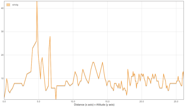
Distance: 10.87 miles

Max Altitude: 34 m

Min Altitude: 6 m

Height Gain: 129 m

Height Loss: 121 m


It was a bizarre foggy start to the day, a proper pea souper. I walked through the Knap shrouded in a mysterious gloom.

The tide was out and I considered walking across the bay to Barry Island but I didn’t fancy dealing with the sinking and soggy sand so I continued through parkland and then along Harbour Road. When I was little, driving down this road in the car meant you were seconds away from South Wales’ answer to Disneyworld, Barry Island Pleasure Park. Hot summer evenings, huge eyes, excitement, neon, the Log Flume, the wide-mouthed hippos on the jungle ride, clouds of candy floss, the ghost train, those red toffee dummy things on ribbons, the Waltzers, chips and fun. Happy days. But then Barry Island seemed to go a bit, well, rubbish, and people stopped going there. It went derelict and became nothing more than a fond childhood memory. However, a few years ago the life started to come back into it and it got a facelift finally. Before I got to the fair today though I had to walk towards Friar’s Point first.

The first thing I saw was this –

The mist was lifting slowly on Whitmore Bay.

Across the beach was Barry Island in all its glory.

I guess you can’t mention this place any more without mentioning ‘Gavin & Stacey’.


Despite the fact that many of the shops and eateries were shut, it still had that unmistakable vinegary smell of chips and sweet candy.

The promenade which, just a few years ago, had gone to look unkempt and depressing was clean and landscaped once more.

The happy memories were dashing in and out of my mind. I’m making it sound like I haven’t visited here since I was a kid. That’s not true of course. But today seemed to be more of a stroll down memory lane than usual. Maybe it was because I was so close to home. Maybe it was because I was walking through at the end of more than 1100 miles of hiking. Who knows.

And by the way, if you’re thinking of calling this big wheel ‘the Barry Eye’, forget about it. A certain tourist attraction in London is not happy about it.

On a hot summer’s day, the following view includes hundreds and hundreds of beachgoers who have flocked here from across South Wales. It’s bizarre to see it so quiet.

I continued along the renovated prom.


I reached the relatively new and supremely colourful beach huts.


How pretty are they?


And unlike certain beach huts in other areas of Wales, these ones only cost £10 for peak times. No more struggling to get your underwear on whilst trying to pin your towel to your chest with your chin.


There’s also this jolly traversing wall, which spells out ‘Ynys y Barri’ (in Welsh Barry get a definite article preceding it).

I was enjoying my walk a lot. And I was enjoying Barry Island. I genuinely think that this is the nicest seaside destination of its sort in Wales. It wasn’t ten years ago but it certainly is now.

Everywhere you look, an effort has been made and that’s great.

I was getting to Nell’s Point.


I climbed up the hill. I was headed for the house of Chris and Margaret, a couple I had met in Freshwater East. We had chatted for ages and I had promised to pop by on my way past.


I knocked the door and Chris answered. I had surprised him and he was pleased to see me. Soon, Margaret arrived back from her walking group and we had tea. After a lovely chat and catch up I was back on my way.

I rounded the island and overlooked the lighthouse (yay!) on the breakwater.

Oh, did I mention it was Halloween?


Soon I was on the other side of the fairground and underneath the not-Barry Eye.


And I spotted the rogue panda from earlier on. He seemed to have his own bamboo so I didn’t need to feed him.


From there I took the new road off the island and along the redeveloped waterfront.

It was cold but crisp.


I deviated from the official path and cut through the docks.

I was behind the Dow Corning works.

I love this road. On the surface it’s ugly but it offers a glimpse behind the scenes of the local maritime industry.


I had an ulterior motive to my move off route. Firstly, it would actually bring me back to the side of the water sooner, but moreover, my route would take me past one of my favourite buildings in South Wales – the former Sully Hospital, now known as Hayes Point. It was built in 1936 and originally housed tuberculosis patients before later becoming a psychiatric facility.

I was back on the side of the water, but not yet on the official Wales Coast Path. Looking across the bay I could see Ynys Sili (Sully Island).


I walked past Tŷ Hafan, the Welsh children’s hospice, and looked back. How I love this stretch of coastline. The Wales Coast Path rejoined me and I moved onwards.


Every few metres there were little bits and bobs showcasing the area’s heritage and history.


Ynys Sili or Sully Island is a tiny tidal island near Swanbridge. A pirate known as ‘The Night Hawk’ used the island as his base in the 13th century and it’s had its fair share smuggling too. In 2011, it was put up for sale for £1.25 million but was then reduced to just £95,000 due to lack of interest. 


I popped into the Captain’s Wife pub for a quick drink before re-starting my hike.

There’s been an awful lot of coastal erosion in this neck of the woods, meaning that the Wales Coast Path has been re-routed to avoid the landslides.


My stopping point for the day was to be Trwyn Larnog (Lavernock Point). It was at this location that the very first wireless signals over open sea were sent by Guglielmo Marconito to Ynys Echni (Flat Holm). It said “ARE YOU READY”,  followed by “CAN YOU HEAR ME”. The reply was “YES LOUD AND CLEAR”. Quite amazing really. And now there’s this caravan park here to mark the spot.

I stopped hiking with a heavy heart. Tomorrow would be the last day of my hike. This incredible adventure was almost at an end.


152. Aberogwr (Ogmore) – Y Barri (Barry)

152. Aberogwr (Ogmore) – Y Barri (Barry)

20161030_altitude

Distance: 23.90 miles

Max Altitude: 79 m

Min Altitude: 4 m

Height Gain: 592 m

Height Loss: 591 m

Before I set out I had decided that today needed to be a mammoth hike, no matter what. I wanted to arrive in Cardiff Bay on the 1st of November, the start of Pancreatic Cancer Awareness Month. It was an opportunity too important to miss. So even if my legs dropped off, I was determined to go the distance, as they say.

I set off from Ogmore Castle on the Wales Coast Path, and flanked the Afon Ogwr beside me. Across the water was the Merthyr Mawr dunes, with what’s known as ‘the Big Dipper’ (a huge energy-sapping, leg-killing sand mountain) peeking out.

I rounded the opening of the estuary onto Aberogwr (Ogmore-by-Sea). Here’s where the coastline changes dramatically. It’s the beginning of the Glamorgan Heritage Coast, a 14 mile stretch of sheer beauty. Also my most familiar stretch of the Wales Coast Path, as I’ve walked this section so many times. It never ceases to amaze me how this part gets overlooked in favour of, say, Pembrokeshire. To me it is just as stunning as any other part of our coastline, if not more so.

I left Ogmore on a narrow track high above the cliff edge.

Why do I love it so? Well, quite simply, look  –

I’m sure some could go into a lengthy geological diatribe, but instead, I think it’s just best to appreciate the layered cliffs for what they are visually. Again, I was annoyed that the weather wasn’t finer for better pictures, especially since I was arriving into yet another of my favourite beaches, Southerndown, the much beloved destination for local surfers.

Also in Southerndown is the secret cliff top garden. In summer it’s a joy.

Coming to Trwyn y Witch, I looked out upon a view that never ceases to take my breath away, and I’ve stood on this clifftop dozens and dozens of times.

Again, I wish for a blue sky. But even under the murky grey, it looks spectacular.

And then I reached somewhere that I’d been looking forward to getting to for the entire trip; probably one of my favourite places on earth – Nash Point. By now, reader, you know my penchant for lighthouses and this happens to be one of the best on the whole path. This one dates from 1831 and was placed here because of the treacherous nature of Nash Sands. It first became electrified in 1968 and was the last manned lighthouse in Wales before it became automated in 1998. There are actually two lights, a high light and a low light, as well as a fog horn (but that only gets sounded a couple of times each month for visitors these days).

I had a cup of tea and a banana at the nearby Clifftop Cafe before getting back on the trail. 

My next port of call was Castell Sain Dunwyd (St Donat’s Castle).

This particular castle has to have one of the most colourful histories in Wales. The earliest bits of it date from the late 12th century. However, it was in the 20th century that its notoriety came into its own because upon spotting it in a magazine in 1925, the newspaper mogul William Randolph Hearst decided he wanted it. He spent a fortune renovating it and bringing electricity to it for the first time; he even brought electricity to the local neighbourhood. Some of Hearst’s famous guests included guests included Charlie Chaplin, Douglas Fairbanks, John F Kennedy and George Bernard Shaw. Incredible.

After his newspaper empire fell on hard times, the castle was put up for sale but used by troops during the Second World War. Eventually, it became what it is now – Atlantic College, founded in 1962.

As with other parts of the path, there were WWII defences dotted about.

Just a short walk from St Donat’s was Llanilltud Fawr (also known as Llantwit Major, which always makes me wince). This is another of my beloved local beaches and the beach cafe does splendid cliffs.

I come here often for a cup of tea and a marvel at the cliffs.

I continued east towards towards Sain Tathan (St Athan).

On the way is the Seawatch Centre but sadly looking overgrown and unloved.

The Glamorgan Heritage Coast was at an end and the beast of Aberthaw Power Station came into full view. This used to be a golf course before this lump got dumped on the landscape in 1968. The pollution it emits has recently come under scrutiny but heaven only knows what that means for its future.

On the beach leading up to the power station are these cubes which line the beach. They are anti-invasion defences which date back to the Second World War that formed part of the Western Command’s coastal defences.

Out in the water is the power station’s caisson.

The sea wall has some interesting graffiti daubed on it.

By now I was walking right next to the power station. The Wales Coast Path takes you as close to it as you could be.

When it was built the Afon Ddawan (Thaw) was rerouted down this channel.

The Aberthaw Lime Works were opened in 1888 and was in operation until the mid 1920s. It’s now derelict.

Looking back, it’s a beautiful area, in spite of the power station.

I hiked past Fontygary and towards Trwyn y Rhws (Rhoose Point), which claims to be the most southerly point of mainland Wales.

I came to Porthkerry caravan park and ended up hiking past this inviting swimming pool. Anyone fancy a dip? No, I didn’t think so.

I was in autopilot having trodden this route on so many occasions. I came past the Porthkerry Viaduct.

This is when those layered cliffs reappear, just before Cold Knap.

The tide was out so I was able to walk across the pebble beach rather than take the higher route through the forest above. And for that I was thankful!

These cliffs really are magnificent and present themselves differently every time I walk past.

Shattered, I had made it as far as I could. It was my longest day yet on the Wales Coast Path and I was beaten. There was nothing left but to watch the sun disappear into the water in front of me.

151. Rest Bay – Aberogwr (Ogmore)

151. Rest Bay – Aberogwr (Ogmore)

20161029_altitude

Distance: 10.80 miles

Max Altitude: 30 m

Min Altitude: 1 m

Height Gain: 143 m

Height Loss: 148 m

It was great to be back at Rest Bay, one of my favourite beaches. It wasn’t often that I had seen it under such grey skies. My memories are of a blue sky, fluffy clouds and hot sun. So I was extra pleased to see the water teeming with surfers, keen to make the most of the windy conditions.

I followed the Wales Coast Path towards Porthcawl and along the seafront. It was quiet with hardly anybody about. The polar opposite of when hundreds of Elvis impersonators descend on the town each year.

I was reverting to type and making a beeline for the….yes you guessed it, the lighthouse! What else?!

This iconic lighthouse was built in 1860 and was the last coal and gas-powered lighthouse in the UK. It switched to being powered by gas in 1974. Incredibly, it had run on a meter placed at the bottom of the tower and brave souls had to feed in coins into it in order to keep the light burning. The lighthouse eventually went electric in 1997.

Porthcawl lighthouse and breakwater is also notorious for its storms. If you want to see how rough the sea can get at this apparently calm spot, then click here.

The Wales Coast Path then diverts inland to avoid Coney Beach Pleasure Park. You can walk through it but I wasn’t much in the mood for neon and flashing lights so I followed the track and came out on Trecco Bay.

I left Porthcawl and the funfair behind and headed across Newton Burrows towards Merthyr Mawr.

The photo that follows hardly does it justice but Merthyr Mawr is the site of some of Europe’s highest sand dunes.

And some of the scenes from the 1962 film, Lawrence of Arabia, were shot right here.

I am kicking myself for not taking some better shots while I was passing through. Many’s the time I’ve struggled up those dunes in the name of exercise.

It all went awry after the dunes. I was routed inland in order to avoid the Afon Ogwr. There were missing waymarks and I ended up in some commune. I was lost.

It was a little creepy to say the least. I needed to get to Ogmore Castle so I was delighted to finally spot this helpful stone waymark to help me.

Rather than cross the Afon Ewenni (Ewenny river) further up stream using a footbridge I chose to use these stepping stones. Many’s the time I’ve padded across these stones trying to avoid clattering into the water. I’ve not fallen in yet and today was no exception! Dry feet all round. Result!

The prize when I reached the other side was one of my favourite castles in Wales, Castell Ogwr or Ogmore Castle. I would have liked a photo of it from the other side of the river featuring the castle and stepping stones, but the tractor and trailer that were parked out front didn’t exactly add to the ambience, so here’s one closer up instead.

I decided to end my day here. It wouldn’t get much better than this after all. I had intended to go further but I believed that I could make up the distance in the coming days.

150. Baglan- Rest Bay

150. Baglan- Rest Bay

150_20161028_altitude

Distance: 16.20 miles

Max Altitude: 43 m

Min Altitude: 1 m

Height Gain: 185 m

Height Loss: 177 m

After yesterday, I was well on track to make my end goal, so I woke up sore, shattered but chuffed. I was looking forward to rejoining the coast on the first part of my day’s hike.

Aberafan is a beautiful stretch of coastline with soft sand and decent surf.

Public art adorns the promenade every few metres.

Once again I was grateful for the flat and even surface; nothing short of a godsend for my battered feet.

But all good things must come to an end, they say.

And the beach at Aberafan Sands was no exception.

From here on out, I would be hiking through and around one of South Wales’ most famous industrial landscapes – Port Talbot.

I walked with curiosity. Some people dislike the urban or industrial sections of the Wales Coast Path, preferring the numerous rugged and wild cliffs and so forth, but not me. One of the unique things about the WCP is its variety. When I’m walking past a factory or power station or even an alleyway, it’s as though the trail gives me the chance to look behind the scenes somehow, and offer a glimpse of something I wouldn’t ordinarily see. And me being a nosey sort, well, I find that pleasing.

Besides, the path was perfectly flat, so I wasn’t complaining. And there were things to study every few metres too.

My map told me that I had to cross this bridge. It had been built in 1903 by the Aberavon Corporation.

However –

A gap had been prized open in the fence and a pensioner rode through on his bike, giving me a smile as he did so. But new waymarks were directing me in the opposite direction, different to my map. So I followed them.

I was being led into Aberafan along the pavement.

Incidentally, calling this location ‘Port Talbot’ is a fairly recent thing. Port Talbot is formed from the merging of several villages, including Baglan, Aberafan and Margam. The name Port Talbot came about as a result of the Talbot family, who were local landowners. The Talbots were patrons of Margam Abbey, and also built Margam Castle. An extensive ironworks was built on their property. And they went on to develop a port and railway system too.

After I crossed the above footbridge I was on the lookout for a waymark. Finally I saw one. But I was being led down narrow lanes that I didn’t feel entirely comfortable walking down.

So I decided to walk through the town in order to try to find some food instead.

I ended up back out on the side of the road with the steelworks right in front of me. How many thousands of times have I driven past on the M4 staring a the smoke stacks I wonder? Not once have I stood beneath this behemoth at ground level though.

Everywhere I looked there were pipes and smoke and metal and grime.

The Wales Coast Path then took me through the village of Margam. By now I was far inland and walking past streets and houses on the pavement. Eventually, I was diverted back towards the coast.

Suddenly, the heavy industry disappeared and I ended up in woodland.

On the other side of the spiked fence was Eglwys Nunydd reservoir, a body of water I’d seen so many times from inside a car while whizzing past. It was created to provide water for the Tata steelworks.

I reached the end of the wooded lane and found myself at a level crossing. Only this was the type of level crossing that I hadn’t seen before. Instead of one or two lines, there were at least ten. I imagine one or two were for passenger trains and the rest for the steelworks.

There were warning and health and safety signs everywhere.

And I got to see the steelworks from the other side.

It was eerily quiet and a little creepy, I don’t mind admitting.

I seemed to be in some sort of defunct railway yard.

Pylons towered above me, their wires buzzing with electricity.

The ground became boggy but a purpose built causeway spared my feet from the sog.

Well, almost.

There was no doubt about where I was. The grime and oil from nearby was more than evident.

Continuing, I wasn’t sure of the way, so ascended a sand dune to see where I was in relation to the steelworks and the coast. That’s when this train graveyard appeared.

So I went exploring.

This is somewhere that I’ll definitely return to in the future. But with a proper camera rather than just a mobile phone.

The Wales Coast Path was heading into the Kenfig National Nature Reserve, one of Wales’ top sand-dune reserves.

The steelworks were now behind me. Unlike Shotton or Pembroke Dock for example, Port Talbot had left me feeling empty. Perhaps it was the weather. A blue sky has the ability to give most things a lift, but here I was under grey skies.

Anyway, I was back next to the sea once more so all was well with the world.

Even better was the dedicated track for walkers.

I reached Sker Point, location of one of Wales’ worst sea tragedies, and one which my mother remembers and has told me about. In 1947, the SS Samtampa was a steamship which ran aground at this location. There were 47 deaths, 39 from the ship and eight from volunteer crew of the Mumbles lifeboat. I had walked past that RNLI station only yesterday.

This sign told me that I was nearing the end of my day. I was next to the Royal Porthcawl links golf course.

It meant that I was coming in to one of my favourite beaches, Rest Bay. The sweet memories of long, hot childhood summers came flooding back. Splashing in the sea, building sand castles, exploring rock pools and then gathering bits and bobs quickly before the tide came in. The tidal range in this neck of the woods is the second highest in the world and comes in like an F1 car. One minute you’re padding about on dry sand, the next you’re up to your neck in saltwater if you’re not careful.

It was getting dark so I was grateful for this special EU-funded boardwalk that guided me in to Rest Bay.

My day finished with me looking out at the sea in wonderment. How on earth had I got here? Had I really walked all this way in order to get to one of my favourite beaches? I could scarcely believe it. It seemed nothing short of surreal.

I was still on course to make it back to Cardiff Bay on the date that I had in my mind. The adventure was almost over.

149. Southgate – Baglan

149. Southgate – Baglan

149_20161027_altitude

Distance: 22.05 miles

Max Altitude: 102 m

Min Altitude: 7 m

Height Gain: 535 m

Height Loss: 570 m

Yesterday evening had been spent studying maps and mileage charts. I had had a finish date for my trek in and for a while but I needed to see if my target was realistic. I was determined that it was, so I began to work out my distances needed every day over the next few days in order to make it happen. It seemed do-able.

With that in mind, I set out from Southgate and headed east on the Wales Coast Path. It wasn’t a blue sky day but it looked pretty dramatic nonetheless.

I was faced with the inevitable on Pwlldu Head.

They looked friendly enough and studied me with curiosity.

But then….

This time I was fortunate, and they made way for me eventually. The track took me down to Pwlldu Bay. I crossed the ford using a footbridge.

Shortly I arrived into Caswell Bay, another wonderful surfing location. It was looking as quiet as I’d ever seen it. No thrill seekers today.

I had a cheeky hot chocolate at the cafe and continued.

Another surfing destination was next. This time Langland Bay. And again, it was quiet.

I was making good time. The goals I had set were spurring me onwards and it felt like I had reached Limeslade in next to no time.

Extra motivation came in the form of another lighthouse to add to my growing collection on this hike. How many is that now?? The Mumbles Lighthouse was completed in 1794.

It was a short descent into the Mumbles itself and past the lifeboat house. In 1947 the Mumbles lifeboat and her crew of eight were lost while assisting the SS Samtampa which had run aground near Rest Bay.

From now on, it would be a flat and even surface for miles and miles, so I knew I was in with a good shot of hiking quite a distance. Some people hate walking on concrete or tarmac but it’s a godsend for my dodgy ankle. And by now, I’m never happier than when I’m faced with no hills. Hiking 1100 miles will do that to you.

The huge swoop of Swansea Bay was laid out in front of me, fresh to conquer. So off I went.

As I walked, I started to feel guilty about not spending more time in the Mumbles. I didn’t even stop for a Joe’s ice cream, which is nothing short of scandalous, frankly.

Dotted along the coastline were various public art exhibits. This one denotes a musical osprey.

Not sure about the added graffiti, mind you.

I looked out from the seafront back towards the Mumbles. I had come such a long way already.

I was at Swansea’s Civic Centre. What a view. It was the beginning of the Maritime Quarter, an area of the city that has undergone a lot of regeneration and where work is still ongoing.

Again, lots of public art on show. This is Zeta Mnemonical, a sculpture and weather vane.

And plenty of nice detailing on the buildings too.

Although it wasn’t as inspiring as the beachfront, I was grateful for the flat and even surface to walk on. So were my feet.

And yes, I was enjoying my walk. Very much in fact.

By now I was near the Swansea Barrage, built across the Afon Tawe. This is where Swansea gets its indigenous name, Abertawe. The English version, Swansea, is thought to be derived from Old Norse.

This is the Trafalgar Bridge, a pedestrian and cycle bridge that spans the river.

It cost £1.2 million to build and part of the bridge swings open with the lock gates. I had arrived just in time to see the lock gates open up for a small boat.

I waited for the bridge to swing back and crossed to the other side.

Dramatic skies hung above the marina.

It was the last dramatic view that I had during my walk. The Wales Coast Path has to turn away from the coast in order to avoid the city’s docklands area. I found myself walking on the pavement alongside the main road for what felt like ages. It wasn’t inspiring, but it wasn’t hard on my feet either, so it was a compromise I was willing to make. I walked past industrial units and factories with hundreds of cars driving by me. There wasn’t much to photograph so I didn’t need to stop.

By the time I got to Baglan, I could scarcely believe the progress I had made. My mileage chart said the hike was 18 miles but my GPS said 22. Either way, I had just taken a huge chunk of my remaining journey out. I felt bad for rushing past Swansea and not exploring further but I had my goal in mind and nothing would deter me from it.

148. Horton – Southgate

148. Horton – Southgate

148_20161026_altitude

Distance: 10.3 miles

Max Altitude: 83 m

Min Altitude: 2 m

Height Gain: 358 m

Height Loss: 308 m

Today I was joined on my walk by a friend of mine, Becca. Two and a half years ago we had tackled the Inca Trail together. So I was delighted to be walking alongside her once more, though this time at lower altitude and much closer to home. We had a lot of catching up to do so naturally we talked so much at the beginning of the walk that we missed the waymark directing us off the beach and onto the Wales Coast Path. When we did rediscover the waymark, somebody had balanced this Edvard Munch-esque stone on top. Apt.

We walked past some big and expensive looking homes. The owner of one was in his garden and invited us  in to take photos from his lawn. He was very proud of his garden so it would have been rude not to.

We continued along the trail. In a while we spotted a rope lying across the path and dangling over the edge of the cliff.

Naturally we had to investigate in the hope of discovering a smuggler’s cache or pirate’s gold…

But the only thing we discovered was the view. Lovely isn’t it?

There has been a lot of coastal erosion on this section of the path.

We noticed this discarded child’s dummy hanging on a plant.

But there was worse to come. In the distance we spotted a huge white object. When we got closer we saw that it was a huge pile of rubbish bags, just heaped up on the shore line. We were both disgusted. The amount of rubbish I see on a daily basis on our coastline is nothing less than a disgrace.

Anyway, after rounding the headland, we ended up in the thick of Oxwich Woods where the trail became a punishing series of climbs up never ending steps. Back in 2013 I walked between Port Eynon and the Mumbles during a day’s hike, and it’s funny how I had forgotten how hard this section is. Or maybe I had just blocked it out of my mind…(!)

Huffing and puffing, moaning and ranting, we ended up in Oxwich and made a beeline for the beachside cafe. It was open. Apparently.

The shop next door was open too.

Disheartened, we headed for the swanky Oxwich Bay Hotel for lunch instead. We walked in and were given a frosty reception by the waitress. Maybe it was because we were in our hiking gear rather than our ballgowns at 12pm. Looking around, it didn’t look like they got a lot of passing backpacking trade, but nonetheless, we were there to eat.

“Yes, girls?”, was the welcome we got. Staggered by her greeting, I held my hands up in an ‘are you kidding me?’ way.

“Oh you want a table?”, she responded, as though she thought we were there to clean the guttering rather than have lunch.

Begrudgingly, she showed us to a table and we ordered food. It was delicious and that the fact that we were getting dirty looks from for our attire didn’t diminish the taste one bit. In fact, it made it even better. So good in fact, that we indulged in our lunch for two whole hours. Easily, the longest lunch I’ve had on my travels.

By the time we got back on the trail, we were stuffed to the gills. But we had a beautiful beach stroll ahead to get rid of the bloated feeling.

What we hadn’t considered was that the tide was coming in while we were gorging ourselves. By the time we got to the eastern end of Oxwich Bay, we had no choice but to ascend up through the dunes of Oxwich Burrows to the top of the headland rather than just strolling around on the sand. We huffed and puffed through sinking sand once more.

Here was the prize when we got to the top.

We descended to Three Cliffs Bay where we walked through woodland and next to the tidal creek.

Pennard Pill has 26 stepping stones across it for walkers to get to the other side.

And neither of us fell in.

In the distance was the stunning Pennard Castle, built in the early 12th century during the Norman invasion of Wales. It now lies in the grounds of Pennard Golf Course.

What stunning scenery……and we didn’t look too bad either!

Another ascent to the top of the cliff gave us a view of where we had come from during the day. It was quite a distance.

Our day ended in Southgate. It had been so wonderful to have company during the day and to have a long chat and catch up with an old friend. Diolch, Becca.

147. Rhossili – Horton

147. Rhossili – Horton

147_20161025_altitude

Distance: 7.89 miles

Max Altitude: 80 m

Min Altitude: 6 m

Height Gain: 184 m

Height Loss: 249 m


The weather was not as kind to me as it had been during the previous days. It was a damp and claggy morning on the Wales Coast Path. But I couldn’t complain. I had had the most incredible few days of sunshine and blue skies.

With my jacket zipped up I began walking in high winds above Rhossili Bay.

To my right a blue sky was attempting to pop out from beneath the clouds, but to my left it was a different story.

Ahead of me was Worm’s Head. I had always thought it had been named thus for obvious reasons. However, following further investigation, it seems that I was wrong. It was named ‘wurm’ which meant ‘dragon’ by Viking invaders. You can see why. It’s actually a tidal island. I considered walking closer to it but thought it better to return in finer weather.

The National Coastwatch Institution occupies a former Coastguard station at the tip.

I continued. Unlike yesterday, today’s terrain was far more challenging. It amazes me that people I talk to often assume that I am walking on an actual path, sculpted, smooth and made of tarmac! The reality looks more like this most days –

There were quite a few people at Rhossili and many had walked down to Worm’s Head too. But by the time I rounded the headland I was alone once more. 

Mewslade Bay and Fall Bay were deserted.

Rays of sunshine were attempting to break through but without much luck.

The stunning sight of Overton Mere lay ahead, together with a treacherous descent to reach it. 

I wasn’t far from Port Eynon and would just have to round the headland (after another ascent!) to get there. 

Overton Mere was like a lunar landscape. This bay has a reputation for having caves which are perfect for hiding caches and contraband. I didn’t go hunting but maybe I should have. 

I left Overton Mere behind and headed up towards Port Eynon Point, all the time looking back in wonderment. By now the blue sky was beginning to win through.

A monument stands at the tip of Port Eynon Point. It stands as a testament to the founding of the Gower Society who helped preserve these cliffs for the nation. 

What a wonderful and fitting tribute.

And with that, I was almost in Port Eynon itself. 

A lifeboat station was established here in 1884, after the locals of the village watched helplessly as a steamship called the ‘Agnes Jack’ was stricken on nearby rocks and all its crew drowned. The lifeboat station looked after this stretch of the Gower coast for years until a tragedy in 1916. During a rescue attempt in gale force winds at nearby Oxwich, the lifeboat was capsized twice by enormous waves and three lifeboat crew members drowned. The RNLI decided that it was therefore too dangerous for villagers to attempt rescues in such treacherous conditions and the lifeboat station was closed.

There is now a lifeboat station in Horton due to the increase in tourists, some of whom get into danger in the water.

I had an ice cream in Port Eynon and continued on through the dunes towards Horton where I finished my walk for the day. 

My ankle was huge. Tramping across uneven surfaces all day had taken their toll. Ice and elevation was how I spent the rest of my evening.

145. Crofty – Rhossili

145. Crofty – Rhossili

145_20161023_altitude

Distance: 15.47 miles

Max Altitude: 73 m

Min Altitude: 1 m

Height Gain: 383 m

Height Loss: 342 m


I could scarcely believe that I had yet another blue sky above my head. My luck was in once more. I began hiking beside a saltmarsh.

During World War II, the area was home to several gun batteries. Various types of shells, including high-explosive and mustard gas, were fired across these saltmarshes. Quantities of unwanted munitions were also buried nearer the sea. As a consequence, the area is regularly swept by the Royal Navy’s bomb disposal team. There were rumours that anthrax biological warfare shells had been tested against sheep in the estuary too. Disturbingly, these rumours were actually substantiated in a reply to a parliamentary question from the late Tony Banks in January 1987.

I hurried past.

I saw a pile of stones in the distance, or what I thought were stones, at least. As I got closer, I realised that, in fact, it was a huge pile of discarded cockle shells.

And what I was walking on was a surface of crushed cockle shells.

The Llanrhidian Marsh is a vast expanse of area, which is grazed by sheep…

…and friendly horses.

But since this area is marshland, it can also be dangerous to walk on during high tides and stormy weather.

My walk took me past some idyllic scenery.

Plus this was the first time that I had encountered Shetland ponies on my travels.

Often it felt like I was the inhabitant of some painting depicting a picturesque scene.

This pig sty is thought to date from the 19th century and is a well-preserved example of something that was once a common feature in the Gower landscape.

You see all sorts when you’re walking, you really do.

They’ve got a point –

When I got to the northernmost end of the peninsula, I was prevented from continuing around towards Whiteford Point and was diverted away from the area due to coastal erosion washing the path away. How disappointing. I had been looking forward to adding yet another lighthouse to my collection, especially since the Whiteford Lighthouse is a rare example of a cast iron lighthouse.

On I went aside Broughton Bay whilst vowing to return to the lighthouse.

The Wales Coast Path took me past Ynys Ianwol (Burry Holms). Nine thousand years ago it was inhabited by nomadic Mesolithic hunters. Excavations of the site over the years have uncovered flint tools, as well as charcoal, charred hazelnut shells, and also tools made from wood and bone. During the Iron Age people built a hillfort on the island, while in Medieval times it was the site of a monastery.

To me it looked like a person lying down in the sand on their side.

By now I was heading south on Llangenydd (Llangennith) beach, one of Wales’ finest surfing locations. The sun was setting to reveal the most spectacular sky I think I’d seen during the entire trip. I was mesmerised. Photographers aplenty had gathered on the sand with their expensive cameras to capture the scene, while I attempted to make the best of it with my phone.

I was debating whether to finish my day’s walk right here. But looking southwards, Rhossili was calling to me. The tide was way out so I took advantage of that and walked down the beach. I arrived in Rhossili in virtual darkness.

I capped my wonderful day’s hike with a drink at The Worm’s Head Hotel. It would have been rude not to. These words greeted me on the way in. How apt.

144. Porth Tywyn (Burry Port) – Crofty

144. Porth Tywyn (Burry Port) – Crofty

144_20161022_altitude

Distance: 18.5 miles

Max Altitude: 41 m

Min Altitude: 4 m

Height Gain: 223 m

Height Loss: 225 m

I had decided before leaving Porth Tywyn (Burry Port) that I would visit the Amelia Earhart memorial. As a trailblazing adventurer, she’s among my list of personal heroes. But why is there a tribute here? Well, when she became the first female to cross the Atlantic Ocean by air, Amelia Earhart landed slap bang in Burry Port. Indeed, on the 18th of June 1928, aviation history was created when a small red seaplane with the word ‘Friendship’ written on its fuselage, was spotted flying over the town. The plane gradually descended and landed in the Burry estuary. Earhart and her two flying companions had set off from Newfoundland 20 hours and 40 minutes earlier. Of course, there was much excitement in the local area at this news and the seaplane was escorted into the harbour accompanied by a flotilla of small boats. Hundreds of well wishers had rushed to the dockside to greet the pioneering aviators. The entire story of the flight and the subsequent landing here is a fascinating one.

I set off from the harbour and there too was a memorial to Amelia Earhart.

There are always numerous things to photograph in a harbour. This one was no exception.

Also on display at harbourside is the remains of a World War Two bomb which was found washed up on the beach nearby last year.

I continued along the Wales Coast Path leaving the chubby Burry Port lighthouse behind me.

Ahead of me lay the county of Abertawe (Swansea) and Gŵyr (Gower). I couldn’t have asked for a better walking day. Once again I was tremendously lucky to be hiking under sunshine and a blue sky.

I was on the stretch of the Wales Coast Path known as the Millennium Coastal Park. It’s hard to believe that on this very area once stood the huge beast of Carmarthen Bay Power Station. It occupied 220 acres having been built in 1947. It employed around 500 people and its three stacks could be seen for miles. It shut down in 1984 and was demolished in the early 1990s.

A project was then undertaken to transform the industrial wasteland left behind into something beautiful. The result was the Millennium Coastal Park, including the 22 kilometres of coastline along the Llwchwr estuary between Burry Port and Llanelli. What a success it is.

And glorious it is too.

It’s incredible to think that this area was nothing but ash and industrial detritus.

The railway line runs alongside it too.

I couldn’t resist crossing the line to get a look at the view.

I could include dozens of photos of the view, in fact.

Passing the dock area of Llanelli, I walked beside the Machynys golf course. I’ve walked past a whole host of golf courses on my travels but not one that’s been designed by Jack Nicklaus. Mind you, it could be designed by the ghost of Leonardo da Vinci and it wouldn’t mean anything to me. Golf really isn’t my bag.

I was more interested in the Llanelli Wetland Centre and was sorry that I didn’t have time to explore further. If it’s half as good as the Newport Wetlands Reserve then it’s a winner. Another time.

The marshland became more and more prominent beside me. I was heading up the Llwchwr estuary.

Having walked through some industrial and residential areas, I ended up alongside the Pont Llwchwr, which connects Llanelli with Swansea.

The road bridge runs alongside the railway bridge.

A permanent bridge linking Casllwchwr (Loughor) and Llanelli was first constructed here in 1923. Evidence of the original bridge can still be seen too.

The Wales Coast Path then took a rather convoluted, but unavoidable, route to get onto the Gower, through streets and along roads. I walked on the pavement until I arrived in Penclawdd. This is a village famous for its cockles (and my worst nightmare….bad memories of my family boiling them in a huge pot on the fire and me gagging at the stench!). I wasn’t thinking about molluscs but rather the view over the marsh.

The sun was setting but I still had energy in me for some reason. Ok, I admit to a few coffees and ice creams en route! I had also managed to successfully ignore my feet for the day (who says caffeine and sugar is bad for you?!). So I decided to continue onwards to Crofty while the going was good. I walked along the road until I arrived in failing light.

The weather, the views and the surface had made this day a perfect walking day.

143. Cydweli (Kidwelly) – Porth Tywyn (Burry Port)

143. Cydweli (Kidwelly) – Porth Tywyn (Burry Port)

143_20161021_altitude

Distance: 10.3 miles

Max Altitude: 27 m

Min Altitude: 2 m

Height Gain: 93 m

Height Loss: 84 m


I was back at the point where I’d made the decision not to continue yesterday. My feet were a tad better after icing and elevation but not much. I had to go on though, in order to get back to Cardiff on the finish date in my mind.

I found myself walking through a salt marsh first off.

There were some very familiar sights. These cattle were not followers and merely eyed me with suspicion.

I was hiking on the site of the former RAF Pembrey. It was constructed between 1937 and 1939. In the 1950s, part of the airfield became agricultural land, which is what I was walking on. Another part became motor racing’s Pembrey Circuit while another bit serves as Pembrey Airport, which opened in 1997. 

I continued along tiny concrete tracks.

I walked through Pembrey Forest for a few kilometres. Finally I reached the coast, the true coast. I had spent days negotiating my way up and down Carmarthen Bay’s numerous estuaries so I was delighted to see the sea once again.

I couldn’t have asked for a better beach on which to rejoin the seaside. I was standing on Cefn Sidan (which means ‘silky back’) and it was the image of perfection…

…in both directions.

I came upon a shipwreck that was poking out of the sand. Cefn Sidan is the resting place for dozens of wrecks. Many of them were revealed in the January 2014 storm surge.

Cefn Sidan was once known for a group of people known as ‘Gwyr y Bwyelli Bach’, which means ‘people of the little axes’. These were people who carried hatchets with them in order to plunder shipwrecks. Between the years 1770 and 1870, they lured vessel after vessel to their doom in order to get their hands on the cargo. When it was dark and stormy they would light bonfires inland. To a captain or a lookout they’d look like they were near a harbour and the ships would be drawn inshore to the shallows only to be devastated by the enormous waves.

Other than the one I saw below, the most obvious wrecks that remain on Cefn Sidan are hard to reach. They are mostly lying at the northern end of the beach, further up than where I entered the sand. Also, the northern end of the beach is closed on weekdays due to the firing range. A crying shame.


Other than shipwrecks, walking along the sands presented an array of shellfish….


…and general sea life.

The sands are rich in bird life too.


I tried to zoom in on this flock as best I could.


Even the sand itself was mesmerising in its wavy patterns.


And although it’d be washed away in a few hours, I was pleased to have made my mark on Cefn Sidan. It was the first time I’d ever been here but it certainly wouldn’t be the last.


I had walked alone for several kilometres but began to see other people up ahead in the haze. They looked almost ghostly.

Across the water lay Gwyr (the Gower) and there was the Worm’s Head sticking its neck out. I could hardly believe that I’d walked this far. To think that I was almost on the Gower.


I left the beach and entered Pembrey Country Park, which exists on the former Royal Ordnance Factory site. It was here that the manufacture of explosives took place. The isolated sand dunes of Pembrey Burrows provided the ideal conditions for such a task. One thing that has really struck me during my hike is how the nature of the Welsh coastline has been shaped so much by war, conflict and defence.

Anyway, on display within the Park are these two anchors. They were found on Cefn Sidan within 200 metres of each other. Their weight signifies a ship of at least 1000 tonnes.

I think this place is a lovely place to spend the day. To think of what it was and what it has been transformed into is incredible. And I never even knew it existed.

Also, who doesn’t love a timber dinosaur?!

The track took me next to the EU-funded Ski Pembrey facility.


Looking across the bay once more, I could see the Gower, and Worm’s Head.

Today’s destination was Porth Tywyn (Burry Port) though.

I had a dedicated track, which I was thankful for. What with the state of my feet these paths are a godsend, they really are.

My finishing point for the day was the jolly harbour at Porth Tywyn.

And to my sheer delight I got to add yet another lighthouse to my burgeoning collection. Not that I’m becoming obsessed with lighthouses. Oh no. Not me. No sir.

This harbour was built between 1830 and 1836 to replace the harbour back at Pembrey, and this lighthouse was built in 1842.

It’s no Strumble Head or South Stack maybe, but I like its chubby little charm.

Another ten miles in the bag, then. Tomorrow I would bid Sir Gaerfyrddin goodbye and say hello to Abertawe (Swansea).

error: This content is under copyright.