Browsed by
Month: August 2016

71. Diwrnod Gorffwys – Rest Day

71. Diwrnod Gorffwys – Rest Day

I awoke feeling like I’d been hit by a sledgehammer. I was shattered despite sleeping for ten hours. A sure fire sign that I needed to rest. I’ve been resisting taking a rest day for two and a half weeks but have had to give in. 

So that is what I decided to do today. Nothing. 

At the start of the day, I felt guilty. I thought I should be out there, making progress. 

However, I then checked my stats, which is something I haven’t done for a while. I saw that since I started walking, I have climbed more than 43,000 feet on the Offa’s Dyke Path and Wales Coast Path in accumulative terms. To put it in perspective, Everest is 29,000 feet. And I’ve lugged a 20KG the whole way too. 

After this realisation, I decided not to be so hard on myself when I’m walking, and to stop being disappointed with what I perceive to be short distances. This isn’t a weekend’s ramble or even a week-long backpacking trek. People who think it is probably haven’t walked more than a thousand miles carrying almost half their body weight on their backs. The only people who understand what this is like is the other people who’ve done it, frankly. 

So in sum, I don’t think I’m doing half bad, all things considered. 

Oh, and I’ve loved doing nothing today too.

70. Rhôs-y-Llan – Porth Colmon

70. Rhôs-y-Llan – Porth Colmon

Distance: 7.25 miles

Max Altitude: 58 m

Min Altitude: 3 m

Height Gain: 166 m

Height Loss: 180 m

The first mission of the day was to find food. My supplies bag was almost empty due to not finding any shops or cafes open. So I walked to Tudweiliog as I had been told that there was a shop and Post Office there. 

The ladies in the Post Office had read about my challenge in the Daily Post when the fabulous Bethan Gwanas wrote her column about me. I restocked on (mainly junk, sadly) food and enquired about WIFI. They pointed me in the direction of The Lion just down the road. So that’s where I headed and spent two hours struggling to get yesterday’s blog online.

Only then could I get back on the trail. I rejoined the Wales Coast Path at Porth Towyn.

Shortly after that last photo was taken, I wandered into a field, off the path, mistakenly. A couple who’d been in the hotel eating pointed me back to the WCP from over a fence and after that, we got talking. Gwilym and Enid are walkers from Bangor who love Llŷn, and really, who can blame them. 

Gwilym told me a few things about the local area. These decaying huts were once owned by fishermen. In the background you can see Yr Eifl, which I passed over a couple of days ago.

The ruined building on the horizon was once the harbourmaster’s house and not a church as I had thought.

Before we said our goodbyes, we spotted something bobbing in the waters below. A seal with a beautiful grey nose had popped its head up for a look around. Feeling happy at seeing yet another seal, I continued alone. 

Reaching Penllech, I had a cheeky tea cake which I’d bought in Tudweiliog. I hadn’t eaten one of these in years. So so good!

It was a windy day, and despite wearing my layers, I was still feeling the chill. As you can see.

One of the things I’ve noticed most in this neck of the woods is landslides. I walk past them almost every day. Some more frightening than others. None more so than this one, on the southern end of Penllech. Clambering down with care, I got past this bit with my heart beating in my throat. 

I walked into Porth Colmon with my feet raging at me so I decided to quit while I was ahead. This bright red tractor signified the end of my journey today.

69. Pistyll – Rhôs-y-Llan

69. Pistyll – Rhôs-y-Llan

Distance: 10.77 miles

Max Altitude: 88 m

Min Altitude: 1 m

Height Gain: 243 m

Height Loss: 278 m

Greeting me at the breakfast table was a hearty meal, two friendly smiles and plenty of hot coffee. Once again, I had a great conversation with Jane and Brian before saying my goodbyes.

Thank you from the bottom of my heart to the two for looking after me and providing such fantastic accomodation for the night. It meant the world.

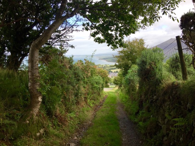
And with that, I was back on the trail in Pistyll, heading towards Nefyn first off. I was happy to be walking under a blue sky again.

The Wales Coast Path was diverted down a country road, probably to avoid some farmers’ fields. I spotted a campsite with a cafe that said non-campers were welcome, and more crucially they had wifi. So I went in for a cup of tea and the intent to update the blog with my number 67 and 68 entries between Pontllyfni and Pistyll. No such luck. It wasn’t open on Mondays. Ah well. Onwards to Nefyn.

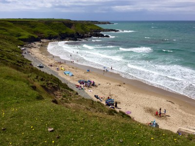
I walked along the beach for a couple of kilometres. I was the only person around. The sand was dotted with pretty rocks and I wanted to pick each one up and put them all in my pocket.

When I reached Nefyn, I made a beeline for the cafe. Again, not open. And so, for the people who ask me why I carry food with me, this is why! It’s also why my blogs are so late in being published.

I ploughed on towards Porth Dinllaen. I was high above the beach by now.

During this time, I bumped into a backpacker from the Netherlands named Ralph. He’s a journalist on holiday and walking the Llŷn section of the Wales Coast Path. I overtook him and he overtook me a few times. We chatted for a bit. It was good to see a tourist from farther afield than usual. The reason he’s here is even better. He chose Wales because of Euro 2016, proving that a little football success stretches far beyond just sport.

I had to stop in wonderment when I reached Port Dinllaen. So perfect.

My intent was to get to the famous Tŷ Coch Inn in order to stop for food and sort the blog out. It seemed though, that everyone else had had the same idea as me; well, the food bit anyway. It was jam packed with tourists, and the queue stretched way out of the door. I couldn’t stand the thought of battling the throngs with my rucksack on in order to get food so I ended up just having a quick drink and getting on my way. What a shame. Well, I guess it gets added to my ever-growing list of places to return to.

I felt low having to walk away from Tŷ Coch. It really is a stunning spot for a pub.


After navigating a craggy section of the WCP, I ended up on a golf course. The contrast between the rugged coastline and the coiffured green was bizarre.

I was gawped at and admonished by portly men sitting in golf buggies, festooned with designer brands. Imagine somebody walking the coastline! Walking! With a rucksack! The humanity…

The Nefyn and District Golf Club was once an Iron Age promontory fort. How times change. Sometimes not for the better.

On I treaded. From nowhere, the weather changed and I was quickly donning my waterproofs. After it passed, I sat down above a quiet cove and listened to the sounds around me. I saw something bobbing in the sea. Could it be…? Yes, it was a seal! I hadn’t seen one since Llandudno. One of his friends popped his head up above the water next to him and before I knew it I was watching two seal pals frolicking in the waves. It made my day.

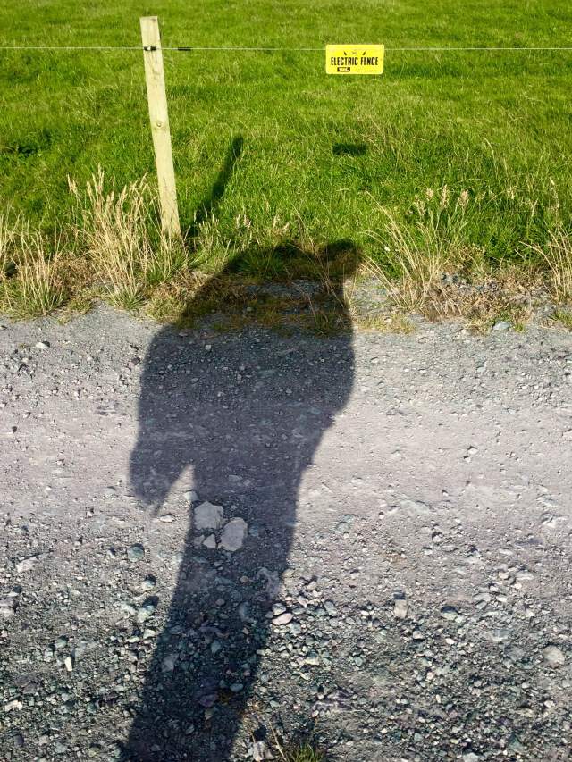
It was time to get to camp for the night. My instructions were to find an electric fence and head inland, which is what I did.

IMG_3303


A huge thanks to Hirdre Fawr Farm for giving me a pitch for the night! And thank you to the tireless Terry for arranging once more.

———–

I’m currently sitting in The Lion Hotel in Tudweiliog trying in vain to upload this blog. The internet is painfully slow. It’s taken me 90 minutes to get this far. Something tells me that this is how it will be for the next couple of days at least. It may be a few days until the next instalment so apologies in advance if that is the case.

68. Trefor – Pistyll

68. Trefor – Pistyll

Distance: 6.1 miles

Max Altitude: 349 m

Min Altitude: 15 m

Height Gain: 478 m

Height Loss: 469 m

Like yesterday, I decided before the get go that this would be a half day, of sorts. Better than having a full day off kicking my heels, I thought that getting even a few miles under my belt would be better than none at all.

So off I went from Trefor. Almost immediately the Wales Coast Path started going up. And up. And up. In no time, Trefor and the surrounding coast was distinctly small.


But it didn’t stop there. The ascent continued up and through Yr Eifl, the three-peaked mountain range. The views got better and better.


Meanwhile, my calves were staging a coup against me. I struggled on upwards, my pack seemingly getting heavier with every single step. Eventually with much huffing and puffing and geeing myself on, I got to Bwlch Yr Eifl, standing at 1150ft. It’s not a great height to climb by any stretch of the imagination, but it is when it’s tagged onto more than 500 miles of walking.

From there it was a nice easy descent down into Nant Gwrtheyrn.

https://instagram.com/p/BIz0upIBczJ/

This tiny quarry village was abandoned in the 1940s, the buildings becoming derelict. But the land was purchased in the 1970s and a restoration project got underway. It is now a vital heritage and learning centre for the Welsh language. I have happy memories of staying here in primary school. I couldn’t wait to see how it had changed.


It still had the warm and homely village feel that I remember.


Cafe Meinir (named after the tragic heroine of the Rhys and Meinir Welsh love legend) was open and it would’ve been rude to go past without ordering something.

With my belly full, I rejoined the Wales Coast Path, which helpfully goes right through Nant Gwrtheyrn and across to Porth y Nant.

Strewn along the beach were heavy duty quarrying artefacts from the bygone industrial era; a gold mine for someone like me who loves such things!


Once again, the WCP started to ascend. “Please, no!” I thought to myself. One mountain range is quite enough for one day.


Yes the views were spectacular as you can see but my oh my, my calves, feet, legs…soul (!) hated my guts.


My day was almost over however, and the pain in my feet would shortly be gone.

A few weeks ago, if you remember, I was interviewed on the Shan Cothi programme on BBC Radio Cymru. Brian Thomas who runs Penllŷn Accomodation was listening and got in touch with me offering a place to stay when I got to Pen Llŷn. And there he was in Pistyll waiting for me!

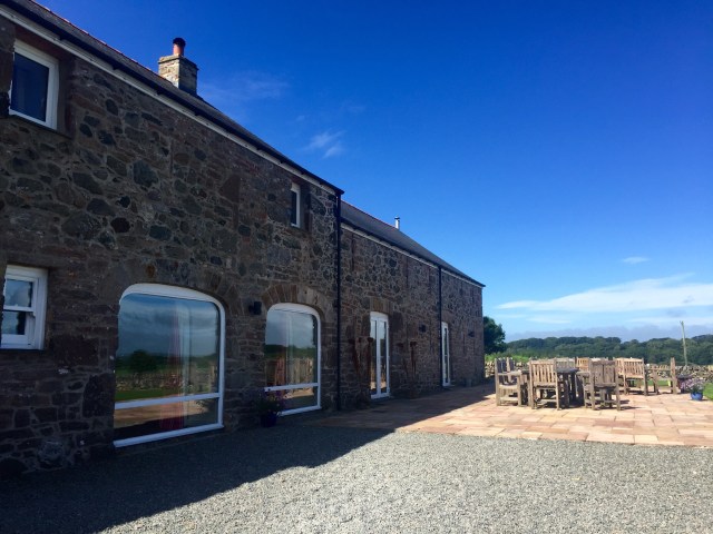
I was whisked away to his BnB, where I met his wife Jane and was shown to the most wonderful room, fit for a queen. I felt very lucky and very spoilt. I shall add some photos of this fabulous place tomorrow, as soon as my signal allows it. In the meantime, here was the sunset from my window.


That reminds me, apologies in advance for late blog posts. My signal is mostly non-existent at the moment but I shall be uploading updates as an when it’s possible.

67. Pontllyfni – Trefor

67. Pontllyfni – Trefor

Distance: 8.16 miles

Max Altitude: 67 m

Min Altitude: 3 m

Height Gain: 217 m

Height Loss: 157 m

I wasn’t sure what to do about today. I didn’t know whether to have a total rest day or just carry on. So I decided to compromise and do a half day instead.

I rejoined the Wales Coast Path at Pontllyfni. As with the previous day, the route was a rather dull stretch next to the A499. But to my left shoulder was the ominous sight of Gyrn Ddu, towering.

Whilst in front of me was Yr Eifl, the mountain range consisting of three peaks. This was what I could see so prominently from Ynys Môn on a fine day as I rounded the south west tip.


I ambled onwards next to the traffic but trying to concentrate on the mountains instead. Finally a right hand turn took me off the road and towards Trefor. I was overjoyed at reaching the quiet beach, and even more thrilled to be greeted there by this happy-looking tractor.


I nosed around the harbour for a while and was mesmerised by the setting. I mean, look at it…


This pier just around the corner from the harbour was recently condemned. However there were still people fishing on it. Braver than me, that’s for sure.


I decided at this point to call it a day. Tomorrow is going to be a biggie.

https://instagram.com/p/BIzYNe7Br98/

66. Caernarfon – Pontllyfni

66. Caernarfon – Pontllyfni

Distance: 12.42 miles

Max Altitude: 35 m

Min Altitude: 3 m

Height Gain: 133 m

Height Loss: 136 m

I awoke at the crack of dawn once more. Instead of getting irritated, I was actually rather pleased as the sunset over Fferm Is Helen was stunning.

I’m so incredibly grateful to Grace and the rest of the family at Fferm Is Helen for being so welcoming. The facilities are fantastic, as are the views. Without question my favourite campsite so far on my journey. Diolch yn fawr!

After leaving, I headed west on the Wales Coast Path. The Menai Straits were on my right shoulder for a few kilometres. A flotilla of sailing boats were taking advantage of the winds.


I was diverted inland for a good while and finally the trail reached the mudflats and marshes of Y Foryd. Under grey skies it looked pretty atmospheric.

And then came the part of the day I’d been waiting for – Caernarfon Airport! As I arrived a microlight was getting ready to take off. I watched from just a few metres away.

And within minutes the Coastguard Rescue helicopter took to the skies. 

I sat in the cafe and had lunch while watching the various light aircraft take off and land. As I was leaving I noticed that the Caernarfon Airworld Museum was open so I decided to pay a visit. It really didn’t disappoint. 


I spent a happy 90 minutes ooh-ing and ah-ing at the various displays and memorabilia. It’s one of the few museums where you can sit in the cockpits of real vintage aircraft. 


https://instagram.com/p/BIvBGUrBkp2/

There’s also lots of history regarding the old RAF Llandwrog and its role during WWII, as well as features on some local heroes of the air. 

I left with my head filled with all things aviation and carried on towards Dinas Dinlle. This had been one of my favourite places to come to for a chill out when I worked in Bangor. And although there a few more tourists than there had been back then, it still hadn’t lost its charm. Or its views. This is one place I will never get sick of returning to.


The WCP then cut inland to avoid nesting birds and I found myself walking on the side of the A499, which wasn’t particularly inspiring. 

So I decided to call it a day when I got to Pontllyfni. I had done more than I had planned to but didn’t feel any worse for it.

65. Bangor – Caernarfon

65. Bangor – Caernarfon

Distance: 10.44 miles

Max Altitude: 92 m

Min Altitude: 5 m

Height Gain: 167 m

Height Loss: 182 m

Still buoyed by yesterday, I woke up happy despite the pain in my feet waking me up on several occasions during the night. 

I went downstairs for breakfast to find an envelope with my name on it waiting for me at the table. I opened it with curiosity. Inside was a beautifully written note and a donation from Monica, one of the staff I had chatted to at dinner. I was so touched by the gesture, it was all I could do not to blub in the dining room. Thank you so much to everyone at the Garden Hotel.

The note is now tucked away safely into my rucksack for good luck, and will stay with me for the rest of my journey.

My first task was to go into Bangor to sort a few things out. I may be on the trail but real life still goes on. 

After all the admin and some food I set off to rejoin the Wales Coast Path. It was a long and boring walk through the suburbs of Bangor. The only interesting thing I accomplished was to nip in to Ysbyty Gwynedd for a can of drink. I can’t say I’ve ever popped into a hospital for a drink before. 

I ambled on in boredom until I got to Y Felinheli. I almost missed the turn down into Dinorwic Marina, but was pleased when I got there. At last, I was beside the water once again. 

A little further on in the village itself I stopped to have a snack. I was overlooking Ynys Môn, where I’d been just a day earlier. In the meantime, Pam, the lady I met in Malltraeth had left me a very kind message and donation. Thank you, Pam!

From there, it was just a very long walk on a Tarmac trail until I got to the outskirts of Caernarfon. 

In a few miles I came to Doc Fictoria in Caernarfon. I decided to stop to rest my feet. I may have had an ice cream at the same time. 

Continuing along the waterfront took me past the harbour and famous castle. 

https://instagram.com/p/BIspO4FhT-y/

Before I knew it, the castle was behind me. I remember visiting at the age of nine with my parents, part of a whistle-stop tour we did of North Wales’ castles. 

When I arrived at Fferm Is Helen, I had the most fantastic welcome from the family. In fact, they already had my map open on the laptop when I walked in through the door. We chatted for ages over a cup of tea before I was shown the facilities. 

All that was left for me to do was to pitch Clark Tent up in the most idyllic spot, overlooking the Menai Straits and watch the sun set on another day.

64. Brynsiencyn – Bangor

64. Brynsiencyn – Bangor

Distance: 13.6 miles

Max Altitude: 58 m

Min Altitude: 2 m

Height Gain: 310 m

Height Loss: 286 m

A refreshing night’s sleep coupled with a hearty breakfast at The Outbuildings set me up for the day ahead. 

It was a nice way to do breakfast too. Instead of the usual business of everyone being on separate tables, all the guests sat together around a large kitchen table instead. So over food we all chatted. 

The lady next to me recognised me. “Were you going up Holyhead Mountain the other day?” 

Indeed it was me. I had encountered Jacqueline, from Ayrshire, half way up. I was on the ascent, huffing and puffing while she was descending to Ynys Arw (North Stack). What an incredible coincidence that we’d be eating breakfast together just a few days later. 

I got dropped off back at Foel Farm Park and started walking. It was mid-morning and I needed to upload the blog, so in I went to the Sea Zoo cafe to do so. I may have had a scone too. 

And then I was properly on my way. The name of this boat greeted me. An omen? Or a fact? Something to accept and overcome, probably. 

And from then on, for a few hours anyway, it was a relatively quiet walk with few distractions. The only thing that wasn’t quiet was the wind, which was beyond blustery and was buffeting me off balance. 

It was like Ynys Môn was winding down and preparing to deliver me back to the mainland, but not wanting to let me go, at the same time.

The Wales Coast Path took me across field and through farmland. At one point, I wished I had that trusty flamethrower/ machete combo that I’d invented back on the Offa’s Dyke Path. I didn’t though and got stung by nettles instead.

Soon I ended up back on the shores of the Menai since high tide had passed. I walked for what felt like ages with this underfoot.

There were very few things of interest. I could barely keep my phone still to take photos because of the winds. 

https://instagram.com/p/BIpiVuNh5dg/

Finally, the Britannia Bridge came into sight. 

Walking on further I came to the bizarre Nelson monument on the shore. I didn’t stop to examine further and soon it was behind me. 

Once again, I was led inland and through the grounds of a church. The high winds made the graveyard resemble something out of The Omen. I didn’t hang about.

And then, I passed under the Britannia Bridge. The space beneath bridges is always creepy and this one was no exception. 

I could have stayed for hours photographing the structure and capturing all the little details but the winds on the Menai were still giving me trouble. 

Still a bit creeped out from the graveyard and the bridge, I practically flew through a dark forest that followed. Relief when I saw the Menai Bridge through a gap in the hedge. The end was nearing.

The events that followed were an extraordinary coincidence. And I’d love to know the odds. Long story short, In Menai Bridge, I bumped into the woman who is responsible for the Wales Coast Path’s social media accounts. Eve and I have been communicating digitally on Twitter/Facebook/Instagram for weeks, but of course, under the guise of the WCP. Suddenly, she was in front of me completely by accident. A human face! And a lovely one at that too. What were the chances of that happening???

We talked for ages. She even got me a cup of tea and then offered me a lift to Bangor. How kind. 

And then a further coincidence. As Eve and I were getting into her car, another pulled up beside us. It was Jacqueline from breakfast (and Holyhead Mountain).  Again, the chances of that?

With my mind boggling I was dropped off in Bangor by Eve. We said our goodbyes and I was so happy to have met her.

I had a BnB at The Garden booked. I didn’t think the local council would take kindly to me camping in the middle of a traffic island. That’s where I ate that evening too. It was a healthy meal which I badly needed after weeks of sugar and junk. The waitresses there were incredibly kind and quizzed me on my journey. They even hugged and high fives me as I departed to bed. 

I was sorry to say goodbye to dear Ynys Môn. I had grown to love the island. Already, I cannot wait to return. But first I have the small matter of another 500 miles to travel. 

63. Pen-lôn – Brynsiencyn

63. Pen-lôn – Brynsiencyn

Distance: 4.21 miles

Max Altitude: 29 m

Min Altitude: 6 m

Height Gain: 77 m

Height Loss: 85 m


There had been rain overnight so my first task was to dry to dry Clark Tent off as best I could. It hadn’t been a particularly great night’s sleep. Ok, it had been awful, truth be told. I had a quick coffee before packing up. Rain had turned into a muggy day, and I was clammy already.

Fortunately, the White Lodge, where I was camping, was right on the side of the Wales Coast Path. Thanks to them for my discounted pitch and thank you to the tireless Terry for arranging it.

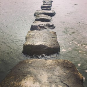
The path directed me through farmland and tracks, away from the coast. Then it hit the side of the Afon Braint, where the only means of crossing were these stepping stones.

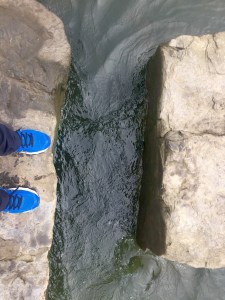
A bit nerve-racking at high tide!

But I made it to the other side without plunging in!

After the previous night’s rain, the boggy marshland was even more sodden underfoot.

It occurred to me that I must be close to my 500th mile of walking. I checked and I had indeed just gone past that milestone, probably when I was crossing the stepping stones. So I stopped at the edge of a field to contemplate my journey. 500 miles on foot….when you say it like that…(!) I felt chuffed at that moment, and a tad overwhelmed.

I continued. And that, reader, is when I learnt that on a journey like this, you have to take the rough with the smooth. What I hadn’t realised in my moment of self-congratulation was that I was in a boggy field saturated with silage. As soon as I put my right foot down it got stuck in the grot and I was up to my legs in the foul gloop. I pulled my foot out only for my shoe to be left behind.

Meanwhile, there was my sock, dripping in cow effluent. Lovely.

I pulled my shoe out of the muck with a loud “schlock!” and hopped back to the kissing gate on the edge of the field, where I attempted to do a clean up job. But really, without hot water and soap, there’s only so much you can do. All I can say is that my travel towel took a hammering (and turned a deep brown colour), while I thanked science for the invention of hand sanitiser.

I won’t tell you how I got to the other side of the field eventually. All I will say is that the US Navy SEALS would be impressed.

Still inland, I walked through more farmland and even through people’s front yards before being led through country lanes. And very nice lanes they were too.


I was also impressed with the closing mechanism on this gate. I don’t want to sound dull but when you have to open numerous gates every day, you really do notice a bit of innovation.

And then the view of the day as I rounded back towards the coastline. The Menai Straits with Caernarfon directly opposite.


The WCP then hugged the shoreline and I crunched across it.

With my feet still wet and my socks still saturated in cow diarrhoea I decided to call it a day when I got to Foel Farm Park. I had promised myself a half day after all.

It turned out that the tireless Terry had organised a room for the night for me at the wonderful Outbuildings in Gaerwen.

And so that is how I ended my evening. I was able to bathe and rid myself of dung, as well as relax and have a decent meal.

It had truly been a day of ups and downs.

62. Malltraeth – Pen-lôn

62. Malltraeth – Pen-lôn

Distance: 8.71 miles

Max Altitude: 51 m

Min Altitude: 7 m

Height Gain: 148 m

Height Loss: 109 m

I woke up at the crack of dawn, literally. It had just turned 5am. I tried to get back to sleep but couldn’t do I decided to do something practical instead – I re-waterproofed my kit. It was long overdue too. 

I wandered back and forth to my tent, feeling smug at how efficient I was being with my time (a rare thing in my life). Pitched next to Clark Tent was another tiny tent. I had mistakenly made assumptions about who was inside when I saw a bike next to it. So when Pam (who I’m sure won’t mind me saying that she’s a little bit older than I am) came over to say hi, I was full of admiration because I learnt that she was cycling from Cardiff to Holyhead solo. We spoke for ages about all outdoor matters – kit, load carrying, feet, distance, water purification, maps; geeky stuff, you know. 

Pam also had a close relative die from pancreatic cancer so understood the severity of the disease. I was touched and energised when she praised my efforts. Being admired by someone who has travelled the world, biked across America and climbed mountains far and wide was high praise indeed. I watched her pack her bike and waved her on her way.

Hopefully Pam will have reached Holyhead safely and will by now, be back at home on the Isle of Wight. I hope we keep in touch.

It was time for me to get packing. As I was filling my dry bags, I heard an “Excuse me”. The lady from the large tent on the other side was calling to me. “Would you like a hot drink?”, she asked. Well, I didn’t need asking twice. What a kind gesture.

I joined Katherine, Kol and their two children – from the Wirral – for a coffee outside their tent. We talked for long time while we sipped our drinks. When you travel alone, and suddenly get the chance to talk to another person or people, the effect is overwhelming. We exchanged details and I went on my way. 

But it wasn’t long before they had donated to my page and left the nicest message for me too. As with Pam, I hope we stay in touch.

Thank you to Pen-y-Bont Camping for giving me a complimentary pitch for the night. Highly recommended, not least because they have laundry facilities, which is fairly thrilling when you are stinking like a dog. I am, as ever, grateful for the generous gesture.

When I left camp, I had about a 1.5 kilometre hike back into Malltraeth, where I intended to grab breakfast. Disappointment greeted me –

So I went into the village to the shop, where I had a rather depressing egg bap. Food was food though. 

I needed to cross the Malltraeth marsh on the cob to get to the forest on the other side. Tidal doors first designed by Thomas Telford about 200 years ago were replaced a few years ago. But the originals can still be seen in a display.

Hitting Niwbwrch Forest meant the start of a very long walk through the forest. The weather was looking iffy and rain was forecast.

A few kilometres later I rejoined the coast again as the Wales Coast Path touched the beach. It was wide and there was barely a soul around. 

Despite not being on the WCP, I had already decided to visit Ynys Llanddwyn. It would have been criminal not to. Llanddwyn means ‘the church of St. Dwynwen’. She is the Welsh patron saint of love, and generations of people have made a pilgrimage to this island. My turn was long overdue.

Up ahead was the Tŵr Mawr Lighthouse. And you know how I enjoy a good lighthouse by now. 

On a fine day, Eryri (Snowdonia) and Llŷn would be clearly visible across the water but today were shrouded in cloud.

I found this cannon a bit odd. Why was it pointing inland? Any ideas?

I vowed to return to Ynys Llanddwyn on a fine day with blue skies. But then it was time to rejoin the Wales Coast Path, and re-enter the Niwbwrch Forest. It felt endless.

Eventually, after several kilometres, I left the bizarrely sand-ridden forest. Fine rain had been coming down for a while and yes, I was walking in wet and sandy shoes yet again. I was overjoyed to walk on grass again after trudging through the sand; honestly, it really is the small things in life.

My feet were paining me though. Probably the result of yesterday’s over-zealous 18.5 miles. But I had no choice but to wince onwards. I would take it easy over the next couple of days to make up for it.

Grass turned to country roads and I ended up at a historical place of interest that I’d never heard of, and I felt a bit ashamed. Llys Rhosyr was a court belonging to the native royal family before they were killed and Wales conquered by Edward I in 1282. The site was explored and excavated in 1992. I had no idea it even existed; so much for my A Level in history eh, (though I never did see the point of studying Protestantism in England in the 16th century, but there we go).

With the rain coming down harder, I had to rush to get to camp in Pen-lôn. When I got there I put Clark Tent up in lightning fast time in order to avoid getting soaked. I jumped inside as soon as he was pitched and slid into my sleeping bag. I felt pretty glum. 

Eventually I got to sleep despite the best efforts of the Olympic snorer in the tent next door, who managed to produce a noise of Harley Davidson proportions.

———–

Today was the fourth anniversary of my dad’s death and it had been on my mind for the entire day. I wondered what he’d make of my walk. 

Cwsg mewn hedd, Dad. 

error: This content is under copyright.