Browsed by
Month: July 2016

45. Traeth Coch – Borth-Wen

45. Traeth Coch – Borth-Wen

Distance: 6.7 miles

Max Altitude: 33 m

Min Altitude: 3 m

Height Gain: 98 m

Height Loss: 79 m

Today’s walk started after midday and a morning of rain and wind. Yesterday’s blue skies were now today’s grey storm clouds.
Traeth Coch looked a different beach from yesterday.

The area was soggy marshland and the path followed a series of duckboards which led onto the sea wall. There were a series of passing points on the wall, since it was so narrow, and on each one I passed I noticed that somebody had made shell offerings. What a nice touch. 

It was dry when I started walking but just as I got off the sea wall, a fine intermittent rain began falling. It was enough to make me tuck my phone into my waterproof pocket, which meant no photos. 

It got heavier and heavier until I was all zipped up inside my waterproofs, with just enough of a gap in my hood for my eyes to peep out of. On and on I trudged in the wet, over sand, mud and rocks. I saw nobody. 

Finally I rounded Traeth Coch and reached The Ship Inn. Salvation!

I went inside, had coffee, made good use of the driers in the toilet as well as their wifi, since my mobile signal had long since vanished. 

I got chatting to two couples in the pub. They were staying locally. They quizzed me about my trek and told me some of their own tales. 

After a second coffee the weather had cleared up enough for me to consider going outside again. My clothes and shoes were dry so off I went again after I’d said my goodbyes. Indeed, a blue sky and evening sunshine had appeared. Relief.

I walked around Trwyn Dwlban and Traeth Benllech stretched out in front of me. 

The path was set back from the beach and went through woodland. At times it reminded me of the Inca Trail. 

I reached the front at Benllech. I noticed these little Wales Coast Path ceramic pavement waymarks for the first time since Chepstow.  

Most of the time on Ynys Môn though, I’m following the Anglesey Coast Path waymarks whose logo look like this –

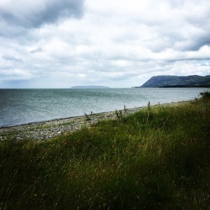
Above Benllech, the path got pretty wild. Lots of it had been repaired quite recently it seemed. I’m guessing that much of it was due to coastal erosion. I looked back at the view of where I’d been once more.

I found a decent campsite, practically on the cliff edge. Earlier I had enquired at another only to be told that it would be £36 to pitch Clark Tent. Thanks but no thanks!

I hadn’t made as much progress as planned because of my feet but I’m not going to be too hard on myself. Every step counts. 

44. Penmon – Traeth Coch

44. Penmon – Traeth Coch


Distance: 8.7 miles

Max Altitude: 120 m

Min Altitude: 2 m

Height Gain: 243 m

Height Loss: 263 m

Today’s start point was the bus stop where I’d finished yesterday, near Penmon. Quite a fitting location considering I was dropped off having had yet another night’s fantastic sleep in a bed (a bed!). 

It couldn’t have been a more perfect day’s weather for walking, for me anyway. The sky was blue and the sun was beating down. There was a sharp wind to provide coolness. Conditions were ideal and I almost revelled in it as I got underway and aimed for the water’s edge. 

I looked across to the mainland. I scanned from left to right, from Y Gogarth (Great Orme) across to the cliffs at Penmaenmawr. I could hardly believe that just a few days earlier I had walked across there. 

The next landmark was Penmon Priory. St Seiriol (almost me, but not quite) founded a monastery here in the 6th century, which was later reorganised in the 13th century. 

I took a look inside the church too. 

https://instagram.com/p/BH12rAzh-rC/


Nearby was a dovecote built by the rich Bulkeley family of Biwmares in the 1600, who converted the Priory into a home after the Dissolution. 

It has around 930 nesting holes. 

If there’s one thing I enjoy, it’s a good lighthouse. And I knew there was a beaut coming up at Trwyn Ddu (which means ‘black nose’). And it really didn’t disappoint. I mean, look at it –


I spent a good hour here just marvelling at the view and declaring it to be total perfection across social media. That’s Ynys Seiriol on the right side of the photo, also known as Puffin Island. St Seiriol established a hermitage there after he abandoned the priory up the road. The brown rat was accidentally introduced to the island at one point, which led to the puffin population being decimated. But a rat poisoning programme has seen puffin numbers increase again. 

Much as I didn’t want to move on, I had to. The Wales Coast Path was routed inland. I kept looking back at the view every few metres until I almost couldn’t see it at all. 

I walked through fields and up roads. Occasionally I could see the sea to my right. This continued for several miles. I didn’t see a soul. But I did see this sheep with rather a desperate itch –

https://instagram.com/p/BH2868Eh6YO/

I eventually reached a vantage point much further on where I could look back and see Ynys Seiriol with Y Gogarth tucked in behind it. 

Looking ahead gave me my first view of Traeth Coch (Red Wharf Bay) in the distance. This is where I was headed.

And Traeth Coch was to be my stopping point for the day. On I went following the waymarks, which had all been present and correct throughout the day. I even thought to myself how lucky I’d been not to have been lost considering the path had gone inland. And so it was Sod’s Law that almost at that very point the waymarks went missing, which led me to have to guess the way. Of course, I guessed wrongly and wandered into a field of sheep, only to have to wander back again. I tried another direction and was faced with an electric fence. The third option was blocked by a hedgerow made up of entirely stinging and scratching foliage, nettles, brambles and thistles. Brilliant. But I could see a waymark post beyond it. So I had little choice but to climb over the hedge, getting stung and all sorts in the process. Oh to have a machete for these occasions. Or maybe just a flame thrower.

From there it was a straight shot to the beach, which looked idyllic in the evening sun. My feet were in bits once more but the view. Oh that view….

43. Bangor – Penmon

43. Bangor – Penmon

Distance: 9.93 miles

Max Altitude: 112 m

Min Altitude: 1 m

Height Gain: 203 m

Height Loss: 201 m

I’ve been taking it easy for the past couple of days. On Monday I discovered that I’ve damaged the tendons in my foot. It explains why the pain had been keeping me up at night. I have orders to take it easy as well as using orthotics to try to alleviate the problem. I’m trying to put it all out of my mind though.

On Monday, I walked across the Menai Bridge on to Ynys Môn (Anglesey). I forgot to switch my GPS on until I was half way across though. Schoolgirl error. Since then, I have had the most fantastic couple of days being spoilt rotten by friends of the family, Ann and Noel, who live on Ynys Môn. I feel like a new person once more. I’m not sure they realise how grateful I am but maybe they will when they read this blog. Diolch o galon!

Back to the trek…. This morning I left from the stunning Menai Bridge, heading anti-clockwise on the Wales Coast Path.

Had I not been right at the start of my day I would have stopped properly in Porthaethwy (Menai Bridge village) for a nose and a cup of tea. But it didn’t feel right doing so after I’d only just set set off.

I was heading towards Biwmaris. The WCP after Porthaethwy was routed inland for some reason, so I found myself walking through ordinary countryside away from the sea. I am never a fan when this happens, as it is meant to be a coastal path. However, I’m guessing the reason this happens in this location is in order to avoid walking alongside a busy A road.

After walking along a quiet country road for a couple of miles I was taken through a marshy forest and had to squish through a very tight kissing gate. My roll mat is always an issue with these.

I was soon arriving into Biwmaris and was relieved to see the water once more.

I always loved coming to Biwmaris when I worked in Bangor. It’s a popular place for tourists and incomers too; Helen Mirren owns a holiday home right on the sea front.

I love the architecture, the quirkiness and the taste of salt.


I didn’t call at the castle as I’d been before. So after a cream tea, I headed out of the town. The weather was perfect. The views even more so. This was the life!

The tide was out so I took the low tide WCP option along the shore. I crunched along the rocky beach, wishing I had more time to do some beachcombing. There were treasures to be found every few steps, interesting stones and magnificent bits of sea glass rubbed smooth by the ebb and flow of the waves.


In about a kilometre or so, the nature of the shoreline changed. There were caves cut out of the cliffs and clear evidence of coastal erosion.


It was early evening and I decided to spare my feet and call it a day. My stopping point was this glamorous bus stop just outside Penmon, where I took my shoes off and gave my tootsies a rest.

Back again tomorrow for more.

40. Llanfairfechan – Bangor

40. Llanfairfechan – Bangor

Distance: 12.59 miles

Max Altitude: 53m

Min Altitude: 1m 

Height Gain: 254m

Height Loss: 223m

After a cup of tea on the front at Llanfairfechan, I set off. It was blustery and looked to be threatening rain. 

This section of the Wales Coast Path took me through several nature reserves. I walked past vast expanses of mud flats, home to a range of wildlife. This is a popular place for birdwatching and bird hides appeared at regular intervals; great for twitchers and great for hikers hiding from rain (me, frequently).

After about 3km or so, the Wales Coast Path waymarks disappeared. They just weren’t there or seemed to have been removed deliberately. 

In any case, I went the wrong way, and it was only when I got to a “STAY OUT!” sign about 2km further on that I realised. So back I went, looking for any waymarks. None were to be seen so I decided to just busk it and walked along the shore line for a bit. Hey, it’s a coastal path so surely I couldn’t be far off. 

Finally, the joy of seeing a waymark!

I bumped into a friendly dog walker who told me that the way ahead was not passable due to a landslide. Apparently boulders were blocking the path and he had had to turn back. I had no choice but to carry on though. This is what greeted me –

A huge mass of boulders indeed. Nothing was to be done about it except for scrambling down to the shore and traversing them that way. I did wonder about the cause of it all though. 

As I advanced on Bangor, I did my usual trick of looking back at where I’d been. There were the cliffs at Penmaenmawr with Y Gogarth (Great Orme) way off in the distance. It’s hard to express the feeling of knowing that you’ve made up that distance on foot. 

Just before its arrival in Bangor, the Wales Coast Path is sadly routed away from the coast. There is no current access to the National Trust’s Penrhyn Castle grounds. The trail follows a convoluted route inland for quite some time. This was when I found myself on a bit of a wild goose chase on the outskirts of Bangor.

Missing waymarks again meant I was guessing the route. I guessed wrongly and ended up in Llandygai Industrial Estate somehow. A couple of alleyways later and I’d found the A5 and decided to use the pavement next to it. I worked in Bangor for about six months as a young reporter so was glad that I knew my way. 

It didn’t long to get back to the water’s edge. Next stop was Bangor Pier. After the kerfuffle on the pier at Llandudno, I wasn’t about to get an ice cream, that’s for sure.


I was heading for Menai Bridge, the structure, that is, not the town. Once again, missing waymarks left me walking across a couple of random farmers’ fields.  Relief when I once again found the road that descended to the bridge. 

The next step would be to leave the mainland and carry on my trek around Ynys Môn (Anglesey). 

39. Diwrnod Diwylliedig – Cultured Day

39. Diwrnod Diwylliedig – Cultured Day

It was so stormy last night that I barely slept. High winds and heavy rain battered Clark Tent. I shivered and hoped that the canvas wouldn’t give way and take off with me inside. 

Heavy rain and wind continued for the rest of the morning and afternoon. Meanwhile, I was having yet more technical issues getting the latest blog online, and becoming extremely frustrated in the process. Though perhaps this was a blessing in disguise, as otherwise, I would have got soaked dismantling the tent in the storm. Every cloud, eh? 

By mid afternoon, it had cleared up enough for me to consider making a break for it and getting on to the Wales Coast Path towards Bangor. Finally I decided against it and made the decision to do something else instead. 

As I said recently, I feel as though I often just breeze through places at high speed  instead of taking my time and learning about my surroundings. How fortunate am I to be doing this challenge! Should I not savour every moment and take in as much as possible? It seems to me that many of us walkers place too much emphasis on miles achieved under foot, and I include myself there.

So with a sense of virtue (of sorts, anyway), I doubled back on public transport, and ended up visiting the site of Deganwy Castle. 

Now, most tourists and visitors and whatnot will be more than aware of north Wales’ magnificent castles – Conwy, Caernarfon, Harlech, Criccieth, and so forth. But Deganwy Castle is almost unheard of. And why? Well, because very little of it is still standing, unlike the aforementioned. 


The two hills above Deganwy housed a fortress that was in use from at least the Roman period until its final demolition in 1277. It was the site of siege, bloodshed and destruction for centuries. 


If you want to read about it in full – and find out why it’s barely standing – then this page is a wonderful resource. It’s a shame that this castle is so overlooked in comparison to others when its history is so rich and significant. 

As well as a thrilling history, the view from the top of the west hill took my breath away. I couldn’t stop taking photos. Surely this has to be one of the most stunning views in the world…


In sum, I’m so glad that I took the decision not to walk today. Look at what I would have missed. 

38. Dwygyfylchi – Llanfairfechan

38. Dwygyfylchi – Llanfairfechan

Distance: 7.7 miles

Max Altitude: 62m

Min Altitude: 1m

Height Gain: 153m

Height Loss: 148m

Today was pretty uneventful. Like yesterday I decided to have a sort of half day. I had errands to do and wanted to watch the Wales team’s homecoming. Plus I’m continuing to have technical trouble when it comes to getting this blog online. Ah well…

I started walking in the evening. There were some beautiful colours on the trail.

This part of the Wales Coast Path runs side by side with the A55 mostly, sometimes the railway and sometimes road and rail. It’s noisy and busy. There is an alternative upland route which is taken in Conwy and rejoins the main path in Llanfairfechan. But I was on the lowland route.

Passing by Penmaenmawr’s skate park on the promenade, I was impressed by the street art on show.


The trail then followed a relatively new (built in 2009) pedestrian and cycle bridge above the A55. A lot of engineering had gone into this.

The view from the uppermost section of the walkway was incredible. To my right, Y Gogarth (Great Orme) and Llandudno, while to my front and slightly left, Ynys Seiriol (Puffin Island) and Ynys Môn (Anglesey).

https://instagram.com/p/BHnStwThmXI/

It didn’t take long to reach Llanfairfechan. My stopping place for the evening.

37. Deganwy – Dwygyfylchi

37. Deganwy – Dwygyfylchi

Distance: 6.43 miles

Max Altitude: 18m

Min Altitude: 2m 

Height Gain: 73m 

Height Loss: 73m


The morning weather in Deganwy was an unsettling mixture of high winds, dark clouds, fine rain, bright sunlight and mugginess. As soon as I got on the Wales Coast Path and started walking I felt clammy and uncomfortable.

The sight of Conwy Castle across the bay was impressive but I couldn’t help wondering how much better it would look  in good weather.

I crossed the river into the town next to the famous Telford Bridge.

I had already decided to spend a bit of time in the town instead of my usual thing of just passing through. I have almost always felt guilty during my trek, of not devoting enough time to getting to know unfamiliar places and breezing through. So I had chips at the Galleon.

After I finished eating, I met a couple from Nevada – Eli and Deborah – who were visiting north Wales and walking some of the path. Incredibly, he was a transplant expert and was very knowledgeable about pancreatic cancer. We spent ages chatting and it was good to hear his perspective on the disease.

We said our goodbyes and I wandered around the harbour for a while.

https://instagram.com/p/BHj044XBpO0/

The Wales Coast Path goes right along the harbour and past the smallest house in Britain. I remember visiting here when I was 9 and thinking that it wasn’t really that small.

It was time to follow the path and leave the town behind me, much as I didn’t want to. The weather had cleared up to reveal a beautiful blue sky.

A few hundred metres out of the harbour and on the path next to the marina, I saw a dog bounding around out of control with the owner nowhere to be seen. Oh no, I thought. I’m not the biggest dog fan on earth. It must have read my mind because it came running up to me a high speed and jumped right up on me. Its owner appeared and tried to call the dog away from me but it wouldn’t listen. By this time it was behind me and had bitten into my roll mat and wasn’t letting go, while I shouted at the owner to get it off me. Finally she managed to wrestle it away but I was left a bit shaken. Give me a cat any day, frankly.

The trail rounded the estuary onto Morfa Conwy, a Site of Special Scientific Interest, which is next to a golf course. I saw a sign for an area that had been fenced off in order to give a type of moth a helping hand so that it didn’t get trampled by walkers. Apparently this is the only place in Wales where the Belted Beauty moth calls home.

Opposite me was Y Gogarth (Great Orme) looking splendid under blue skies.

The water looked so inviting that I was going to have to dip my toes in.

https://instagram.com/p/BHk7qIehDOd/

I walked on a bit more into the evening and then sat down for a while watching the waves. This would be a good spot to stop and pick up from tomorrow.

36. Llandrillo-yn-Rhôs – Deganwy

36. Llandrillo-yn-Rhôs – Deganwy

Distance: 10.71 miles
Max Altitude: 129m
Min Altitude: 5m
Height Gain: 265m
Height Loss: 266m

I had a late start today due to having no mobile phone signal and needing to find somewhere with wifi in order to upload my blog. As soon as I managed to get it online, I was off.  I started where I had left off on the promenade at Rhôs. Foreboding clouds billowed above me.

The first landmark I walked past was the tiny St Trillo’s Chapel, one of the smallest in the British Isles with enough seating for just six people.

In a kilometre or so, I entered Penrhyn Bay, where I could have walked along the beach had the tide been out. As it was at high tide, I was routed into a suburb, and from there got on to Little Orme, the smaller of the two headlands that flank Llandudno. Little Orme is a pretty pedestrian name but the Welsh name is utterly spectacular – Trwyn y Fuwch, which means ‘the cow’s nose’.

I walked to the edge of a cliff and saw the head of a seal bobbing below. Sadly, I didn’t manage to get him on camera.

I got a bit lost after that due to missing waymarks. But a very kind woman who was visiting her sheep (yes, really) showed me the way, and on I went down into Llandudno.

As I strode along the promenade, I marvelled at the Victorian architecture.

I headed towards the Great Orme (y Gogarth in Welsh). From a certain angle it looked like a giant sleeping crocodile. I came upon the pier and decided to sample the delights.

https://instagram.com/p/BHiV7vsh-O7/

When I saw this, I couldn’t resist –

It wasn’t granting wishes, so I couldn’t wish ‘to be big’. Instead, it told my fortune –

Half way down the pier I saw an ice cream vendor so in I went for a cone. Rum ‘n raisin – beautiful. As I was leaving I got dive bombed by this chancer of a seagull so had to duck to get out of the way. A few seconds later a seagull (not sure if it was the same one or if they work in gangs in these parts), swooped down on me like a pterodactyl, grabbed the cone out of my hand and flew off with it in its beak. I stood there with my mouth wide open, gobsmacked. A couple from Liverpool were sitting nearby; the woman shook her head in dismay, “Ahhh, disgusting, look at that. It’s the fourth one we’ve seen today”. I started wondering about the possibilities of disguising a hand grenade as an ice cream but remembered that (a) I don’t have a hand grenade, and (b) I’m a vegetarian.

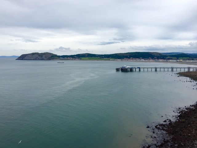
I decided against getting a replacement ice cream on health and safety grounds. I got off the pier, still in disbelief, and started the ascent up the Great Orme with the pier and Llandudno behind me.

I needed to get a move on as my plan was to watch Wales v Portugal in Deganwy. But the ascent was making my progress slow, as was the fact that I kept stopping every 30 seconds to marvel at the view. But you can’t blame me.

I rounded the tip of the Orme and suddenly had views over to Conwy, Penmaenmawr and the eastern side of Ynys Môn (Anglesey). I looked at my watch. Time was ticking. It was a straight descent into Deganwy from here, all the way down the Orme. So I decided to jog the rest of the way in order to be there in time for kick off.

My knees coped well and I got there just in time for the anthem. And although the result didn’t go Wales’ way, I felt nothing but pride for the team. They’ve done more for our country in the past three weeks than many people realise. Together stronger.

Daeth i ben deithio byd

Ond bydol yw ein bedydd…

35. Towyn – Llandrillo-yn-Rhôs

35. Towyn – Llandrillo-yn-Rhôs


Distance: 11.06 miles

Max Altitude: 28 m

Min Altitude: 3 m

Height Gain: 86 m

Height Loss: 77 m


I didn’t get that much sleep. High winds had buffeted Clark Tent all night long and I had been cold and shivery.

Terry came to the rescue first thing with a coffee and breakfast bar.

A little after 10am I got a call from BBC Radio Cymru’s Bore Cothi programme. I had been invited on to talk to Shan Cothi about my trek. I spent about fifteen minutes discussing Cerdded Cymru as well as pancreatic cancer.

Terry made me a hot chocolate and we talked for a while. With that, it was time to say goodbye. I felt so sad to be parting company with someone who had become a kindred spirit over such a short space of time. I cried when I watched his van drive off.

And then, I was on my way once more. I needed to find my way back to the Wales Coast Path. I walked via Pensarn and crossed the railway line to get there. I passed chalet upon chalet, which contrasted with Gwrych Castle in the distance.

I stopped at a beachside resort cafe near Llanddulas for a coffee. I was accosted by a group of curious Liverpudlian women on the way in.

“Where have you walked from, love?”

“Cardiff”

“WHAT?!”

This is by now a very familiar conversation and I enjoy people’s extreme reactions!

My walk after that was uneventful. I enjoyed the feeling of the sun on my face and took in the views. When I got to Colwyn Bay, I could look back and see where I had walked from. I saw Rhyl way off in the distance on the tip of the headland opposite and felt incredulous that I had come this far on foot. Sometimes the numbers seven, nine or twelve miles can feel disappointing. But actually seeing the distance is gratifying.


And my pride was amplified when I reached Llandrillo-yn-Rhôs, where I could truly survey how far I had come.

https://instagram.com/p/BHg9S__BRqF/

34. Prestatyn – Towyn

34. Prestatyn – Towyn

Distance: 7.03 miles

Max Altitude: 13 m

Min Altitude: 3 m

Height Gain: 56 m

Height Loss: 56 m

Have you ever watched one of those old Westerns where a gnarly cowboy rides into some dusty town on his horse? The ones where he’d sidle up to a saloon and sink a bourbon with his spurs clinking. He’d then make his way to the nearest barbershop where he’d have a hot towel shave with a cut throat razor. The barber would top it off by slapping cologne on him and he’d be as good as new. You know the films I mean.

Well, today, that was me. The 21st century female equivalent anyway. Yes, I went to get a manicure and a pedicure before I left Prestatyn. It was bliss. I feel like a whole new person who no longer needs somebody to set about their hands and feet with a scythe. Bliss, I tell you!

I strutted out of Prestatyn on the Wales Coast Path and headed west towards Rhyl on the concrete path between the two. It was fairly uninspiring and my mind drifted.

It didn’t take long to get to Rhyl. The first thing I spotted was the sad sight of a discarded child’s spade. Almost a metaphor for the town.

The looming clouds were looking threatening. The sight of Llandudno miles further along the coast ahead of me disappeared.

I decided to do what any normal human on Rhyl seafront would do and I sat down and got an ice cream. After my 23 miler yesterday my feet were very grateful.


I strolled along the EU-funded coastal defences and wondered if Jean Claude Juncker would be along in his bulldozer soon to tear it all down.

The next stop was Kinmel Bay. Just as I was arriving, a downpour left me scrambling for my waterproofs while I took cover underneath an abandoned penny arcade.


I continued walking towards Towyn where I was given a free pitch for the night by Henllys Farm, which was very kind of them.

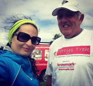
Next to me was another tiny tent. I got chatting to its inhabitant, Terry, who is also in the middle of a charity trek. Terry’s Trek is raising money for Ugandan orphanages. He’s been walking the 870-mile Wales Coast Path since May 1st and will be finishing his quest back in Cardiff (which is where he also started from) this coming weekend. Terry from Pontypridd is travelling in the opposite direction to me and so how incredible it is that our paths not only crossed but that we ended up in the same campsite next to each other!


We spent the evening comparing notes about the WCP and I got some tremendous tips from Terry about what was to come. I was glad to hear that it wasn’t just me who had got lost, been dehydrated, got soaked (constantly) and had had encounters with angry bulls! 

error: This content is under copyright.